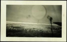
Handwritten photo album caption below this photo reads: "Above the Rockies at 12 000 feet." Photograph depicts the Rocky Mountains from a distance. As the photograph was taken from the inside of an airplane, the plane's wing tip can be seen on the far right of the image. A sun circle is also visible in the top center.
Sans titreImages within album consist primarily of fishery industry, river & landscapes, salmon cannery images (housing, people, workers, boats) on the Nass River and North Pacific Coast, ca.1924-1926. Each photograph is accompanied by a handwritten description glued below or beside the image.
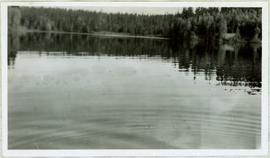
View of ripples in lake. Forest on opposite shore is reflected in water. It is believed this photograph was taken at Summit Lake, B.C.
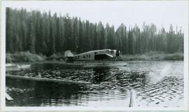
Handwritten caption above this photo reads: "Plane on Sumit Lake." Logs can be seen floating on water in foreground, as well as trees on opposite shore in background. The seaplane has the letters "CF-ATF" on its side.
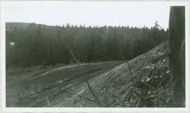
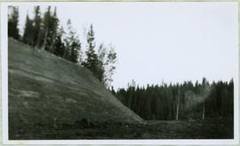
Photograph depicts the steep slope of man-made embankment, forest in background at bottom of slope. Small twigs and pant leg of unidentified individual in foreground.
Photograph depicts the steep slope of man-made embankment. Forest in background, level excavated ground in foreground.
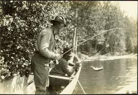
Typed annotation on recto: "Rainbow Trout fishing (Fly fishing) Tachi River - Stuart Lake, B.C." Two men fishing in a canoe with rope tied to another object, and one fish caught in net. Trees on shore in background.
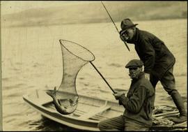
Typed annotation on recto: "Fishing action - Stuart Lake, B.C." Two men fishing in a canoe, with one fish caught in net. Hillside in background. It is speculated that the seated man with fish may be Vivian Grey.
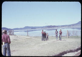
Photograph depicts a game of horseshoes in foreground. Fence crosses midground in front of water, and hills can be seen on opposite shore in background. Handwritten annotation on recto of mounted slide reads: "Playing horse [shoes?] in Legac".
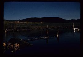
Photograph depicts two boys standing on platform extending into lake. Buildings and fenced areas can be seen on shore in background. Handwritten annotation on recto of mounted slide reads: "boys playing on the lake / Legac".
File consists of maps and pamphlets for British Columbia historic trails, waterways, historic towns, and geological features. Materials include newspaper clippings, placemats, pamphlets, and maps. Highlights include:
- Parks Canada, "Fort Langley National Historic Park British Columbia", [198-?] (pamphlet)
- North Pacific Cannery Village & Museum, "Discover British Columbia's Oldest Surviving Salmon Cannery Only 20 minutes from Prince Rupert", [198-?] (pamphlet)
- Ministry of Lands, Parks and Housing, "Barkerville Provincial Historic Park", 1986 (pamphlet)
- Map, "Yellowhead Highway 16 West Gateway to Alaska", [197-?]
- Columbia River Projects, "Mica Dam", [197-?] (pamphlet)
- Ministry of Lands, Parks and Housing, "Crooked River Provincial Park", 1980 (pamphlet)
- Parks Canada, "Fort St. James National Historic Park", 1981 (pamphlet)
- "Centennial Map of Canadian History and Achievements 1867-1967"
- B.C. Hydro, "W.A.C Bennett Dam Peace River", 1971 (pamphlet)
- Ministry of Lands, Parks and Housing, "Tweedsmuir Provincial Park (south)', 1984 (pamphlet)
- McKenzies M7 Trails West, "Explore the Canadian Rockies", [198-?] (pamphlet)
- Department of Lands, Forests, and Water Resources, "Coastal Systems", 1968 (map)
The map depicts the highest mountains in British Columbia; includes the Rocky Mountains, the Northern and Southern Plateaus, and the Mackenzie Mountain area.
The map is taken from the supplement of the Omineca Express/Bugle Caledonia Courier newspaper. The area map depicts highways, secondary roads, lakes, and gravel roads near Fort St. James, Stuart Lake, Fraser Lake, Fort Fraser, and Vanderhoof.
Item consists of transcript and taped summary of recorded interview with long-time resident Ted Williams who discusses his father' Chuck Williams early years in Prince George c.1920s. He also discusses river transportation, steam boats on the Fraser River and river scowing adventures on the Grand Canyon (BC) and fatalities that occurred.
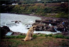
Sans titrePhotograph depicts dog seated on grass in foreground. Unidentified individuals visible below with fishing nets in waterfall area at Moricetown Canyon.
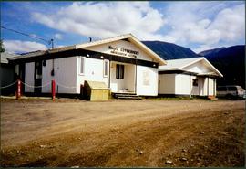
Photograph depicts two white buildings, one with the sign "Nisga'a Government Administration building". Road in foreground, vehicles and hills in background.
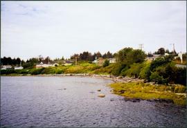
Photograph depicts water in foreground, bayside village in background.
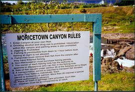
Photograph depicts sign in foreground outlining rules and restrictions for behaviour at Moricetown Canyon. Traditional fishing territory visible behind sign at waterfall in the Bulkley River, B.C. Highway and buildings can be seen in background.
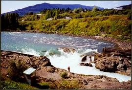
Photograph depicts an unidentified individual standing on cliff above waterfall at Bulkley River, B.C. Fishing territory visible below; highway, buildings, and hills visible in background.
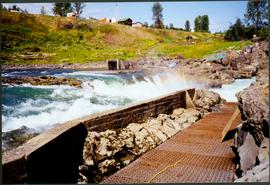
Photograph depicts fishing territory at waterfall rapids in Bulkley River, B.C. Highway and buildings on opposite shore in background.
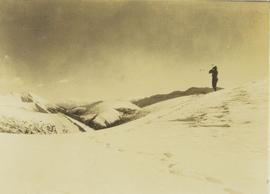
Photograph depicts one unidentified man surveying a landscape from a snowy mountain peak with other mountain ranges in the background.
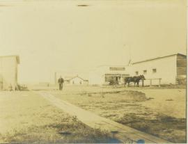
Photograph depicts the main street of Rolla with a dirt street and wooden sidewalks, tethered horses, and the storefront of H.G. Atkinson General Merchants. Three people are visible walking through the streets.
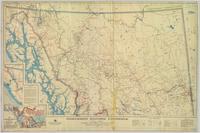
Provincial map depicting communities, bodies of water, transport routes, land districts, parks, telegraph/telephone lines, and mining regions, offices, and engineers. Includes Distance Tables (“Coast,” “Roads,” “Railways,” and “World”) and Index of Post Offices.
Geological topographic map that the Geological Survey produced for the Department of Mines, Canada. Includes two detailed topographic cross sections.
Regional map depicting communities, parks, customs posts, airports, radio stations, hatcheries, bodies of water, transport routes, communication lines, elevation points, and lines of batholith contacts. Includes an inset of St. Elias Mountains. Includes “Special Note on the Mineralization of this Map Area” from Bureau of Mines, Victoria, B.C.
Colour-coded map dividing Northwestern British Columbia, the Western Northwest Territories, and the Yukon physiographically.
Map depicts species of forest trees in British Columbia and their regional distribution.
Accompanied by a 1942 job estimate cost summary sheet for the "Survey railway location west of Fairbanks" work to be done for the Alaska Western Railway project approved by a Colonel of the U.S. Army Corps of Engineers.
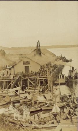
Large crowd is gathered around main building in a harbor. Many boats visible in foreground. Smoke from tugboat partially obscures the scene. Annotation on recto reads: "Prince Rupert BC. Photo by MCrae Bros."
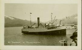
Photograph of the SS Camosun arriving in a harbour in Prince Rupert. A blurry man is in the lower right corner of the foreground. Another large vessel can be seen behind the Camosun. Annotation on recto reads: "SS 'Camosun' at Prince Rupert Allen Photo May 23[?]09."
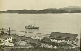
Photograph of a small vessel on the ocean with a dock and harbour buildings in the foreground. Tents and piles of lumber can be seen among the buildings. Annotation on recto reads: "The Wharf, Prince Rupert, BC. 1657." Printed annotation on verso reads "The Wharf, Prince Rupert, BC J. Howard A. Chapman, Victoria. BC. 1657."
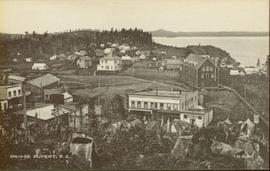
Wide angle photograph of many buildings scattered in a clear cut area. Foreground shows several businesses, including "Kelly Carruther's Supply" and "Prince Rupert Hardware and Supply Co." Some remaining forest is visible in the background. Annotation on recto reads: "Prince Rupert, BC 1659."
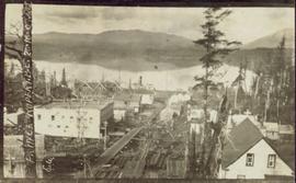
Photograph of several buildings down the street in Prince Rupert, including the church. Lumber pallets are littered around the buildings. Annotation on recto reads: "Prince Rupert, BC. 20.10.07."
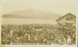
Photograph of large crowd spanning the frame of the photograph. A large marching band is visible along the edges of a small clearing in the centre. Annotation on recto reads: "May 24th Prince Rupert BC."
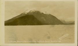
Photograph of a mountain on the waterfront. Annotation on recto reads: "Portland & Stewart. New Twin Cities. Portland Canal. June 17th 1910. Button Photo. Prince Rupert, BC."
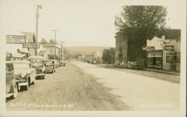
Photo depicts a street perspective cars lining Third Avenue, in Prince George, BC, ca. 1950. Annotation recto reads: "3rd Ave Prince George BC Photo J. Wrathall." Handwritten annotation in pen on verso of postcard reads: “This is the equivalent of our Granville Street. Both theatres are located here as well as Hudson Bay Co., banks, library & stores.”
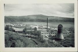
Photographic overview of the Eagle Lake Sawmill. Handwritten annotation in pen on verso reads: “The mill.”
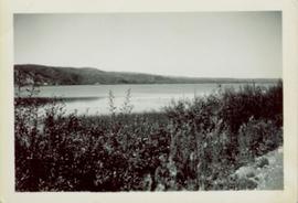
Shoreline perspective of Eagle Lake. Handwritten annotation in pen on verso reads: “This is Eagle Lake. It is about 2 blks [sic] away.”
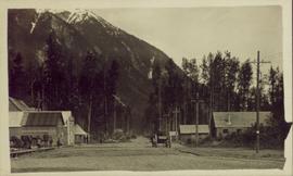
Street view side perspective photograph of several businesses in downtown Stewart, BC.
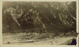
Elevated, wide angle photograph of Stewart, BC with mountains visible in the background.
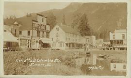
Photograph taken from a low elevation of various businesses in Stewart, BC. Visible businesses include "The R. Boyd Young Co." and "Motel King Edward." Printed annotation on recto reads: "Cor. 5th and Columbia Sts. Stewart. B.C. Hughes #44."
Photograph of two horse driven carts driving past a house situated at the foot of a forested mountain.
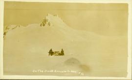
Front view of two men sitting on a pile of supplies with a mountain in the background. Printed annotation on recto reads: "On the Divide Enroute to Naas #96."
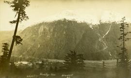
Photo of a mountain with what appears to be Stewart, BC at its foot. Printed annotation on recto is partially obscured by fading and reads: "[Illegible] Stewart, BC."
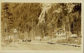
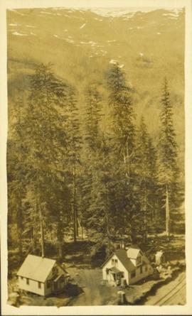
Elevated photograph of two small houses surrounded by tall trees. A large mountain is visible in the background.
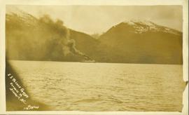
Photograph of the S.S. Prince George traveling through the water. Several mountains are visible in the background. Printed annotation on recto reads: "S.S. Prince George Enroute to Stewart, B.C."
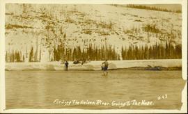
Photograph of several men traveling across a river. Printed annotation on recto reads: "Fording The Nelson River Going to the Naas #93."
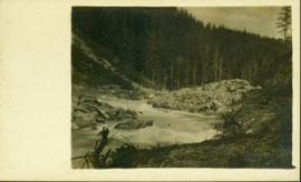
Photograph of a small creek traveling through several rocky embankments.
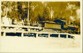
Photograph of a large group of people gathered around a steam engine loaded with coal situated on a wooden bridge. Printed annotation on recto reads: "Stewart BC Aug 9th 1911."
