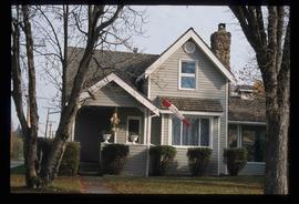
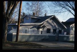
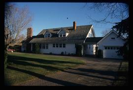
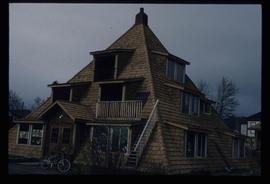
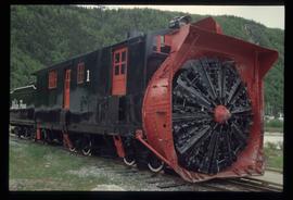
Previsualizar a impressão Fechar

Mostrar 1595 resultados

Archival description
Veteran House
2012.13.1.24.36 · Item · 2000
Parte de J. Kent Sedgwick fonds

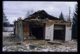
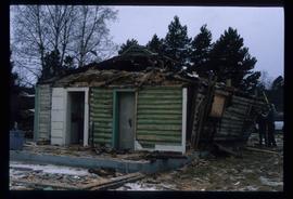
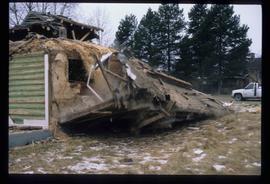
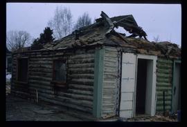
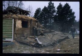
Image depicts a property given to the Veterans of the Second World War, located on the corner of 15th Avenue and Elm Street in Prince George, B.C.

Giscome School - Before
2012.13.1.87.084 · Item · [between 1980 and 2000?]
Parte de J. Kent Sedgwick fonds

Image depicts the Giscome mill site in Giscome, B.C. The bunkhouse is in the background on the left and the school is in the foreground on the right. Map coordinates 54°04'04.8"N 122°22'04.7"W

Giscome - Train Tracks - Before
2012.13.1.87.086 · Item · [between 1980 and 2000]
Parte de J. Kent Sedgwick fonds

Image depicts the Giscome mill site in Giscome, B.C. The bunkhouse is the large building with many windows. A train and railroad tracks are in the foreground. Map coordinates 54°04'17.6"N 122°22'06.1"W

Employee Houses on Giscome Mill Site
2012.13.1.87.088 · Item · [between 1980 and 2000]
Parte de J. Kent Sedgwick fonds

Image depicts employee houses on mill site in Giscome, B.C. Tug boats are in the foreground on the right. Map coordinates 54°04'23.4"N 122°22'16.9"W

Miles Canyon - A River
2012.13.1.98.65 · Item · 1999
Parte de J. Kent Sedgwick fonds

Image depicts a river in the Miles Canyon near Whitehorse Y.T. The Robert Lowe Bridge, built in 1922, can be seen over the canyon.

Railway - Near Summit
2012.13.1.100.19 · Item · 1999
Parte de J. Kent Sedgwick fonds

Image depicts two merging railway tracks, and what appears to be a frozen river, somewhere near the summit of a mountain.

Northwood Upper Fraser Sawmill Sign
2012.13.1.89.161 · Item · 1999
Parte de J. Kent Sedgwick fonds

Image depicts the office at the Northwood Upper Fraser Saw Mill and a sign which reads "Have a safe, quality day." Map coordinates 54.117916, -121.943351

Europe Hotel
2012.13.1.7.178 · Item · Dec. 1999
Parte de J. Kent Sedgwick fonds

Image depicts the Europe Hotel in Prince George prior to its demolition in the 1980s; however, the slide itself was only made in 1999 and the date of the photo is otherwise unknown, but most likely around 1979.

Demolished House
2012.13.1.7.179 · Item · Dec. 1999
Parte de J. Kent Sedgwick fonds

Image depicts a house in the process of being demolished in Prince George, B.C.

Demolished House
2012.13.1.7.181 · Item · Dec. 1999
Parte de J. Kent Sedgwick fonds

Image depicts a house in the process of being demolished in Prince George, B.C.

Demolished House
2012.13.1.7.183 · Item · Dec. 1999
Parte de J. Kent Sedgwick fonds

Image depicts a house in the process of being demolished in Prince George, B.C.

Railway Bridge
2012.13.1.98.03 · Item · 1999
Parte de J. Kent Sedgwick fonds

Image depicts a railway bridge, possibly in the small town of Fraser, located on the Klondike Highway in B.C.

Atlin Lake
2012.13.1.98.14 · Item · 1999
Parte de J. Kent Sedgwick fonds

Image depicts Atlin Lake as well as a small section of Atlin, B.C. The mountain is possibly Atlin Mountain.

Community on the Shore
2012.13.1.98.27 · Item · 1999
Parte de J. Kent Sedgwick fonds

Image depicts what appears to be a small community on the shore of a lake. The location is uncertain.

Snow Plow No.1
2012.13.1.100.03 · Item · 1999
Parte de J. Kent Sedgwick fonds

Image depicts the restored White Pass Snow Plow No.1 in Skagway, Alaska.

Another Train
2012.13.1.100.14 · Item · 1999
Parte de J. Kent Sedgwick fonds

Image depicts another train on the White Pass railway along a forested mountain side.

Tunnel
2012.13.1.100.15 · Item · 1999
Parte de J. Kent Sedgwick fonds

Image depicts the White Pass Train entering a tunnel in the mountain side.

Trail of 98
2012.13.1.100.20 · Item · 1999
Parte de J. Kent Sedgwick fonds

Image depicts a patch of snow-covered ground with a sign that reads "Trail of 98," somewhere along the White Pass railway.

Fire Place and Couch Snow Sculptures
2012.13.1.3.149 · Item · Apr. 1999
Parte de J. Kent Sedgwick fonds

Image depicts a snow sculpted fire place and couch on a skating rink, possibly during the Winter City Conference, in Prince George, B.C. Taken at the Prince George Civic Center. Map coordinates 53°54'45.6"N 122°44'59.6"W

Mr. P.G. on Couch Snow Sculpture
2012.13.1.3.150 · Item · Apr. 1999
Parte de J. Kent Sedgwick fonds

Image depicts a snow sculpture of the Mr. P.G. lounging on a couch, possibly during the Winter City Conference, in Prince George, B.C. Taken at the Prince George Civic Center. Map coordinates 53°54'45.6"N 122°44'59.6"W

Demolished House
2012.13.1.7.182 · Item · Dec. 1999
Parte de J. Kent Sedgwick fonds

Image depicts a house in the process of being demolished in Prince George, B.C.

Demolished House
2012.13.1.7.184 · Item · Dec. 1999
Parte de J. Kent Sedgwick fonds

Image depicts a house in the process of being demolished in Prince George, B.C.