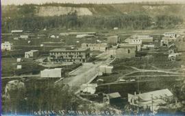
Printed annotation on recto reads: “George St. Prince George B.C.”, handwritten in pencil on verso reads: “CA. 1915”
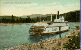
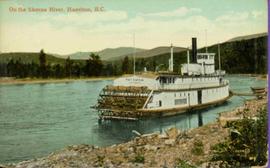
Stern wheeler “Port Simpson” tied to riverbank. Printed annotation on recto reads: “On the Skeena river, Hazelton, B.C.” Handwritten message on verso is addressed to “Mrs. Flossie Strong 6 Nah St. Watermill ME, U.S.A” 1 cent Canadian postage stamp has been canceled with a date of “Dec 24, 5:30 PM 1915 Buffalo N.Y.”
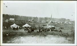
Photograph depicts crowd, horses, tents and flag pole in foreground with buildings and trees in background.
Annotation on verso: “Fourth Fall Fair Prince George, Sept 1915".
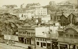
Postcard overview of several identifiable storefronts built amongst the rocky outcrops of Prince Rupert. Printed annotation on recto reads: "Prince Rupert BC."
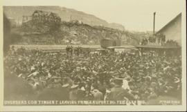
Slightly overhead shot of a large crowd gathered by general store and railroad. Annotation on recto reads: "Overseas contingent leaving Prince Rupert BC Feb 26th 1915. McRae Bros."
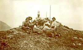
Photograph depicts the sons and daughters of Marion and Archdeacon W.H. Collison sitting on the ground with food supplies at the top of a hill. Individuals believed to be (left to right): Arthur, Elsie, Herbert, Henry (in chef's hat), unknown, William, John Maxwell ('Max').
Handwritten annotation on verso reads: "Collison family on prospecting trip up Portland Canal."
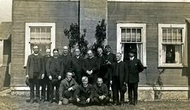
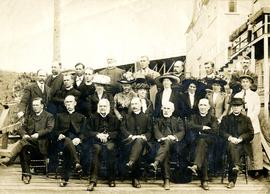
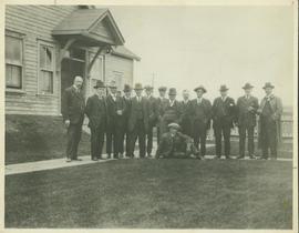
Group stands and sits in front of a large building. W.H. Collison stands fifth from left, W.E. Collison on far right.
Handwritten annotation on verso reads: "Synod at Prince Rupert BC".
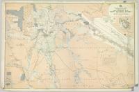
Item is a photocopied 1915 pre-emptor's map of Fort George, published by the British Columbia Department of Lands.
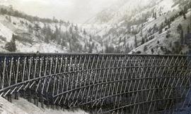
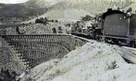
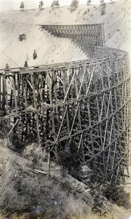
Photograph depicts the Pacific Great Eastern Railway trestle located near Sallus Creek in the area around Lillooet, Fountain, and Pavilion. "Canadian Railway and Marine World" reported that track had been laid to 14 miles North of Lillooet by July 30, 1915 (CR&MW , Sept 1915, p341, c2). 14 miles North of Lillooet is approximately 20 rail lengths beyond the North end of this trestle, leading to a "best estimate" of very late July 1915 or later as the earliest dates for this photograph.
The ca. 1921-1927 “PGE Bridge List” from the notebook of William H. Hewlett (1914-1968) references a Mile 13.7, 14 Mile Creek, frame trestle, 905 ft. long, 182 ft. high, 61 spans of 14.8 feet in the Lillooet Subdivision. A “PGE Track Profile” drawing shows this trestle was on a 1.55% grade and a 12 degree left hand curve. While the drawing had been revised at least twice (with an unknown date for the most recent revision), the pre-“Lillooet Diversion of 1931" mileage figures confirm that the 1915 “Mile 13.7" was in agreement with a more recent hand written note “Sallus Creek”. The trestle appears to have gone by the names "14 Mile" trestle, "13.7 Mile Trestle", and "Sallus Creek" trestle.
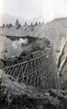
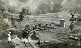
Photograph depicts a Pacific Great Eastern Railway work train on a trestle located near Sallus Creek in the area around Lillooet, Fountain, and Pavilion. The work train appears to be carrying railway workers and a load of rails.
Photographs 2020.08.68, 2020.08.69, and 2020.08.70 are three views of track laying on the Sallus Creek trestle. These form a sequence: 2020.08.68, 2020.08.70, 2020.08.69 in order as track laying proceeds from the South end of the trestle toward the North end. The piece of equipment at the North end of the train in all three images is a track laying machine that lifted a piece of rail and delivered it to the workmen ahead of the machine. "Canadian Railway and Marine World" reported that track had been laid to 14 miles North of Lillooet by July 30, 1915 (CR&MW , Sept 1915, p341, c2). 14 miles North of Lillooet is approximately 20 rail lengths beyond the North end of this trestle, leading to a "best estimate" of late July 1915 as the date for this photograph.
The ca. 1921-1927 “PGE Bridge List” from the notebook of William H. Hewlett (1914-1968) references a Mile 13.7, 14 Mile Creek, frame trestle, 905 ft. long, 182 ft. high, 61 spans of 14.8 feet in the Lillooet Subdivision. A “PGE Track Profile” drawing shows this trestle was on a 1.55% grade and a 12 degree left hand curve. While the drawing had been revised at least twice (with an unknown date for the most recent revision), the pre-“Lillooet Diversion of 1931" mileage figures confirm that the 1915 “Mile 13.7" was in agreement with a more recent hand written note “Sallus Creek”. The trestle appears to have gone by the names "14 Mile" trestle, "13.7 Mile Trestle", and "Sallus Creek" trestle.
Group of men and women pose by large building. W.H. Collison sits second from left in front, W.E. Collison stands third from right in back.
Handwritten annotation on verso reads: "Anglican Church Synod / Prince Rupert".
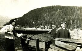
Donald Macdonald and John Maxwell Collison stand on either side of large log using two-handled saw. Donald married the Archdeacon's daughter Emily in 1910.
Handwritten annotation on verso reads: "Uncle Don, Uncle Max & Grandad Hauling wood off [beach?] at Kincolith".
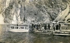
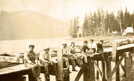
Photograph depicts a group of men, women, and children on the dock at the east end of Seton Lake. Two boats are docked, awaiting passengers. Another group of people are seated in a third boat on the far side of the dock. In the background, the PGE railway grade is visible, dating this photograph on or after 1915. The Seton Lake sawmill is also visible in the background.
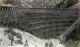
Photograph depicts a partially constructed Pacific Great Eastern Railway trestle located near Sallus Creek in the area around Lillooet, Fountain, and Pavilion. "Canadian Railway and Marine World" reported that track had been laid to 14 miles North of Lillooet by July 30, 1915 (CR&MW , Sept 1915, p341, c2). 14 miles North of Lillooet is approximately 20 rail lengths beyond the North end of this trestle, leading to a "best estimate" of early-mid July 1915 as the latest date for this photograph.
The ca. 1921-1927 “PGE Bridge List” from the notebook of William H. Hewlett (1914-1968) references a Mile 13.7, 14 Mile Creek, frame trestle, 905 ft. long, 182 ft. high, 61 spans of 14.8 feet in the Lillooet Subdivision. A “PGE Track Profile” drawing shows this trestle was on a 1.55% grade and a 12 degree left hand curve. While the drawing had been revised at least twice (with an unknown date for the most recent revision), the pre-“Lillooet Diversion of 1931" mileage figures confirm that the 1915 “Mile 13.7" was in agreement with a more recent hand written note “Sallus Creek”. The trestle appears to have gone by the names "14 Mile" trestle, "13.7 Mile Trestle", and "Sallus Creek" trestle.
Photograph depicts a Pacific Great Eastern Railway work train on a trestle located near Sallus Creek in the area around Lillooet, Fountain, and Pavilion. The work train appears to be carrying railway ties.
Photographs 2020.08.68, 2020.08.69, and 2020.08.70 are three views of track laying on the Sallus Creek trestle. These form a sequence: 2020.08.68, 2020.08.70, 2020.08.69 in order as track laying proceeds from the South end of the trestle toward the North end. The piece of equipment at the North end of the train in all three images is a track laying machine that lifted a piece of rail and delivered it to the workmen ahead of the machine. In this photograph, the machine is at the current end of track and is ready to advance the next length of rail."Canadian Railway and Marine World" reported that track had been laid to 14 miles North of Lillooet by July 30, 1915 (CR&MW , Sept 1915, p341, c2). 14 miles North of Lillooet is approximately 20 rail lengths beyond the North end of this trestle, leading to a "best estimate" of late July 1915 as the date for this photograph.
The ca. 1921-1927 “PGE Bridge List” from the notebook of William H. Hewlett (1914-1968) references a Mile 13.7, 14 Mile Creek, frame trestle, 905 ft. long, 182 ft. high, 61 spans of 14.8 feet in the Lillooet Subdivision. A “PGE Track Profile” drawing shows this trestle was on a 1.55% grade and a 12 degree left hand curve. While the drawing had been revised at least twice (with an unknown date for the most recent revision), the pre-“Lillooet Diversion of 1931" mileage figures confirm that the 1915 “Mile 13.7" was in agreement with a more recent hand written note “Sallus Creek”. The trestle appears to have gone by the names "14 Mile" trestle, "13.7 Mile Trestle", and "Sallus Creek" trestle.
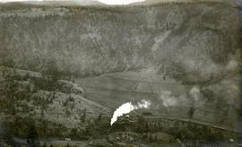
Photograph depicts a Pacific Great Eastern Railway train on Pavilion Creek trestle at Mile 20.3. Also visible are a water tank and possibly the graveyard at Pavilion.
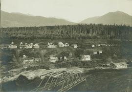
The ca. 1921-1927 “PGE Bridge List” from the notebook of William H. Hewlett (1914-1968) references a 389.4 foot long, 34 ft. high, framed trestle with 26 spans of 14.8 feet at Mile 20.3 carrying the line over Pavilion Creek. There was a water tank at Pavilion located between the North end of the siding and the South end of the trestle. A track profile chart confirms that the track at this point is on a 12 degree curve. This photograph was taken from a vantage point up the hill to the North. The structures at the lower left of this image (2020.08.82) are consistent with a small construction camp, which accounts for the presence of a camp cook in image 2020.08.83.
"Canadian Railway and Marine World" reported in their January 1916 issue (p. 11, c.1), that track had been laid to within ½ mile of Clinton (Mile 45.0) on Dec. 14, 1915. If a constant rate of construction had been maintained from Mile 14, reached on July 30, 1915 as previously discussed, to Clinton, the approximate date of completion to Pavilion would be around the end of August, 1915 which is probably the earliest possible date for this photograph.
Part of a set of 41 original black & white photographs [1908-1933-?]) of the Grand Trunk Pacific Railway line in BC depicting surveying crews, town sites (Prince Rupert and its port, Hazelton and Fort George), and First Nations Peoples.
Postcard photograph depicts sternwheeler tied to riverbank.
Printed annotation on recto reads: “On the Skeena river, Hazelton, B.C.” Handwritten message on verso is addressed to “Mrs. Flossie Strong 6 Nah St. Watermill ME, U.S.A” 1 cent Canadian postage stamp has been canceled with stamp reading “Dec 24, 5:30 PM 1915 Buffalo N.Y.”
Photograph depicts the sons and daughters of Marion and Archdeacon W.H. Collison, and one unidentified man. Buildings can be seen on shore in background.
Handwritten annotation on verso reads: "Collison family at camp (Portland Canal) Max, ?, Henry, Elsie, Arthur, Alice, Herbert".
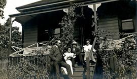
Group stands and sits on front steps of rectory. Left to right: Rev. William Edwin Collison, Mabel and John Maxwell Collison, Alice Collison. (William, Max, and Alice are sons and daughter of Archdeacon W.H. Collison).
Handwritten annotation on verso reads: "Dad & Auntie Al with Aunt May & Uncle Max at the rectory St. Luke's church [...?]".
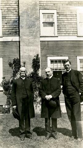
Group stands in front of a large building, W.H. Collison on left.
Handwritten annotation on verso reads: "Arch. WH Collison / Bishop [Du Vernet?] / Arch. Bish. [Du Pencior?] at Prince Rupert".
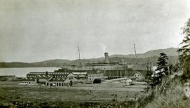
Photograph depicts a large ship behind dock buildings. Railroad crosses foreground, hills visible on shore in background.
Handwritten annotation on verso reads: "Ship in Pr. Rupert dry dock during Great War 1915?".
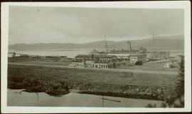
Photograph depicts a large ship behind dock buildings. Railroad crosses foreground, hills visible on shore in background.
Handwritten annotation on verso reads: "Pr. Rupert Drydock".
Architectural plan depicts a proposed standard 10 stall engine house with annex for machine shop and boiler room to be erected at Kamloops, BC.
Item is a photocopied 1915 map depicting the Fort Fraser Division, published by the British Columbia Department of Lands.
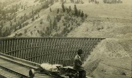
Photograph depicts Mr. Crysdale sitting on a velocipede on the Sallus Creek ("14 Mile") Pacific Great Eastern Railway trestle with an estimated date of very late July 1915 or later. "Canadian Railway and Marine World" reported that track had been laid to 14 miles North of Lillooet by July 30, 1915 (CR&MW , Sept 1915, p341, c2). 14 miles North of Lillooet is approximately 20 rail lengths beyond the North end of this trestle, leading to a "best estimate" of very late July 1915 as the earliest date for this photograph. The velocipede depicted is a 3-wheel, manually propelled vehicle operated by a push-pull (back & forth) action on the actuating handle.
The ca. 1921-1927 “PGE Bridge List” from the notebook of William H. Hewlett (1914-1968) references a Mile 13.7, 14 Mile Creek, frame trestle, 905 ft. long, 182 ft. high, 61 spans of 14.8 feet in the Lillooet Subdivision. A “PGE Track Profile” drawing shows this trestle was on a 1.55% grade and a 12 degree left hand curve. While the drawing had been revised at least twice (with an unknown date for the most recent revision), the pre-“Lillooet Diversion of 1931" mileage figures confirm that the 1915 “Mile 13.7" was in agreement with a more recent hand written note “Sallus Creek”. The trestle appears to have gone by the names "14 Mile" trestle, "13.7 Mile Trestle", and "Sallus Creek" trestle.
Photograph depicts the Pacific Great Eastern Railway trestle located near Sallus Creek in the area around Lillooet, Fountain, and Pavilion. A number of men are working along the trestle, possibly completing final construction work or performing repairs. "Canadian Railway and Marine World" reported that track had been laid to 14 miles North of Lillooet by July 30, 1915 (CR&MW , Sept 1915, p341, c2). 14 miles North of Lillooet is approximately 20 rail lengths beyond the North end of this trestle, leading to a "best estimate" of very late July 1915 or later as the earliest dates for this photograph.
The ca. 1921-1927 “PGE Bridge List” from the notebook of William H. Hewlett (1914-1968) references a Mile 13.7, 14 Mile Creek, frame trestle, 905 ft. long, 182 ft. high, 61 spans of 14.8 feet in the Lillooet Subdivision. A “PGE Track Profile” drawing shows this trestle was on a 1.55% grade and a 12 degree left hand curve. While the drawing had been revised at least twice (with an unknown date for the most recent revision), the pre-“Lillooet Diversion of 1931" mileage figures confirm that the 1915 “Mile 13.7" was in agreement with a more recent hand written note “Sallus Creek”. The trestle appears to have gone by the names "14 Mile" trestle, "13.7 Mile Trestle", and "Sallus Creek" trestle.
Photograph depicts a Pacific Great Eastern Railway work train on Pavilion Creek trestle at Mile 20.3. laden with workers, railway ties, and a steam donkey. The work train may be returning to a work camp, as a man dressed in the attire of a camp cook is standing beside the track.
The ca. 1921-1927 “PGE Bridge List” from the notebook of William H. Hewlett (1914-1968) references a 389.4 foot long, 34 ft. high, framed trestle with 26 spans of 14.8 feet at Mile 20.3 carrying the line over Pavilion Creek. There was a water tank at Pavilion located between the North end of the siding and the South end of the trestle. A track profile chart confirms that the track at this point is on a 12 degree curve. This photograph was taken at trackside. The structures at the lower left of image 2020.08.82 are consistent with a small construction camp, which accounts for the presence of a camp cook in this image (2020.08.83).
"Canadian Railway and Marine World" reported in their January 1916 issue (p. 11, c.1), that track had been laid to within ½ mile of Clinton (Mile 45.0) on Dec. 14, 1915. If a constant rate of construction had been maintained from Mile 14, reached on July 30, 1915 as previously discussed, to Clinton, the approximate date of completion to Pavilion would be around the end of August, 1915 which is probably the earliest possible date for this photograph.
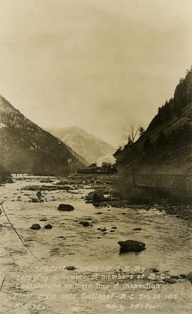
Photograph depicts a Pacific Great Eastern Railway "Special Train" that is "carrying a number of members of B.C. Legislature on their tour of inspection. First train into Lillooet, B.C. Feb. 20, 1915, 5 p.m." The train is depicted on the grade along the Seton River as it leaves Seton Lake.
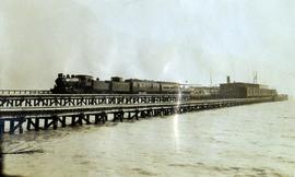
Photograph depicts a Pacific Great Eastern Railway train on the original dock at Squamish (Newport); the vessel in the distance behind the warehouse is quite likely the "MV Ballena", the subject of photograph 2020.08.01.
The equipment shown in this photograph is: Locomotive 51 or 52, built by Montreal Locomotive Works in 1913; caboose C-1, built by National Steel Car, Hamilton, Ontario in 1914; baggage-mail car 51 or 52; passenger coach 2, 3 or 4; and an unknown flat car outfitted as a sightseeing car with canopy. The time-frame for the photograph is between June 8, 1915 (when baggage-mail cars 51 & 52 arrived at Newport Dock) and some time in 1918 (when caboose C-1 was re-numbered to 1801).
Additional information on baggage-mail cars 51 & 52 and coaches 2, 3 & 4:
Baggage and mail cars 51 and 52 were purchased from E.H. Wilson & Co. of Philadelphia at a total cost of $2806.74 each. They were received on line June 4, 1915 and were barged to Newport on June 8. These cars had a length of 64 ft. over buffers, an inside length of 60 ft. and an inside width of 9 ft. 2½ in. and rode on 6-wheel trucks. Although not confirmed, these cars are believed to be of Pennsylvania Railroad heritage with PRR Class MM baggage and mail cars being the most likely candidates. Certainly, all the other cars purchased from E.H. Wilson & Co. were ex-Pennsylvania and the gasoline lighting system with which these cars were delivered was used extensively by the PRR.
Coaches 2, 3, & 4 are former Pennsylvania Railroad Class “PK” closed vestibule coaches #s 3077, 3080, & 3092 which were received on June 10, 1914 after being purchased from E.H. Wilson & Co. for $3859.11, $3858.87 & $3858.87 respectively. They were built by the PRR in 1905, 3070 and 3088 at Altoona Car Shops and 3092 at the Wilmington, Delaware shops of subsidiary Philadelphia, Baltimore and Washington. All had been assigned to P.B. & W. service. The Official Railway Equipment Register lists these cars as 62 ft. long with a capacity of 60 passengers.
Colour-coded map depicting lands open for pre-emption, lands in “University Reserve,” and lands reserved for public auction. Depicts land recording divisions, communities, bodies of water, transport routes, and game reserves.
A Fragment of Primitive Speech: A study of the roots of the language of the Nisga Indians of British Columbia. Rev. J.B. McCullagh. March 1916.
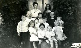
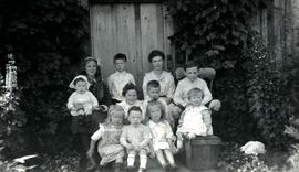
Marion sits to left of husband Archdeacon William Henry, small boy in between. Young children sit and stand in foreground, Katherine 'Katy' and Muriel 'Mimi' stand in background (daughters of W.E. Collison). The group poses in front of a wood door, ivy on either side.
Handwritten annotation on verso reads: "Grand-dad (Arch. W.H. Collison) & Grannie with grandchildren at Kincolith".
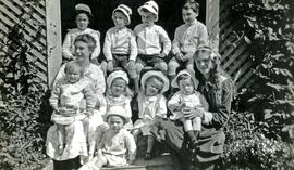
The group poses in front of a wood door, ivy on either side.
Handwritten annotation on verso reads: "The family at Kincolith - Summer House, 1916 / Back Row L-R: Art Macdonald, Bill Collison, Reg Collison, Jack [John] Macdonald / Front L-R: Katie Collison with Don Collison, Marion Collison, Joyce Collison, Muriel (Mimi) Collison with Colin Macdonald, Hugh Macdonald".
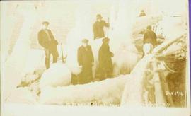
Photograph depicts 6 Men on a fishing boat with water in the background. Equipment on the boat is covered with a very thick layer of ice. Printed annotation on recto reads: “Rupert Fishing Boat After Stormy Trip Jan 1916”. Handwritten annotation in pencil on verso reads: “Rupert Fishing Boat , A Stormy Trip”.
Richard (Dick) Corless came to Prince George in 1913 from England, where upon he became an undertaker and a car dealer. He operated his funeral home business at the corner of Quebec and Fourth Avenue in Prince George. All of the funerals that he performed were recorded in a ledger, including deaths by the influenza pandemic of 1918. Mr Corless transferred his business to Assman’s Funeral home in 1931 and his ledger remained with a family member who subsequently donated it to the BC Archives.
The Prince George Genealogical Society became aware of the ledgers’ existence, and a member viewed it in the BC Archives in Victoria. Because of its fragile condition it was not suitable for photocopying; however, the BC Archives considered that it might be eligible at some point for micro-filming.
In July 2007 the Corless Ledger, was transferred from BC Archives to the Northern BC Archives and Special Collections at UNBC. Subsequently, this ledger was digitized and these images were lent to the Prince George Genealogical Society for transcription.
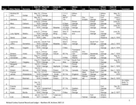
This funeral ledger consists of significant information on deaths in Prince George, BC, from the years 1916 to 1931. The ledger contains personal information regarding individuals who have died, including their name, cause of death, age, residence, ethnicity and the date of their death.
Item is a photocopy of Plan No. 1268 showing a subdivision of part of Indian Reserve no. 1 Lot 343 in the Cariboo District of British Columbia.
Postcard depicts a CPR passenger train near a summit of the Rocky Mountains.
Series contains one funeral ledger that consists of personal information regarding individuals' causes of death, their name, age, and place of residence. The ledger also contains information regarding payment for caskets or other funeral arrangements.
Item consists of one funeral ledger that contains personal information regarding individuals' causes of death, their name, age, and place of residence. The ledger also contains information regarding payment for caskets or other funeral arrangements.
Transcript of the contents of the Richard Corless Funeral Ledger made by the Prince George Genealogical Society. Transcript includes a column of comments by the transcriber providing some additional information and corrections.
Item is a photocopy of Plan No. 1268 showing a subdivision of part of Indian Reserve no. 1 Lot 343 in the Cariboo District of British Columbia.
The Whale House of the Chilkat. George T. Emmons. Anthropological Papers of the American Museum of Natural History, Vol. XIX, Part I. New York: 1916.
The group poses in front of a wood door, ivy on either side.
Handwritten annotation on verso reads: "Family group at Kincolith 1917 / Mimi [Muriel] with Colin, Bill, Katie, Jack / Art, Reg / Winnie [Marion Winnifred], Hugh, Joyce, Don".
List of men in group photo noted in handwritten annotation on verso.
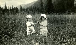
Photograph depicts two young granddaughters of Marion and W.H. Colllison, holding flowers in grassy area. Forest and hills in background.
Handwritten annotation on verso reads: "Winnie & Joyce at Kincolith". Marion Winnifred is the daughter of John Maxwell Collison, and Joyce is the daughter of William Edwin Collison.
Item is a photograph of a team of horses pulling a tanker.
Map depicts species of forest trees in British Columbia and their regional distribution.
