Mylar map is a plot map of a research plot at the Aleza Lake Research Forest. Provides date the plot was established, the harvest history, the silviculture history, remeasurement history, and information about individual trees.
Map depicts historical timber sales areas and permanent sample plots (PSPs) at the Aleza Lake Research Forest. This map may be a guide (or otherwise related) to maps 2006.18.5.43-59.
Item is a British Columbia Forest Cover Map, serial number 093J010. Includes full format forest cover labels.
Item is a British Columbia Forest Cover Map, serial number 093J010. Includes full format forest cover labels.
Photographs are panoramas taken from the Churchill BC Forest Service Lookout, located at latitude 54°04' and longitude 122°16'. The photographs were bound together and include a transparent grid that was intended to be used for locating forest fires.
Slide depicts a cleared area in a forest, likely at the Aleza Lake Experiment Station.
Slide depicts cleared ground and felled trees in a forested area, likely at the Aleza Lake Experiment Station.
File consists of slides depicting the Aleza Lake Research Forest and area taken by Michael Jull.
Annotation on slide: "BCMoF"
Annotation on slide: "CP 57 Lower Burnt, January 1992, Rubber-tired skidder on road, R-O-W in advance regen, Dawson Crk district"
No annotation on slide.
Photograph depicts Harry Coates, Ted Baker, and John Revel at Aleza Lake Research Forest re-opening ceremony on July 9, 1992.
Annotation on photograph verso: "July-Aug. 1991, View of Summit Lake EP 1162. Area from top of Teapot Mountain, looking east. Trial area is east of Crooked River, north of Caine Creek [Forest Service] Road, south of gravel pit (on right)".
Annotation on photograph verso: "D6 grapple skidder used for road development only. 27/12/91. Summit Lake Selection Trial"
Annotation on photograph verso: "View SE from Jtn of A Road and Main Road. Uncut stand on left; selection logging virtually complete in centre and right. 15/1/92. Summit Lake Selection Trial"
Annotation on slide: "Summit Lake D4H highdrive"
Annotation on slide: "Summit Lake, March 1992".
Annotation on slide: "Summit Lake Select Trial: Resid. Basal Area Study".
No annotation on slide.
Annotation on slide: "Basal scarring on Douglas fir, Summit Lake".
Annotation on slide: "Summit Lk., Mod. vol. removal".
No annotation on slide.
Annotation on slide: "Heavy Residual Basal Area: Summit Lake".
File consists of photographs taken by Paul Sanborn during the May 9, 2002 UNBC/UBC Aleza Lake Research Forest Field Tour for UNBC and UBC faculty members.
File consists of slides depicting Joselito Arocena's University of Alberta PhD fieldwork at a research site in the Alberta foothills near Hinton. Arocena had just started his PhD fieldwork in 1988 under the supervision of Dr. Steve Pawluk. Persons depicted in the photographs include: Joselito Arocena, Dr. Steve Pawluk (blue hat), and Paul Sanborn.
File consists of digital images for use in UNBC NRES brochures. Also includes accompanying text for the brochures.
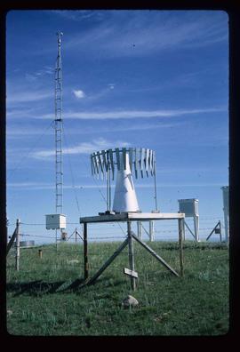
File contains slides depicting various types of instruments at various locations, including Willow River.
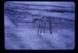
Image depicts a hand-held ice drill.
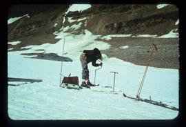
Image depicts an unidentified individual drilling into the ice.
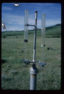
Image depicts an atmometer. According to the slide, it is being used for measuring the rate of water evaporation "from carborundum stone." The location is uncertain.
Image depicts a snow gauge at an uncertain location.
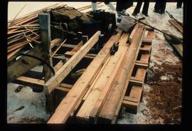
Image depicts a saw and numerous wooden boards at an uncertain location.
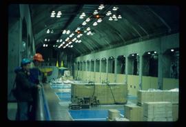
Image depicts two unidentified individuals in hard hats leaning against the railing of a large, open space inside an unknown concrete structure. It is possibly located in Fort St. John, B.C.
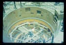
Image depicts two individuals at work inside what appears to be a piece of machinery. It is possibly located somewhere in Fort St. John, B.C.
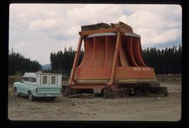
Image depicts an orange turbine in Fort St. John, B.C.
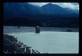
Image depicts the Lajoie Dam on the Bridge River from the upstream side.
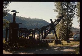
Image depicts a steam shovel, located in Quesnelle Forks.
Fonds consists of the research records of Dr. Paul Sanborn, a University of Northern British Columbia faculty member in the Department of Ecosystem Science and Management.
Zonder titelDuring a year away from studies in 1987-88, Dr. Paul Sanborn developed a successful grant proposal to the Science Council of BC (SCBC) to pursue a postdoctoral project with Dr. Tim Ballard in relation to sulphur-deficient soils in BC and prescribed fire. This project built on an existing broadcast burning study conducted by Macmillan Bloedel Ltd. near Port Alberni on Vancouver Island, led by Bill Beese (later at Vancouver Island University). Dr. Sanborn's work addressed sulphur forms and amounts in the soils at these sites, and the chemical processes influencing sulphur availability in relation to prescribed fire.
Only one part of this work was eventually published:
Sanborn, P.T. and T.M. Ballard. 1991. Combustion losses of sulphur from conifer foliage: Implications of chemical form and soil nitrogen status. Biogeochemistry 12: 129–134.
https://doi.org/10.1007/BF00001810
The remainder of the work was documented in the Project Completion Report to SCBC, dated February 28, 1990.
Thirty-four of the accompanying project data files were selected for archival retention.
This document file "Cluculz Creek Fertilization Research Site.pdf" contains a field description and basic characterization data for a representative pedon at the E.P. 886.10 site.


