Aperçu avant impression Fermer

Affichage de 2245 résultats

Archival description
950 résultats avec objets numériques Afficher les résultats avec des objets numériques
Prince George
2012.13.1.3.169 · Pièce · Mar. 2003
Fait partie de J. Kent Sedgwick fonds

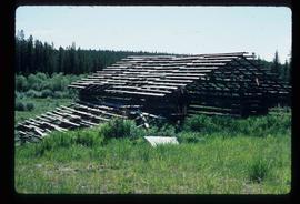
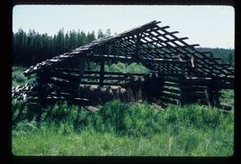
Image depicts an aerial view of what is possibly an outlying area of Prince George, B.C.

Studio 2880 Arts Complex
2012.13.1.3.170 · Pièce · Apr. 2003
Fait partie de J. Kent Sedgwick fonds

Image depicts Studio 2880 Arts Complex in Prince George, B.C. Map coordinates 53°54'36.9"N 122°46'30.3"W

Central Fort School
2012.13.1.40.07 · Pièce · 1979
Fait partie de J. Kent Sedgwick fonds

Image depicts an old, boarded up school, possibly the Central Fort George Traditional School in Prince George, B.C.

PGE Grade - View South
2012.13.1.41.03 · Pièce · 2001
Fait partie de J. Kent Sedgwick fonds

Image depicts a view of the south direction of the grade for the British Columbia Railway, which was formerly known as the Pacific Great Eastern until 1972. It is at an uncertain location, possibly near Woodpecker or Prince George.

Intercontinental and P.G. Pulp Mills
2012.13.1.5.01 · Pièce · Oct. 1975
Fait partie de J. Kent Sedgwick fonds

Image depicts two mills; the Intercontinental Pulpmill is on the left side of the tracks in the image and the Prince George Pulp and Paper Mill is located on the right side in Prince George, B.C. The Northwood Pulp Mill can be seen in the distance.

2012.13.1.5.10 · Pièce · 6 Sept. 1993
Fait partie de J. Kent Sedgwick fonds

Image depicts two mills; the Intercontinental Pulp Mill is on the right in the foreground, and the Prince George Pulp and Paper Mill is on the left in the background. The picture is taken from the South, possibly off Yellowhead Bridge in Prince George, B.C.

Spruceland
2012.13.1.5.24 · Pièce · Mar. 2003
Fait partie de J. Kent Sedgwick fonds

Image depicts a Lakewood view of Spruceland in Prince George, B.C.

College Heights
2012.13.1.5.25 · Pièce · Mar. 2003
Fait partie de J. Kent Sedgwick fonds

Image depicts College Heights, particularly along Gladstone Drive, in Prince George, B.C.

Trailer Park
2012.13.1.5.27 · Pièce · Mar. 2003
Fait partie de J. Kent Sedgwick fonds

Image depicts a trailer park by either the Fraser or Nechako River in Prince George, B.C.

British Columbia Rail
2012.13.1.5.30 · Pièce · Mar. 2003
Fait partie de J. Kent Sedgwick fonds

Image depicts an aerial view of the BC Rail, in Prince George, B.C. It is now known as CN Rail.

Mud (Chilako) River
2012.13.1.6.084 · Pièce · July 1977
Fait partie de J. Kent Sedgwick fonds

Image depicts Mud River, also known as the Chilako River, at Blackwater Road, Prince George, B.C.

Bee Hive Burner
2012.13.1.7.001 · Pièce · Oct. 1975
Fait partie de J. Kent Sedgwick fonds

Image depicts a bee-hive burner beside a rail-road track at an unidentified mill somewhere in Prince George, B.C.

Northern Rooms
2012.13.1.7.002 · Pièce · Oct. 1975
Fait partie de J. Kent Sedgwick fonds

Image depicts an old building with a sign labelled "Northern Rooms" in an uncertain location somewhere in Prince George, B.C.