Previsualizar a impressão Fechar

Mostrar 1971 resultados

Archival description
1322 resultados com objetos digitais Mostrar resultados com objetos digitais
Jackladder at Nash Sawmill
2014.2.1.12 · Item · [before 1941]
Parte de Cornel Neronovitch Logging and Sawmills Collection

Photograph depicts a log jack-ladder up to Nash Sawmill, co-owned by Cornel Neronovitch and Fred Tesluk. This sawmill was steam powered and burnt down in 1941. The sawmill was located on a back-channel of the Fraser River.

Canadian Institute of Forestry fonds
2007.39 · Fundo · 1951 - 1965

This fonds consists of membership lists and application forms, correspondence, reports, minutes, information bulletins, and constitution & by-law information created or received by the Canadian Institute of Forestry - Cariboo Section during its first years of establishment.

Sem título
Publications
2000.1.3 · Série · 1956-1991
Parte de Cassiar Asbestos Corporation Ltd. fonds

The Publications series consists of news bulletins and newspapers documenting the community and work life of the residents of Cassiar, BC. Content includes text and photographs, as well as jokes, comics and games.

On March 7, 1956 the Cassiar Reporters Guild published one issue of an untitled newspaper simply titled “The Cassiar?” (vol.1, no.1) along with a “name that newspaper” contest call out to the local community. It is believed that no other issue of this first volume was published until December 7, 1957 when The Asbestos Sheet (vol.2, no.1) was published. The Asbestos Sheet, was generally published twice a month and ran from December 1957 to September 1976; after which time both its name and its format changed: the 8-1/2 x 10” news bulletin changing to an 11 x 17” newspaper; and The Asbestos Sheet becoming the Cassiar Courier. The Courier was published monthly from fall 1976 until February 1991 when it stopped circulation shortly before the closure of both the mine and the company town.

Box Inventory
2000.1.4 · Série · 1950-1998
Parte de Cassiar Asbestos Corporation Ltd. fonds

The Cassiar Asbestos Corporation and townsite records encompass a massive archival holding of approximately 1,600 bankers boxes. A box level inventory was created by student employees of the archives over a 15-year period. This inventory is provided here for access purposes only and its accuracy cannot be guaranteed.

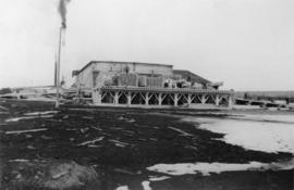
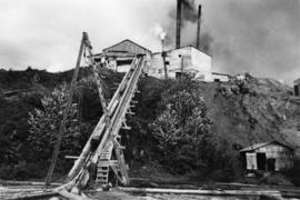
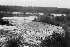
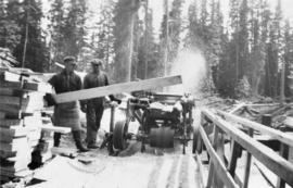
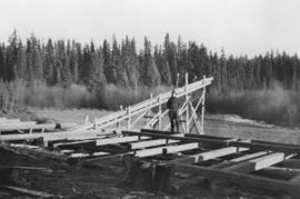
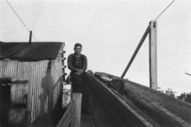
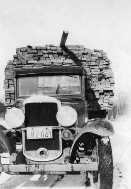
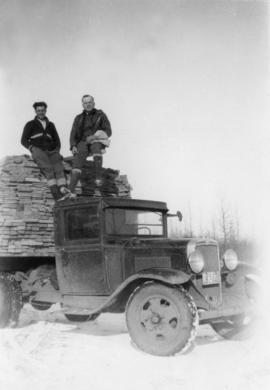
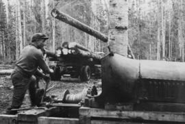
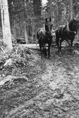
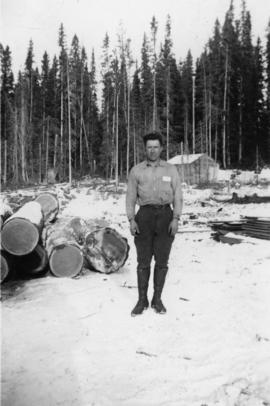
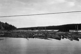
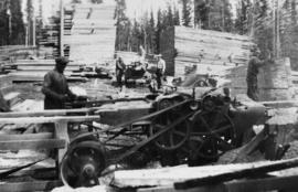
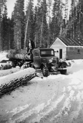
In 1952 the Cassiar Asbestos Mining Corporation constructed an asbestos open-pit mine and mill and created a town site for its workers that became the town of Cassiar, British Columbia, 50 miles south of the Yukon border, and 80 miles north of Dease Lake. For 40 years Cassiar was a thriving asbestos mining town with a population at its peak of about 2500, with production statistics for 1989, recording over 60 million tonnes of ore mined, producing a billion dollars of new wealth. In 1989 Cassiar added an underground mine to the site, and despite attempts to run it profitably, in 1992 the entire mine closed partially due to the global market decline in the demand for asbestos, resulting in the closure of the town, and the move of its workers and families out of Cassiar. An auction was held to sell off all the mining equipment, townsite infrastructure, its buildings, people’s residences and the site was bull-dozed, with many houses burned to the ground. Today little remains in this remote area of Northern British Columbia to mark Cassiar’s industrial, economic or social history.

In 1992 the University of Northern British Columbia acquired the holdings of CAMC and the Cassiar townsite recognizing its potential for academic research, as the records could provide insight into natural resource industry extraction operations in Northern BC from mid to late 20th century, illustrative of ‘boom & bust’ industries, and to provide context to the development of the Cassiar Asbestos Mining Corporation and the history of the ‘life’ of a one-industry company town. The holdings document mining operations by CAMC and of the town site of Cassiar, originally consisting of the equivalent of 1800+ bankers’ boxes, including records on construction, engineering, operations, administration of CAMC, tallies of extractions, labour and union activities, corporate events and visits by dignitaries (including Prime Minister Trudeau who visited CAMC’s northern operations unit in Clinton Creek in 1968 and M.P. Iona Campagnolo in 1978). As CAMC was owner of both the mine and the Cassiar town, the company provided municipal services (i.e. sewer, water, and electricity) for its workers and their families. The archived municipal records document townsite construction, including the creation of health, education and community services such as Cassiar’s private hospital, school, library, community centre, hockey arena, and retail store. The holdings also include extensive visual documentation of natural and man-man landscapes within this remote and scenic area of Northern British Columbia. The formats of the archival holdings are diverse consisting of textual, photographic, cartographic materials, electronic records, films, promotional video-recordings, and a near complete run of the Cassiar community’s print newspaper.

S. B. Trick Lumber Co. fonds
2017.7 · Fundo · 1942-2008

Fonds consists of ledgers recording accounts and maintenance notes of the S. B. Trick Lumber Co. and one photograph of the Ambrose Trick Sawmill.

Sem título
Photographs
2017.7.1 · Série · [195-?]
Parte de S. B. Trick Lumber Co. fonds

Series consists of one black and white photograph of S. B. Trick Lumber Company Sawmill.

Ledgers and Journals
2017.7.2 · Série · 1942-2008
Parte de S. B. Trick Lumber Co. fonds

Series consists of two ledgers and two journals. The two ledgers consist of logging accounts including lumber shipments and sales as well as payroll and expenditures. The two journals include handwritten maintenance notes and loose papers of diagrams of equipment.

S.B. Trick Lumber Sawmill
2017.7.1.01 · Item · [195-?]
Parte de S. B. Trick Lumber Co. fonds

Item is a photograph of the S.B. Trick Lumber Co. Sawmill. Image shows men around processed lumber with the mill in the background.

Accounting Ledgers
2017.7.2.01 · Dossiê/Processo · 1942-1951
Parte de S. B. Trick Lumber Co. fonds

File consists of two ledgers recording sales and expenditures. One ledger includes shipping and sales as well as expenditures, including salaries, from Oct. 1944 to June 1951. The other ledger, with "M + T Journal" on the cover, records logging accounts and payroll from Sept. 1942 to Nov. 1950.

Maintenance Journals
2017.7.2.02 · Dossiê/Processo · 1978-2008
Parte de S. B. Trick Lumber Co. fonds

File consists of two journals both in binding marked Daily Journal 1974. One journal has "Strapper" written across the cover and is mostly empty but contains handwritten strapper maintenance notes and loose paper with diagrams; dates range from 1978-2008. The other journal includes handwritten maintenance notes and loose pages with diagrams, no dates are included.

Prince George Sawmill
2012.13.1.3.158 · Item · Nov. 2000
Parte de J. Kent Sedgwick fonds

Image depicts Prince George Sawmill taken from across the Nechako River looking southwest. Map coordinates 53°56'00.0"N 122°44'29.7"W

Prince George Sawmill
2012.13.1.3.159 · Item · Nov. 2000
Parte de J. Kent Sedgwick fonds

Image depicts Prince George Sawmill taken from across the Nechako River looking southwest. Map coordinates 53°56'00.0"N 122°44'29.7"W

Northwood Pulpmill
2012.13.1.3.160 · Item · Nov. 2000
Parte de J. Kent Sedgwick fonds

Image depicts the Northwood Pulpmill in Prince George, B.C. taken from above the Nechako River looking east. Map coordinates 53°56'00.0"N 122°44'29.7"W

Upper Fraser Mill
2012.13.1.87.046 · Item · [between 1975 and 1995]
Parte de J. Kent Sedgwick fonds

Image depicts Upper Fraser mill yard with log deck and beehive burner in silhouette across railroad tracks. Located in Upper Fraser, B.C. Map coordinates 54°07'01.5"N 121°56'29.6"W

Upper Fraser Mill
2012.13.1.87.061 · Item · [between 1975 and 1995]
Parte de J. Kent Sedgwick fonds

Image depicts the entrance to the Upper Fraser mill yard in Upper Fraser, B.C. Map coordinates 54°07'10.8"N 121°56'51.7"W

Upper Fraser Mill
2012.13.1.87.062 · Item · [between 1975 and 1995]
Parte de J. Kent Sedgwick fonds

Image depicts the entrance to the Upper Fraser mill yard in Upper Fraser, B.C. Map coordinates 54°07'10.8"N 121°56'51.7"W

Upper Fraser Mill
2012.13.1.87.063 · Item · [between 1975 and 1995]
Parte de J. Kent Sedgwick fonds

Image depicts the Upper Fraser mill yard with a CN train in Upper Fraser, B.C. Map coordinates 54°07'10.8"N 121°56'51.7"W

Upper Fraser Mill
2012.13.1.87.064 · Item · [between 1975 and 1995]
Parte de J. Kent Sedgwick fonds

Image depicts numerous log decks at the Upper Fraser sawmill. Map coordinates 54°07'10.8"N 121°56'51.7"W

Upper Fraser Mill
2012.13.1.87.066 · Item · [between 1975 and 1995]
Parte de J. Kent Sedgwick fonds

Image depicts the Upper Fraser Road running through Upper Fraser, B.C. A newer style round burner is seen in the background. Map coordinates 54°07'05.7"N 121°56'38.9"W

Giscome - Train Tracks - Before
2012.13.1.87.086 · Item · [between 1980 and 2000]
Parte de J. Kent Sedgwick fonds

Image depicts the Giscome mill site in Giscome, B.C. The bunkhouse is the large building with many windows. A train and railroad tracks are in the foreground. Map coordinates 54°04'17.6"N 122°22'06.1"W

Giscome - Power Poles
2012.13.1.87.098 · Item · [between 1975 and 1995]
Parte de J. Kent Sedgwick fonds

Image depicts the remains of a street of houses in Giscome, B.C. The quarry is slightly visible in the background. Map coordinates 54°04'20.9"N 122°21'53.1"W

Sawmill Town?
2012.13.1.87.106 · Item · [between 1975 and 1995]
Parte de J. Kent Sedgwick fonds

Image depicts numerous buildings at an uncertain location. A beehive burner and what appears to be a large pile of wood is visible in the background.

Floating Logs, Eaglet Lake?
2012.13.1.87.151 · Item · [between 1975 and 1995]
Parte de J. Kent Sedgwick fonds

Image depicts numerous tree logs floating on a body of water. The location is uncertain, but is likely Eaglet Lake.

Giscome Houses and Giscome Mill
2012.13.1.87.156 · Item · [between 1975 and 1995]
Parte de J. Kent Sedgwick fonds

Image depicts several houses and the Giscome saw mill in Giscome, B.C. in the background. Map coordinates 54°04'20.9"N 122°21'53.1"W

Giscome Sawmill
2012.13.1.87.167 · Item · [between 1975 and 1995]
Parte de J. Kent Sedgwick fonds

Image depicts the mill site at Giscome, B.C. Map coordinates 54°04'19.7"N 122°22'04.7"W

Giscome Sawmill
2012.13.1.87.168 · Item · [between 1975 and 1995]
Parte de J. Kent Sedgwick fonds

Image depicts the mill site at Giscome, B.C. Map coordinates 54°04'19.7"N 122°22'04.7"W

Giscome Sawmill
2012.13.1.87.169 · Item · [between 1975 and 1995]
Parte de J. Kent Sedgwick fonds

Image depicts the mill site at Giscome and its beehive burner. Map coordinates 54°04'19.7"N 122°22'04.7"W

Giscome Sawmill
2012.13.1.87.170 · Item · [between 1975 and 1995]
Parte de J. Kent Sedgwick fonds

Image depicts the mill site at Giscome, B.C. Map coordinates 54°04'19.7"N 122°22'04.7"W

Giscome Sawmill
2012.13.1.87.171 · Item · [between 1975 and 1995]
Parte de J. Kent Sedgwick fonds

Image depicts the mill site at Giscome, B.C. A sign in the foreground reads "Maynard's Industrial Auctioneers." Map coordinates 54°04'19.7"N 122°22'04.7"W

Giscome Sawmill Food Stand
2012.13.1.87.172 · Item · [between 1975 and 1995]
Parte de J. Kent Sedgwick fonds

Image depicts a food stand at the mill site at Giscome, B.C. Map coordinates 54°04'19.7"N 122°22'04.7"W

Northwood Upper Fraser Sawmill Sign
2012.13.1.89.161 · Item · 1999
Parte de J. Kent Sedgwick fonds

Image depicts the office at the Northwood Upper Fraser Saw Mill and a sign which reads "Have a safe, quality day." Map coordinates 54.117916, -121.943351