Aperçu avant impression Fermer

Affichage de 2133 résultats

Archival description
1985 résultats avec objets numériques Afficher les résultats avec des objets numériques
Small Mountain
2012.13.1.50.079 · Pièce · [1978?]
Fait partie de J. Kent Sedgwick fonds

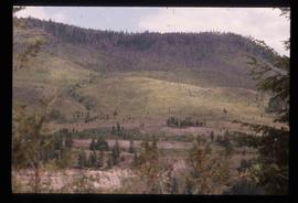
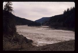
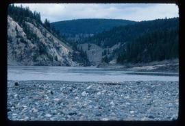
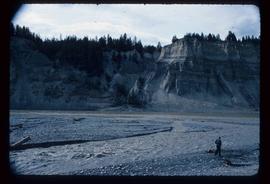
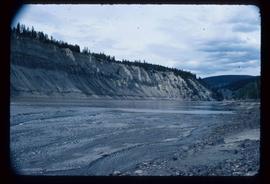
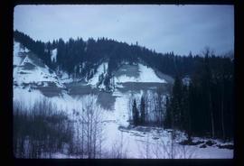
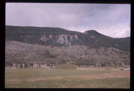
Image depicts a small mountain at an unknown location. The slide is labelled "basalt" for an unknown reason.

Slump?
2012.13.1.50.078 · Pièce · [1978?]
Fait partie de J. Kent Sedgwick fonds

Image depicts what is likely a slump slide at an unknown location.

Lava Formation?
2012.13.1.50.077 · Pièce · [1978?]
Fait partie de J. Kent Sedgwick fonds

Image depicts a formation of rock; presumably solidified lava, as the slide is simply labelled "lava." The location of the image is uncertain.

Scenery
2012.13.1.50.076 · Pièce · [1978?]
Fait partie de J. Kent Sedgwick fonds

Image depicts a scenic view of a section of land at an unknown location.

Robin Hood Flour
2012.13.1.50.068 · Pièce · [1978?]
Fait partie de J. Kent Sedgwick fonds

Image depicts an old log cabin with the sign "Robin Hood Flour" on it at an uncertain location. It is possibly at the 153 Mile House.

Farm
2012.13.1.50.067 · Pièce · 1978
Fait partie de J. Kent Sedgwick fonds

Image depicts a farm on the west side of the Fraser, south of Quesnel, B.C.

Fraser Valley
2012.13.1.50.066 · Pièce · 1978
Fait partie de J. Kent Sedgwick fonds

Image depicts the Fraser Valley, looking north, possibly from Marguerite, B.C.

Fraser River
2012.13.1.50.065 · Pièce · 1978
Fait partie de J. Kent Sedgwick fonds

Image depicts the Fraser River, looking south from Marguerite, B.C.

Old Slump
2012.13.1.50.064 · Pièce · 1978
Fait partie de J. Kent Sedgwick fonds

Image depicts an old slump type of landslide. The slide labels it as being near "McAlister."

River
2012.13.1.50.061 · Pièce · 1978
Fait partie de J. Kent Sedgwick fonds

Image depicts a river at an uncertain location.

River
2012.13.1.50.060 · Pièce · 1978
Fait partie de J. Kent Sedgwick fonds

Image depicts a river at an uncertain location.

Rudi's Bridge
2012.13.1.50.059 · Pièce · 1978
Fait partie de J. Kent Sedgwick fonds

Image depicts a small foot bridge at an unknown location. The slide is simply labelled "Rudi's Bridge."

Farm
2012.13.1.50.058 · Pièce · 1978
Fait partie de J. Kent Sedgwick fonds

Image depicts a farm at an unknown location.

Ducks
2012.13.1.50.055 · Pièce · 1978
Fait partie de J. Kent Sedgwick fonds

Image depicts a large flock of ducks in a field full of water at an unknown location.

Slump?
2012.13.1.50.051 · Pièce · 1978
Fait partie de J. Kent Sedgwick fonds

Image depicts an unknown individual standing next to what appears to be a slump type of landslide at an unknown location.

Near Williams Lake
2012.13.1.50.032 · Pièce · 1974
Fait partie de J. Kent Sedgwick fonds

Image depicts an aerial view of some scenery near Williams Lake, B.C. The highway and BCR tracks are visible among the trees.

Near Williams Lake
2012.13.1.50.031 · Pièce · 1974
Fait partie de J. Kent Sedgwick fonds

Image depicts an aerial view of a stretch of power lines somewhere near Williams Lake, B.C.

BCR
2012.13.1.50.027 · Pièce · 1975
Fait partie de J. Kent Sedgwick fonds

Image depicts the BCR tracks passing through a mill somewhere near the 100 Mile.

Strathnaver
2012.13.1.50.025 · Pièce · 1975
Fait partie de J. Kent Sedgwick fonds

Image depicts what is likely the Dunkley Lumber Mill in Strathnaver, B.C.

Strathnaver
2012.13.1.50.024 · Pièce · 1975
Fait partie de J. Kent Sedgwick fonds

Image depicts what is likely the Dunkley Lumber Mill in Strathnaver, B.C.

Watson Mansion - 108 Mile Roadhouse
2012.13.1.50.015 · Pièce · 1974
Fait partie de J. Kent Sedgwick fonds

Image depicts the Watson Mansion at Mile 108 of Highway 97. It was built by Captain Geoffrey Watson in 1904, and was burned down by a chimney fire in 1983.