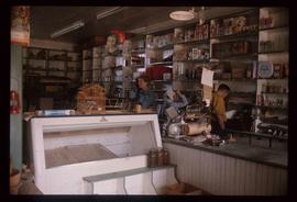
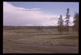
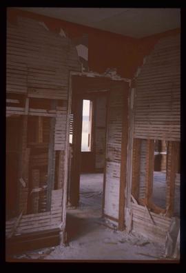
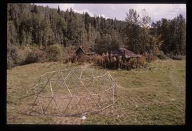
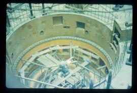
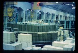
Image depicts numerous wood crates and large pieces of machinery in an unknown concrete structure, possibly somewhere in Fort St. John, B.C.
Image depicts a group of unidentified individuals wearing hard hats inside an unknown concrete structure, possibly located in Fort St. John, B.C.
Image depicts a piece of machinery shaped like a large metal cylinder. It is possibly located somewhere in Fort St. John, B.C.
Image depicts a view of Prince George from Cranbrook Hill looking east.
Image depicts the old Hudson's Bay Company Trading Post at McLeod Lake.
Image depicts a structure that appears to be a type of zipline, ferry platform at an unknown location.
Image depicts an old convenience store, with a sign on it labelled "Al Crosina." It is located at the 153 Mile House.
Image depicts the interior of an old convenience store; there are several unknown individuals present. It is located at the 153 Mile House.
Image depicts a section of land, with a few houses, in Soda Creek, B.C.
Image depicts the Watson Mansion in 108 Mile Ranch, B.C. It burned down in 1983 as the result of a chimney fire.
Image depicts the ruined interior of a mansion at an unknown location.
Image depicts a church on a hill in Hagwilget, B.C.
Image depicts a church on a hill in Moricetown, B.C.
Image depicts a totem pole in Kitwanga, B.C.
Image depicts two old, overgrown and collapsing buildings, as well as a metal frame; it is located somewhere in Kitwancool, B.C.
Image depicts a wooden fence at an uncertain location, perhaps somewhere in the Chilcotin region.
Image depicts a wooden fence at somewhere in Meldrum Creek, B.C.
Image depicts a shed somewhere in Kitwancool Lake, B.C.
Image depicts a wooden Ranch House at an uncertain location.
Image depicts a row of houses in Wells, B.C.
Image depicts the Wells Hotel in Wells, B.C.
Image depicts a lake viewed "south-east from lodge;" it is possibly Takla Lake.
Image depicts a view of Prince George from City Hall looking northeast with the pulp mills in the background. Map coordinates 53°54'46.3"N 122°44'41.9"W
Image depicts a view of Prince George from Cranbrook Hill looking southeast. Map coordinates 53°54'51.5"N 122°49'05.2"W
Image depicts an Anglican church and a bell tower in Kitwanga.
Image depicts a building in Wells, B.C. It possesses the letters "W.V.F.B." on it.
Photograph depicts the old hospital building in Wells. At the time the photo was taken, 1978, it was being used as an apartment building, and that is still its current use.
Image depicts a farm at an unknown location.
Image depicts a small foot bridge at an unknown location. The slide is simply labelled "Rudi's Bridge."
Image depicts the interior of an old convenience store; numerous unknown individuals are present. It is located at the 153 Mile House.
Image depicts what appears to be a Ranch at Soda Creek, B.C.
Image depicts the tombstone of T.J. Menefee in the cemetery in Soda Creek, B.C.
Image depicts the Jack O' Clubs Hotel in Wells, B.C. It burned down on February 14th, 1994
Image depicts Wells, B.C.
Image depicts a street in Wells, B.C.
Image depicts an old, boarded up building labelled as "Cariboo Rooms" in Wells, B.C.
Image depicts a view of McBride in the Rocky Mountain Trench.
Image depicts a dam on what is possibly the Peace River.
Image depicts what appears to be a motel in Hudson's Hope, B.C. The slide is labelled "camp HH."
Image depicts the log building that acts as the public library in Hudson's Hope, B.C.
Image depicts the interior of a store, possibly in Fort St. John, B.C.
Image depicts several unidentified individuals exiting a church made of logs, possibly in Fort St. John, B.C.
Image depicts a view of Fort St. John, B.C.
Image depicts two unidentified individuals in hard hats leaning against the railing of a large, open space inside an unknown concrete structure. It is possibly located in Fort St. John, B.C.
Image depicts two individuals at work inside what appears to be a piece of machinery. It is possibly located somewhere in Fort St. John, B.C.
Image depicts a number of identical buildings and vehicles at "Driftwood Creek" in the Driftwood Canyon Provincial Park.
Image depicts a cabin on the "west arm" of Takla Lake.
Image depicts a few piles of culverts in Leo Creek, B.C.
Image depicts a building, possibly an office building, next to a set of rail road tracks in Leo Creek, B.C. An unknown individual is present, and a number of barrels and culverts are visible in the foreground.
Image depicts numerous houses in Kitwancool, B.C.