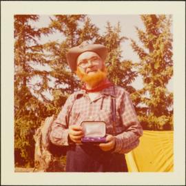
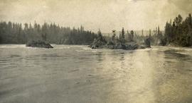
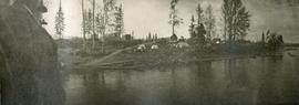
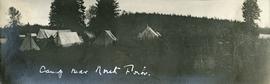
Slide depicts the Ranger Station at the Aleza Lake Experiment Station.
Item is a photograph of Alex Moffat dressed as a prospector holding gold nuggets he salted into a gravel bed and later panned out and gave to Princess Margaret.
Item consists of transcript of interview with writer, film maker, and guide outfitter Andy Russell conducted by Bob Harkins at Prince George Radio Station, CJCI regarding Russell's experiences with guiding in Northern Rockies. Russell also discusses his new work The Life of a River and discusses the environmental impact of hydro-electric development on rivers
Zonder titelImage depicts the Lakeland Sawmill in Prince George, B.C, identified by the beehive burners; the one with white smoke belonged to Pas Lumber Co. which was bought out by Lakeland in 1987.
Image depicts the Lakeland Sawmill in Prince George, B.C.
Image depicts Prince George Sawmill taken from across the Nechako River looking southwest. Map coordinates 53°56'00.0"N 122°44'29.7"W
Photograph depicts a cluster of wooden buildings including a flagpole and church spire at a Lheidli T'enneh village site. Original photo identified this image as "Indian Village, Fort George".
Photograph depicts view of the river from a boat. There is a silhouette of a person wearing a hat in the foreground.
Photograph depicts four men paddling a long canoe. The canoe is loaded with supplies and a dog, river and forest in the background.
Photograph depicts six men standing outside a small log building. A sawhorse in the foreground, a tall pole "cache" and forest in the background.
Photograph depicts one man standing on the bank of a river, forest in the background. The image is not in focus or possibly a double exposure.
Photograph depicts eighteen or more canvas tents scattered on the river shore next to rough cabins and an outhouse.
Item is McNaughton Lake, B.C. Map 83D and Part of 83C Second Status Edition (1975) from "Classification and Interpretation of some Ecosystems of the Rocky Mountain Trench, Prince George Forest Region, British Columbia: First Approximation" (1984).
Large-format map depicts the Monkman Public Sustained Yield Unit (PSYU) east of Prince George.
Forest cover map showing a crossing area of the McGregor River is annotated with a road and ferry crossing.
Slide depicts a man operating heavy equipment in a forest, likely at the Aleza Lake Experiment Station.
Slide depicts a sawmill in operation, likely located in the Upper Fraser area, with a pile of burning wood products and a beehive burner.
Slide depicts a bulldozer clearing ground, likely at the Aleza Lake Experiment Station.
Item is a photograph of Mr. Williston, Chief Forester John Stokes and Tom Wright of Canadian Forest Products examining an area near Prince George in order to determine the timber area required for a Pulp Harvesting License for a proposed pulp mill that would depend completely on waste wood.
Item consists of transcript of interview with Alex and Chris Muldowan discussing family history and Muldowan's involvement in forestry in North Central BC.
Zonder titelImage depicts the Northwood pulpmill in Prince George B.C.
Image depicts Prince George, possibly with the Northwood Pulpmill in the background.
Image depicts Prince George Sawmill taken from across the Nechako River looking southwest. Map coordinates 53°56'00.0"N 122°44'29.7"W
File consists an audio recording of an oral history with Harry Coates recorded by David Mills.
File consists a transcript of an oral history with Harry Coates recorded by David Mills.
Videocassette is a VHS recording of an interview with John Revel produced by Spectrum Videoworks as part of a BC Forest Service "Esprit de Corps" institutional memory project.
Map reproduction of the Aleza Lake Research Forest depicts timber sale areas, forest cover, and other details.
Slide depicts a cleared area in a forest, likely at the Aleza Lake Experiment Station.
Slide depicts cleared ground and felled trees in a forested area, likely at the Aleza Lake Experiment Station.
Photograph depicts two people and a dog team on a snowy river bank with a narrow passage of open water and a snowy bluff in the background.
Photograph depicts a four-dog team harnessed to a loaded sleigh. Two people stand near the loaded sleigh on a snowy forest path.
Photograph depicts a small cluster of buildings near the river bank.
Photograph depicts four men pinning a "Union Jack" flag to the exterior of a building.
Photograph depicts several men standing on the river bank. Possibly A.H. Holland in center of photo.
Photograph depicts the rough waters and rocks at Fort George Canyon.
Photograph depicts a view of the river shore, a few scattered buildings and tents are near the shore. A footpath leads from the water's edge between the dwellings and through the newly cleared land.
Photograph depicts a view from a high hill looking down on the Nechako river. There is forest and low rolling hills in the background.
Photograph depicts a view of a lake from a row boat. The back of one male boat passenger and oars are in the foreground.
Photograph depicts several canvas tents set in lush vegetation near dusk.
Photograph depicts seven or more men relaxing near a canvas tent. Some of the men appear to be whittling wood. Long underwear dry on a tent rope and wood smoke drifts past the men and tent to the forest behind.