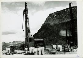
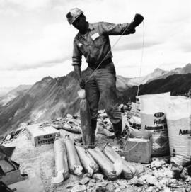
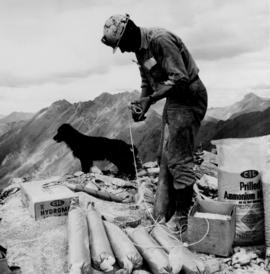
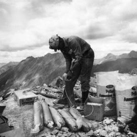
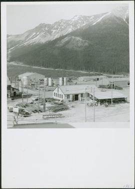
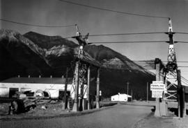
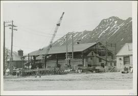
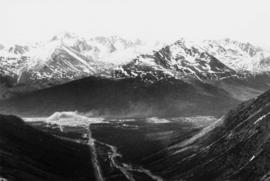
Photograph depicts truck at reject plant in foreground. Mine road can be seen leading to plant in centre background, town in right background. South mountain range visible in distance. Handwritten annotation on recto of photograph: "June 1970 / Looking South across Rock Reject Tailings / Note Southern direction of conveyor [?] towards No 1 Gully. Tom Kiefer".
Photograph depicts colour-coded model of mine in display case. Legend partially legible in image: "TALUS / VOLCANICS / WASTE SERPENTINE / AAA ORE / AA ORE". Handwritten annotation on recto of photograph: "Cassiar B.C. June 1970 by Tom Kiefer".
Photograph depicts Wabco in left foreground in front of shop building, tractor, and miscellaneous supplies. Mine valley and mountains in background. Handwritten annotation on recto of photograph: "Cassiar B.C. 1970 June 23 by Tom Kiefer".
Photograph depicts large dry rock storage building on left, mill in background, dryer building on far right. Road and power poles cross foreground, mountains stand in background. Photo caption next to printed copy of image in 1953 Annual Report: "Completed dry rock storage and dryer buildings."
Photograph depicts red truck dumping waste at what is believed to be the tailings pile at the Cassiar plant. Small building and unidentified individual in bottom left foreground, valley and mountains in background. Photo caption next to printed copy of image in 1953 Annual Report: "Stockpile of 80,000 tons of Ore at Mill."
Photograph depicts large dry rock storage building in foreground on right, mill on left behind tailings pile, and dryer building in centre behind conveyor belt connecting mill to dry rock storage. A cloud can be seen rising from plantsite. Trees and Troutline Creek cross foreground, mine valley and mountains visible in background. Stamped annotation on recto of photograph: "ANSCO PRINTON Munshaw Colour Service Ltd. MAR 10 1955".
Photograph depicts large dry rock storage building in foreground on left, mill in background, dryer building in right midground. Miscellaneous supplies in far right foreground, mountains visible in background. Handwritten annotation on verso of photograph: "Sept 1954". This photograph was originally stored inside duotang labeled "CASSIAR ASBESTOS CORPORATION LIMITED PHOTOGRAPHS 1954"; photo caption beneath this image: "40,000 Ton Dry Storage Building / Mill / Dryer Building".
Photograph depicts an unidentified man standing to left of large puddle in gravel pit, mountain peaks in background. Photo speculated to have been taken on the plant, or near the Cassiar airstrip, facing south west. Stamped annotation on recto of photograph: "JUN. 1987".
Photograph depicts yellow conveyor belt in foreground over gravel pit, dump truck behind in midground. Mountains visible in background. Photo speculated to have been taken at the plant or near the Cassiar airstrip. Stamped annotation on recto of photograph: "JUN. 1987".
Photograph depicts close up view of gravel pit, ruler displayed for scale. Photograph speculated to have been taken at the plant or near the Cassiar airstrip. Stamped annotation on recto of photograph: "JUN. 1987".
Photograph depicts bench at 6430 elevation. Blasthole drills, shovels, dozers, and dump trucks can be seen on bench in midground. Mine valley in background. Handwritten annotation on verso of photograph: "1961".
Photograph depicts mine area at Cassiar, crushing plant visible on left. Various mine buildings visible midground. Blasthole drills, shovels, dozers, and dump trucks can be seen on bench in foreground at 6430 elevation. Handwritten annotations on recto of photograph: "6"; "View looking NW from top of S. peak 6790 elev. on 6430 stripping bench on it and 6050 ore bench further down on left."; "July 1961".
Photograph depicts buildings at various locations in mine: crushing plant (centre?) and what is believed to be the original tramline loading station on left. Mine road featured in center, blasthole drill visible near dump truck in midground. Mine valley in background. Photo believed to have been taken from mine's South Peak. Handwritten annotation on verso of photograph: "1961".
Photograph depicts a car and two dump trucks near a small garage by road in mine. One man stands at garage site among tires and miscellaneous tools. Blasthole drills, shovels, and dump trucks visible in distance. Rocks in foreground, mountains in background. Handwritten annotation on verso of photograph: "1961".
Photograph depicts men standing near two Atlas Copco Drillmasters (blasthole drills). These are precision hammer drills which had their own power source. Large bags of ammonium nitrate in foreground, mountaintops in background. The men depicted here were likely members of the explosive crew. It is believed that this photo was taken on the North ridge, near the cirque dump. Handwritten annotation on verso of photograph: "1961".
Photograph depicts men standing near two Atlas Copco Drillmasters (blasthole drills). These are precision hammer drills which had their own power source. Large bags of ammonium nitrate in foreground, mountainside in background. The men depicted here were likely members of the explosive crew. It is believed that this photo was taken on the North ridge, near the cirque dump. Handwritten annotation on verso of photograph: "1961".
Photograph depicts a man wearing a hard hat preparing long narrow bags of explosive material. Large bags of ammonium nitrate in right foreground, mountains in background. Handwritten annotation on verso of photograph: "1961".
Photograph depicts an Atlas Copco Drillmaster (blasthole drill) near the mine road, mountainside in background. This is a precision hammer drill which had its own power source. It is believed that this photo was taken on the North ridge, near the cirque dump. Handwritten annotation on verso of photograph: "1961".
Photograph depicts a man wearing a hard hat preparing explosive material, mountains in background. Dog stands near edge in midground, large bags of Ammonium Nitrate in right foreground. Handwritten annotation on verso of photograph: "1961".
Photograph depicts a crawler cable shovel on right, and bulldozer partially visible on left. Rock face of mountainside in background. Handwritten annotation on verso of photograph: "1961", on recto: "Mining 80 D shovel on [?] 64/70 to 6560 saddle on peak."
Photograph depicts a man wearing a hard hat preparing long narrow bags of explosive material. Large bags of ammonium nitrate in right foreground, mountains in background. Handwritten annotation on verso of photograph: "1961".
Photograph depicts explosion, part of the bench-mining process employed at Cassiar. Handwritten annotation on verso of photograph: "1961".
Photograph depicts tower and bucket tram in left foreground, plantsite in midground, mountains across valley in background. Dry rock storage building, mill, tailings pile, and many other buildings visible in plantsite. Handwritten annotation on verso of photograph: "1961".
Photograph depicts crawler cable shovel and dump truck in excavation area of mine. Handwritten annotation on verso of photograph: "1961".
Photograph depicts crawler cable shovel, bucket over box of Kenworth truck in excavation area of mine. Handwritten annotation on verso of photograph: "1961".
Photograph depicts various buildings in plantsite, vehicles and electricity lines throughout. Equipment garage stands in left background behind tank farm, carpenter shop in right background, machine and electrical shop in building semi-visible on far right. Mine road can be seen at foot of mountain in background. Handwritten annotation on verso of photograph: "1961".
Photograph depicts dry rock storage building on left, mill in foreground, and tailings piles behind mill in midground. Mountains in background. Handwritten annotation on verso of photograph: "1961".
Photograph depicts front of dry rock storage building, conveyor visible above on left. Handwritten annotation on verso of photograph: "1961".
Photograph depicts a gravel road passing under crossing. Sign posted to pole reads "CAUTION TRAMLINE CROSSING CAUTION AVIOD PASSING UNDER MOVING BUCKETS". Garage stands in left midground, mountains in background. Handwritten annotation on verso of photograph: "1961".
Photograph depicts a large shelter over building believed to be power house. Electricity lines cross midground and run to power house. A man can be seen crossing the foreground by steel frame supplies, and a second building is partially visible on right. Mountains stand in background and a crane can be seen operating in front of power house. Handwritten annotation on verso of photograph: "1961".
Photograph depicts long wood building believed to be the bar and snackbar at Cassiar B.C. Two men can be seen standing on one of three porches to building. Pole, car, and trees in foreground; unknown buildings and mountain base in background. Handwritten annotation on verso of photograph: "1961".
Photograph depicts long wood building speculated to be the Community Centre at Cassiar, B.C. Sports net stands in right foreground. Flag pole, barrel, and stand of trees can be seen in front of building. Mountains in background. Handwritten annotation on verso of photograph: "1961".
Photograph depicts four houses in line behind trees and steel drums. Road in foreground, mountains in background. Handwritten annotation on verso of photograph: "1961".
Photograph depicts building containing Cassiar's bar and snackbar, visible across ball field. This building originally housed school classrooms, movie theater, barber shop, and rec centre with three pool tables. Private liquor store originally located in far right of building. Liquor store was known to be the only legal bootleg liquor business in the province at the time, before it was transferred to Cassiar's government liquor store and replaced with a Sear's office. Catholic church and other buildings are visible behind trees in right midground. Road and field in foreground, valley and mountains in background. Community Centre located behind photographer, out of frame, curling rink on photographer's right.
Photograph depicts men's ball game in foreground, spectators and cars visible behind backstop net. Bar and snackbar building in right midground, trees and mountain base in background. See item 2000.1.1.3.19.52 for information regarding bar and snackbar building.
Photograph depicts flowing water believed to be Troutline Creek which ran south of Cassiar, B.C. Tailings pile and plant buildings visible behind forest in midground, northern mountain range in background. Handwritten annotation on verso of photograph: "Cassiar June 15 71".
Photograph depicts mine valley and road in foreground. Cassiar plant visible in left midground, townsite in right midground. Southern mountain range in background.
Photograph depicts flowing water believed to be Troutline Creek which ran south of Cassiar, B.C. Tailings pile and plant buildings visible behind forest in midground, northern mountain range in background. Handwritten annotation on verso of photograph: "Cassiar June 15 71".
Photograph depicts flowing water speculated to be Troutline Creek which ran south of Cassiar, B.C. Forest on opposite shore and mountains in background. Handwritten annotation on verso of photograph: "Cassiar June 15 71".
Photograph depicts fenced church building with what appears to be speakers mounted on roof above main entry. Road and trees in foreground, mountains in background. Handwritten annotation on verso of photograph: "Cassiar June 15 71".
Photograph depicts long bunkhouse buildings located between the Cassiar plant and townsite. They were originally used seasonally by university students, or by new employees on waiting lists for the more accommodating panabode "Winter Bunkhouses" (see item 2000.1.1.3.19.113). These buildings are speculated to be bunkhouses number 86, 87, and 88. Trees cross midground; new mill building, tailings pile, and mountains visible in background. Handwritten annotation on verso of photograph: "Cassiar June 15 71".
Photograph depicts flowing water speculated to be Troutline Creek which ran south of Cassiar, B.C. Forest on opposite shore and mountains in background. Handwritten annotation on verso of photograph: "Cassiar June 15 71".
Photograph depicts tramline buckets and tower on plantsite. Vehicles, building materials, and unidentified buildings also visible on plantsite (including what appears to be a water tower). Mountains and valley in background. Handwritten annotation on verso of photograph: "Cassiar June 15 71".
Photograph depicts two unidentified men on front deck of building behind trees. Road and car in foreground, mountains visible in background. Handwritten annotation on verso of photograph: "Directors Lodge Cassiar June 15 71". Building also known as "House 130".
Photograph depicts brown and white building similar to the "Director's Lodge" at Cassiar, B.C. (see items 2000.1.1.3.19.88 and 2000.1.1.3.19.89). Station wagon parked in driveway behind short fence in foreground. Trees in foreground, forest and mountains visible in background. Handwritten annotation on verso of photograph: "Cassiar June 15 71".
Photograph depicts crusher plant in centre foreground. Shifter shack and vehicles can be seen in front of pit area. West Peak semi-visible in right midground. Mine valley an northwestern mountain range in background.
Photograph depicts the West Peak of the Cassiar mine on McDame Mountain. Pit area visible between West Peak and road in foreground. Mine valley and north mountain range in background. Photo speculated to have been taken from a point on or near the South or North Peak.
Photograph depicts row of houses behind trees. Power line, road, and vehicles in foreground; mountain in background.
Photograph depicts plant buildings below, tailings pile in foreground. Valley and mountains in background. Handwritten annotation on recto of photograph: "CASSIAR".
Photograph depicts plant buildings in front of tailings pile in midground. Forest, power line, and tramline in foreground; south mountains in background.