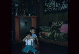
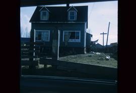
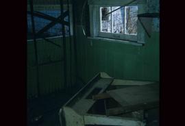
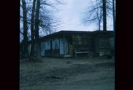
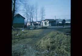
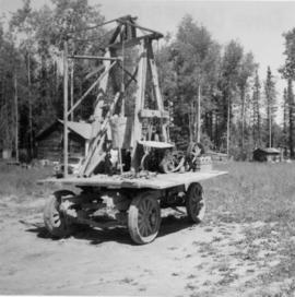
Print preview Close

Showing 950 results

Archival description
Shore Line at Airport
2012.13.1.124.02 · Stuk · 1970
Part of J. Kent Sedgwick fonds

Image depicts the shore line and surrounding land of a lake or river at an airport, possibly in Prince George, B.C.

Ruined Cars
2012.13.1.22.16 · Stuk · 1970
Part of J. Kent Sedgwick fonds

Image depicts several old, ruined cars and an unknown individual in Island Cache.

Animal Pen?
2012.13.1.22.28 · Stuk · 1970
Part of J. Kent Sedgwick fonds

Image depicts what appears to be an animal pen in Island Cache. There is a goat and numerous chickens in the image, as well as a pile of miscellaneous material.

Houses
2012.13.1.22.30 · Stuk · 1970
Part of J. Kent Sedgwick fonds

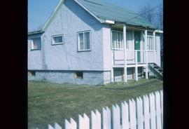
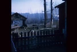
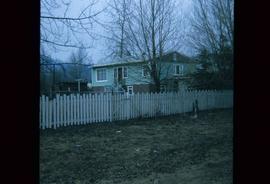
Image depicts a few houses in Island Cache. There are two unknown individuals present.

Houses
2012.13.1.22.17 · Stuk · 1970
Part of J. Kent Sedgwick fonds

Image depicts a few houses and a dog on a porch at Island Cache.

Nechako River?
2012.13.1.22.19 · Stuk · 1970
Part of J. Kent Sedgwick fonds

Image depicts a body of water in Island Cache. It is possibly a small section of the Nechako River.

Animal Pen?
2012.13.1.22.24 · Stuk · 1970
Part of J. Kent Sedgwick fonds

Image depicts what appears to be an animal pen in Island Cache. There are two horses and a chicken in the enclosure, and a rundown building.

A House
2012.13.1.22.34 · Stuk · 1970
Part of J. Kent Sedgwick fonds

Image depicts a house in disrepair, and possibly abandoned, in Island Cache.

A House
2012.13.1.22.18 · Stuk · 1970
Part of J. Kent Sedgwick fonds

Image depicts a house in Island Cache. There are several cars parked outside it.

2006.18.6.01 · Bestanddeel · [196-?]
Part of Aleza Lake Research Forest Society fonds

Photographs are panoramas taken from the Churchill BC Forest Service Lookout, located at latitude 54°04' and longitude 122°16'. The photographs were bound together and include a transparent grid that was intended to be used for locating forest fires.

"Prince George B.C."
2012.13.2.21.08.1 · Stuk · 26 Apr. 1967
Part of J. Kent Sedgwick fonds

This very large drawing shows CN leases and private property buildings on Island Cache in detail.

Zonder titel
CNR Prince George
2013.6.36.1.039.04 · Stuk · 1966
Part of David Davies Railway Collection

Photograph depicts the CNR depot. Considerable renovation work was taking place on both sides of the building and in the interior nearest to the camera.

CNR Prince George
2013.6.36.1.039.02 · Stuk · 1966
Part of David Davies Railway Collection

Photograph depicts a rail bridge over the Fraser River. Canter levelled on both sides were vehicle roadways which ceased to be used in 1987 when a new road bridge was supposed to be completed. The right lane took cars into the city of Prince George.