Image depicts 411 Patricia Boulevard in Prince George, B.C.
Image depicts 1566 Ingledew Street in Prince George, B.C.
Image depicts Ash Street and Patricia Boulevard in Prince George, B.C.
File consists of a transcript of an oral history interview with Bob Harkins/
File consists of a transcript of an oral history interview with Myra and Glen Hooker.
File consists of a transcript of an oral history interview with Ivan and Bev Westerland.
File consists of a transcript of an oral history interview with Ray Williston.
Photograph depicts a large white building surrounded by a fence.
Photograph depicts Lheidli T'enneh Nation burial grounds in foreground, Hudson Bay Company buildings in background.
Photograph depicts six adults and three or more children sitting on the ground with a log cabin in the background. Snow scatters the ground in small patches.
Photograph depicts twenty-eight or more people standing on the river's edge, a stack of wood is ready for loading on the steamer that is anchored near the shore.
Photograph depicts several people in a large field. There are buildings and trees in the background.
Photograph depicts a tarp spread out on the grass, two men sit nearby the tarp. There is a canvas tent in the background with a man standing beside it. Behind the tent is a low hill with a fence bordering the top of the hill. There are blankets drying on the fence.
Photograph depicts a view from a high hill, looking down on the Nechako river. There is forest and low rolling hills in the background.
Photograph depicts a view from a hill of a river winding through the forest with marshlands nearby.
Photograph depicts a view from a hill of a river winding through the forest with marshlands nearby. This may be a double exposure and there is an indiscernible image in the center of the photo.
Photograph depicts a man bathing himself while standing in a small metal tub. Photograph description in album notes this as "His 'Semi Annual'" [bath]. On the left is a log structure, presumably a cache building. A large clearing surrounds the building and bathing man. There is a forest and bluff in the background. Possibly located near Giscome Portage.
Photograph depicts four men pulling a long canoe across a clearing on a wheeled trailer.
Digital video recording is an episode of Spotlight on UNBC from September 1993. Features include an interview with students regarding why they attend UNBC; development of the co-op education program; UNBC's new faculty in the International Studies, Nursing and History departments; plans for convocation 1994; the UNBC academic calendar; the promotion of UNBC in southern media; public bus tours of UNBC; and a tour of the regions with Iona Campagnolo and other UNBC officials. Includes interviews with Fred Gilbert (Dean of Natural Resources and Environmental Studies), Dan Lousier (BC Forest Service), Larry Woods (International Studies), Dana Edge (Nursing), Robin Fisher (History), Carmen Pickering (UNBC Tour Guide), Ken Coates (UNBC VP Academic), Eileen Heir (Yirka Dene Language Institute), Iona Campagnolo (UNBC Chancellor), Ron Sebastian (First Nations artist), and Herb Russell (Executive Director, Gitanyow). Also includes interviews with UNBC students and graduates Kelly Breen, Jackie Watson, Brad and Beverly Freathy, Kathy Vagt, and Terri Stewart (Northwest Community College student advisor).
Digital video recording is an episode of Spotlight on UNBC from November 1993. Features include the development of the UNBC calendar for 1993-1994, the construction of the lab building, the needs of students in the laboratory, space allocation, the UNBC rotunda, a 1 million dollar endowment for UNBC by Northwood, the First Nations forum, the anticipation of the opening of UNBC by Queen Elizabeth, a breakfast held by the UNBC Women's Caucus for women's history month, UNBC is the newsmaker of the year, the federal election results and opinion from UNBC faculty, and views of UNBC by helicopter. Includes interviews with Martin Cocking (Assistant Registrar), Nicole Lyotier (UNBC Liaison Officer), Conchetta di Francesco (UBC Liaison Officer), Lynda Mychaluk (SFU Liaison Officer), Houston Secondary School grade 12 students, Ann McNaughton (BCIT Liaison Officer), Jerry Hurn (Hemingway Nelson Architects), Mark Bernards (Chemistry), Peter McEwan (Lab Manager), Geoffrey Weller (UNBC President), Deanna Nice (Nisga'a), Clive Keen (Director of Communications), Myra Rutherdale (UNBC Women's Caucus), Greg Poelzer (Political Science), and Paul Bowles (Economics).
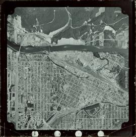
Digital video recording is an episode of Spotlight on UNBC from February 1994. Features include the construction of the UNBC Prince George campus, a spotlight on heart month, the appointment of the Northwest Regional Coordinator, UNBC updates on CKPG TV, and a spotlight on natural resource management and environmental studies. Includes interviews with Peter Heaton (Project Manager), Dean Cooper (former VP Administration), Ken Prkachin (UNBC program chair of Psychology), Maureen Salton (BC Heart and Stroke Foundation), Dana Edge (UNBC Nursing), Margaret Anderson (Northwest Regional Coordinator), Bob Harkins, Fred Gilbert (Dean of Natural Resources and Environmental Studies), Darwyn Coxson (UNBC Biology), Doug Baker (Environmental Studies), Annie Booth (Environmental Studies), Ellen Petticrew (UNBC Geography), Dave Robinson (Outdoor Recreation and Tourism), Winifred Kessler (UNBC Forestry), and Jackie Watson (UNBC student).
Large-format map depicts the Monkman Public Sustained Yield Unit (PSYU) and Tree Farm Licence 30 east of Prince George.
Map reproduction of the Sinclair Spruce Lumber Co. Ltd. T.S.H.L. A01848 C.P. 310 cutting area, likely in the Aleza Lake Research Forest.
Large-format map depicts Northwood Pulp & Timber operating areas in 1975.
Photograph depicts a view of the city of Prince George looking west from the east hill. The confluence of the Fraser River and Nechako River is visible to the right. The Grand Trunk Pacific Railway bridge is visible at centre. The current location of where this photograph may have been taken is likely somewhere near where Highway 16 rises on the hill past the correctional centre (jail).
Map reproduction depicts major areas of the Aleza Lake Experiment Forest.
Slide depicts a black bear eating garbage by wooden outbuildings, possibly at the Aleza Lake Experiment Station.
Slide depicts a detonation in an area of cleared ground in a forested area, likely the Aleza Lake Experiment Station. Work may have been undertaken for roadbuilding activities at the Experiment Station.
Slide depicts a cleared area at the Aleza Lake Experiment Station with plant regeneration.
File consists of an audio recording of an interview with Bill Wade. Includes one original recorded audio cassette and one copy.
File consists of a transcript of an oral history interview with John Broderick.
File consists of a transcript of an oral history interview with John Gaal.
Item is a hand drawn and coloured map by the City of Prince George Planning Department depicting zoning proposed by the Prince George City Planner for the VLA neighbourhood.
Item is a map depicting the Vancouver Carney study neighbourhood area in Prince George.
Item is the Proposed Land Use Map, 1978-2012, referred to in By-law No. 3138, the City of Prince George Official Community Plan. The original draft of this map was completed on October 24, 1977. This version of the map was amended in July 1982.
This map is part of Schedule B of the 1993 Official Community Plan, Bylaw No. 5909 for the City of Prince George. This particular map depicts the east area of the City of Prince George, including the Prince George Airport (YXS) and the Blackburn area.
This map is the Schedule A accompanying map for the City of Prince George's Soil Removal and Deposit Bylaw No. 7022 of 1999. It depicts designated soil removal areas and M.O.T.H. gravel reserves.
This map is Schedule C of the 2001 Official Community Plan, Bylaw No. 7281 for the City of Prince George. This Schedule C map shows the long range land use for the City of Prince George.
Item is a photograph of a CP Rail chip car being dumped. The development of the interior chip pulp industry necessitated new designs for chip rail cars and their dumping facilities.
Item is a photograph of Ray Williston standing beside a plaque at the dedication of the Peace River Power Project Substation bearing his name in Prince George on August 30, 1965.
Item is a photograph of Princess Margaret arriving by Canadian Air Forces jet at Prince George. Lieutenant-Governor Frank Ross is walking beside the Princess.
Originally mounted on a poster with photographs 115, 115.2, 115.3.
Item is a photograph of Prince George taken from the air on August 2, 1965.
Item is a photograph of Prince George taken from the air, looking east with the Cameron Street Bridge in the foreground.
Item is a photograph of Princess Margaret with Lieutenant-Governor Frank Ross and Mr. Williston taken on July 17, 1958 after disembarking in Prince George from a Canadian Forces plane.
Item is a photograph of Mr. Williston (Minister of Lands, Forests & water Resources), Pat Jordan (Minister without Portfolio), Prince George Mayor Harold Moffat, Grace McCarthy (Minister without Portfolio) and Premier W.A.C. Bennett.
Item is a photograph of Mr. Williston, Chief Forester John Stokes and Tom Wright of Canadian Forest Products examining an area near Prince George in order to determine the timber area required for a Pulp Harvesting License for a proposed pulp mill that would depend completely on waste wood.
The CN Rail Bridge is a truss bridge over the Fraser River. It was built in 1914 by the Grand Trunk Pacific Railway and is therefore also known as the "GTP Bridge". The Canadian National (CN) Railway Company took over the Grand Trunk Pacific Railway in 1919.
Photo taken in the late spring of 1936 at the west end of the CNR bridge when flood waters had covered up what was then known as the "tourist camp".
The Nechako Bridge is also known as the Cameron Street Bridge