File consists of correspondence relating to the position of the Associate Dean of Natural Resources and Environmental Science for the College of Science & Management at UNBC. Also includes a job posting.
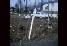
Image depicts two dogs and numerous chickens in a yard at Island Cache.
File consists of an oral history given by Donald Prince, which was gathered as part of Dr. Mike Evan's Island Cache Recovery Project. Includes consent forms, transcripts, and the recorded oral history on the original media.
File consists of donor certificate stationary and annual campaign stickers from the UNBC Office of Development.
File consists of a 2004 donor reception invitation from the UNBC Office of Development.
File consists of photographs of the Donor Recognition Event.
File consists of photographs of the Donor Recognition Event on 12 Jun. 1999.
File consists of photographs of the Donor Recognition Event on 25 Oct. 1997.
File consists of photographs of the Donor Recognition Event in June 2001.
File consists of photographs of the Donor Recognition Event in Nov. 1996.
File consists of photocopies of donor recognition photographs from 1993 to 1997.
File consists of an oral history given by Doreen Tosoff, which was gathered as part of Dr. Mike Evan's Island Cache Recovery Project. Includes consent forms, transcripts, and the recorded oral history on the original media.
File consists of an oral history given by Doris Hakanson, Verna Wiley, and Vidia Wicks, which was gathered as part of Dr. Mike Evan's Island Cache Recovery Project. Includes consent forms, transcripts, and the recorded oral history on the original media.
File consists of an oral history given by Dorothy Lamb, which was gathered as part of Dr. Mike Evan's Island Cache Recovery Project. Includes consent forms, transcripts, and the recorded oral history on the original media.
File contains an original "Do's and Don't's When Marking Stands For Cutting" booklet illustrated by J. Pickford.
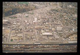
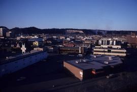
Image depicts an aerial view of downtown Prince George, B.C.
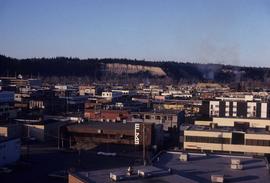
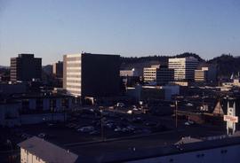
Image depicts downtown Prince George taken from City Hall looking north. Map coordinates 53°54'46.2"N 122°44'43.9"W
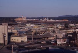
Image depicts a view of Prince George from City Hall looking northeast with the pulp mills in the background. Map coordinates 53°54'46.3"N 122°44'41.9"W
Image depicts downtown Prince George taken from City Hall looking north. Map coordinates 53°54'46.2"N 122°44'43.9"W
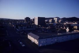
Image depicts downtown Prince George taken from City Hall looking northwest. Map coordinates 53°54'46.2"N 122°44'43.9"W
Image depicts downtown Prince George taken from City Hall looking northwest. Map coordinates 53°54'46.2"N 122°44'43.9"W
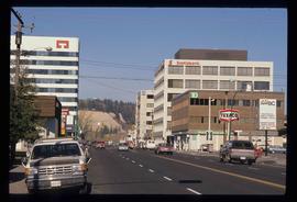
Image depicts downtown Prince George, B.C.
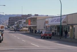
Image depicts 4th Ave at Brunswick St. and the following businesses: Hart Drugs, The Yarn Barn, and Saveco. Map coordinates 53°54'59.9"N 122°44'52.9"W
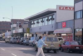
Image depicts 4th Ave at Quebec St, showing the following businesses: The Yarn Barn, Golden Chalice Jewellers, Dandy Lines, Ultrasport, and Saveco. Map coordinates 53°54'58.6"N 122°44'47.5"W
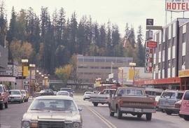
Image depicts George St in downtown Prince George with City Hall in the background. Also visible are the Prince George Hotel and a movie theatre. Map coordinates 53°54'55.0"N 122°44'36.1"W
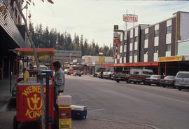
Image depicts George St in downtown Prince George with City Hall in the background. Also visible are the Prince George Hotel, Ming's Inn Chinese Restaurant, Fraser Stationers Ltd., Weiner King food cart, and a movie theatre. Map coordinates 53°54'55.0"N 122°44'36.1"W
File consists of:
- Keynote speech by Dr. Charles Jago to the Northeast BC Resource Municipalities Coalition in Fort St. John on 25 Nov. 2015
- Speech by Dr. Charles Jago to the Canadian Association of Research Administration Western Canada Branch at UNBC on 4 Dec. 2015
File consists of:
- Dr. Donald B. Rix BC Leadership Chair in Aboriginal Environmental Health annual activity report for 2007
- Dr. Donald B. Rix BC Leadership Chair in Aboriginal Environmental Health annual activity report for 2008
Item is a news release announcing the appointment of Dr. Howard Brunt, VP Academic.
File consists of Dr. Jago's Installation Address.
File consists of Dr. Tom Perry Speech to Northern College & University Presidents 28-Nov-1991
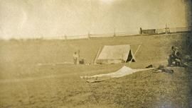
Photograph depicts a tarp spread out on the grass, two men sit nearby the tarp. There is a canvas tent in the background with a man standing beside it. Behind the tent is a low hill with a fence bordering the top of the hill. There are blankets drying on the fence.
Film is a promotional video for Dynacom, the television announcement system installed throughout the UNBC campus.
This photocopied typescript entitled "Early Automobiles in Prince George" by Albert Bell Porter gives anecdotes and accounts relating to early automobile ownership in Prince George circa 1900-1920.
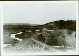
Early spring landscape with roadbed and track in foreground, river in midground, and hill in background.
Handwritten annotation on recto: “PRINCE GEORGE 4-20-13”.
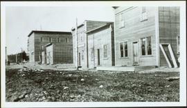
Row of buildings with path and poles. Rough cleared land in foreground, men visible in far left background.
Subseries consists of material collected by Kent Sedgwick for research regarding the communities along the East Line of the Grand Trunk Pacific Railway in Central British Columbia, particularly between Prince George and McBride. These communities and locations include, among others, Shelley, Willow River, Sinclair Mills, Longworth, Dunster, Tete Jaune, Valemount, Mount Robson, and the Yellowhead Pass. Research on these communities was conducted during Kent Sedgwick's involvement in the UNBC-led Upper Fraser Historical Geography Project. The files primarily consist of research notes, audio and transcripts of oral interviews, and photographs of the East Line communities.
Photograph depicts Eleanor Crowe and Brett Enemark at "Words, Loves" conference.
File consists of an oral history given by Elizabeth Carifelle and Doug Carifelle, which was gathered as part of Dr. Mike Evan's Island Cache Recovery Project. Includes consent forms, transcripts, and the recorded oral history on the original media.
File consists of an oral history given by Elizabeth Williams, which was gathered as part of Dr. Mike Evan's Island Cache Recovery Project. Includes consent forms, transcripts, and the recorded oral history on the original media.
File consists of an oral history given by Elsie Christenson, which was gathered as part of Dr. Mike Evan's Island Cache Recovery Project. Includes consent forms, transcripts, and the recorded oral history on the original media.
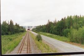
Photograph taken on a 40 ft. high embankment. Looking towards Fraser River. Northwood Pulp and Timber Ltd. in western direction. All trackage owned and built by the mill. Constructed in 1966.
Collection consists of 11 digitized images of Prince George in the 1930s. Includes depictions of snow removal, flooding of the Fraser and Nechako Rivers, the CNR rail yard, and the railway bridge.
Image depicts Eskers Park, near Prince George, B.C.
Videocassette is a VHS recording of an interview with John Revel produced by Spectrum Videoworks as part of a BC Forest Service "Esprit de Corps" institutional memory project.
Image depicts the Europe Hotel in Prince George prior to its demolition in the 1980s; however, the slide itself was only made in 1999 and the date of the photo is otherwise unknown, but most likely around 1979.
Photograph depicts the Europe Hotel on 3rd Avenue.
Photograph depicts the Europe Hotel on the South side of 3rd Avenue. Annotation on verso: "Europe Hotel".
Videotape contains footage of: 16-Oct-06 - EvaluTree; Charmaine Crooks; Katherine Voigt
Videocassette contains raw footage of a stage show with various performers in the UNBC agora and fireworks in celebration of the opening of the UNBC Prince George campus.
