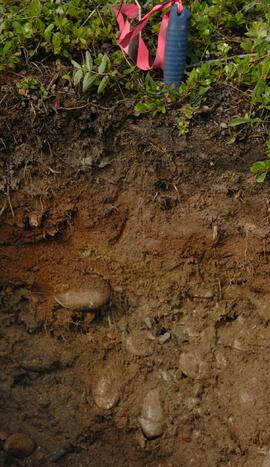
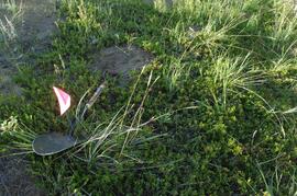
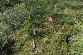
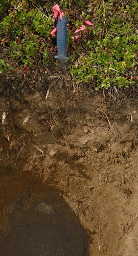
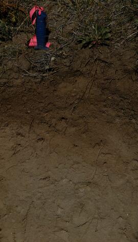
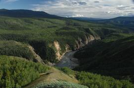
Slide roll contains the following photographs:
Y04-19 (27.5 km on Cultus Bay Rd., near Thorsen Bay)
Date: July 22, 2004
Location Coordinates: 61º 12’ 3.0” N, 138º 28’ 58.3’ W, 819 m asl (± 18.9 m)
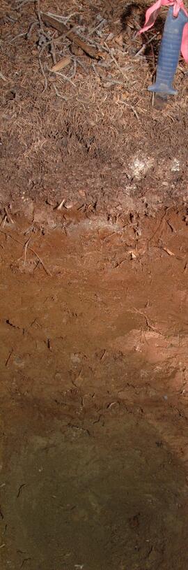
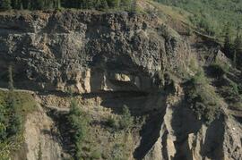
Site Description: Roadcut at base of 30º, E-facing slope. Colluviated loess overlies sandy glaciofluvial at 120 cm. Prominent paleosol with “cumulic” B horizon at 80-120 cm, with strong effervescence throughout exposure.
Sample Depths & Descriptions: Y04-19-01 – charcoal at 95 cm
Roadcut opposite ~ 30 m to NE on grassy S aspect (10° slope) with 15-20 cm of calcareous loess and sand over 2 cm White River ash; strongly effervescent throughout.
Slide roll 7, #36-35 (profile)
Corresponding prints and negatives: Print roll 11, #11A-12A (profile)
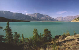
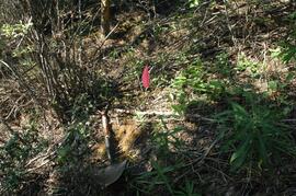
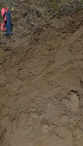
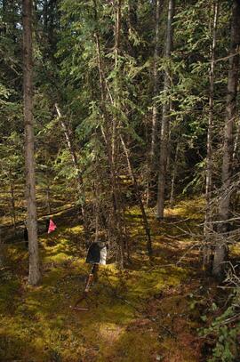
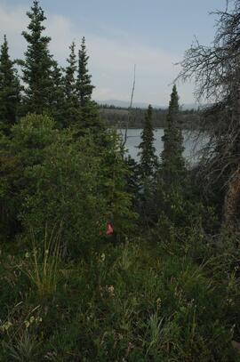
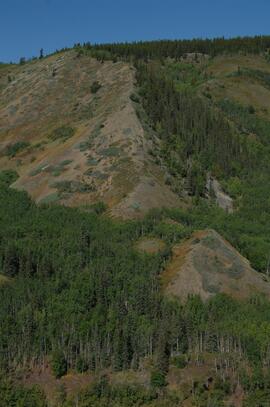
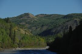
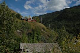
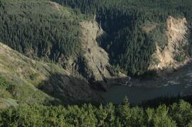
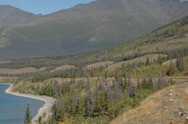
Thorsen Bay landscape
Slide roll 7, #34-32
Corresponding prints and negatives: Print roll 11, #13A-16A
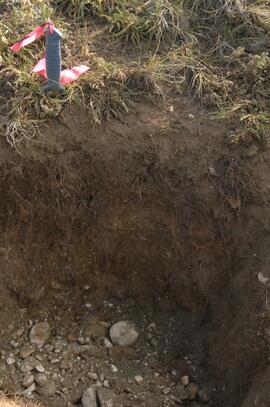
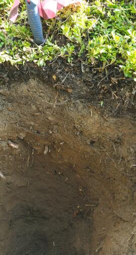
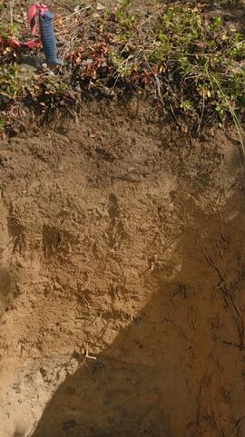
Y04-20B
Date: July 22, 2004
Location Coordinates: 61º 10’ 16.5” N, 138º 26’ 18.7’ W, 797.5 m asl (± 5.9 m)
Site Description: wind-eroded Slims soil on glaciolacustrine with contorted bedding (exposed on blown-out roadcut); calcareous to surface; White R ash pockets at 10-20 cm; S aspect, 5° slope.
Slide roll 7, #31-26
Corresponding prints and negatives: Print roll 11, #17A-21A
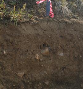
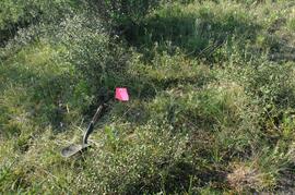
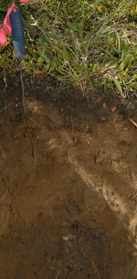
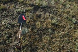
Y04-22
Date: July 22, 2004
Location Coordinates: 61º 9’ 39.24” N, 138º 25’ 7.8’ W, 790.6 m asl (± 6.4 m)
Site Description: toe of 30° slope, W aspect (grassy slope with poplar at toe); 1.0-1.2 of colluviated loess over gravelly glaciofluvial with buried soil at 70-80 cm
Slide roll 7, #25-24
Corresponding prints and negatives: Print roll 11, #22A-24A
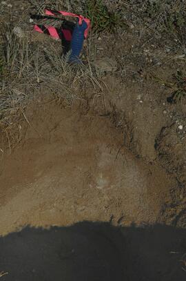
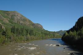
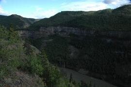
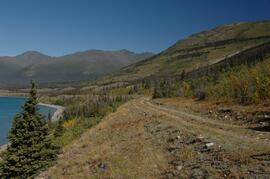
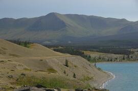
Cultus Bay Rd.
(landscape views looking W from road; lake is likely at ~61°4’ 10.5”N, 138°22’ 31.5”)
Slide roll 7, #23-22
Corresponding prints and negatives: Print roll 12, #0A-2A
Y04-26 (EW)
Date: July 23, 2004
Location Coordinates: 61º 1’ 59.8” N, 138º 21’ 53.6” W, 836.1 m asl (± 7.7 m)
Site Description: grassland at crest of 33° terrace scarp, S aspect.
Sample Depths & Descriptions: Y04-26-01 – 0-10 cm
Slide roll 7, #21-20
Corresponding prints and negatives: Print roll 12, #14A-15A
Y04-27
Date: July 23, 2004
Location Coordinates: 61º 2’ 0.9” N, 138º 21’ 53.6” W, 843.6 m asl (± 5.8 m) (~ 35 m N of Y04-26)
Site Description: spruce forest on terrace surface; level.
- 0-8 cm - Loess-rich forest floor; strongly calcareous.
- 8-13 cm - Bmk
- 13-15 cm - Discontinuous pockets of White R ash
- 15-35 cm - Bmk (Slims soil) – no charcoal visible
- 35-75 cm - Gray calcareous loess.
- 75 cm+ - Gravelly sandy glaciofluvial deposit.
Slide roll 7, #19-18
Corresponding prints and negatives: Print roll 12, #16A-17A
Y04-28 (EW)
Date: July 23, 2004
Location Coordinates: 61º 2’ 34.4” N, 138º 21’ 57.0” W, 820.2 m asl (± 6.1 m)
Site Description: grassland on esker crest W of Jenny L; 30° slope, SW aspect
Sample Depths & Descriptions: Y04-28-01: 0-10 cm
Slide roll 7, #17-16
Corresponding prints and negatives: Print roll 12, #18A-19A
Y04-30 (between eskers, W of Jenny Lake)
Date: July 23, 2004
Location Coordinates: 61º 2’ 31.6” N, 138º 21’ 52.3’ W, 817.6 m asl (± 6.1 m)
Site Description: Level (base of saddle). Colluviated loess to 90 cm+, with White River tephra at 15-17 cm, brownish paleosol at 17-35 cm, underlain by turbated Bmku with multiple charcoal-rich bands.
Sample Depths & Descriptions:
- Y04-30-01 – charcoal at 13 cm (above WR tephra)
- Y04-30-02 – charcoal at 22 cm (below WR tephra)
- Y04-30-03 – charcoal at 75 cm
Slide roll 7, #15-13
Corresponding prints and negatives: Print roll 12, #20A-22A
Y04-31 (EW)
Date: July 23, 2004
Location Coordinates: 61º 3’ 9.2” N, 138º 21’ 30.3’ W, 837.2 m asl (± 6.4 m)
Site Description: crest of N-S esker ridge
Sample Depths & Descriptions: Y04-31-01: 0-10 cm
Slide roll 7, #12-11
Corresponding prints and negatives: Print roll 13, #1-3
Y04-32
Date: July 23, 2004
Location Coordinates: 61º 3’ 7.4” N, 138º 21’ 27.7’ W, 823.7 m asl (± 13.7 m)
Site Description: toeslope on NE side of same ridge as for Y04-31; 20° slope, NE aspect; Cryosol with permafrost at 34 cm; 30 cm of forest floor organic horizons; abundant charred wood fragments at top of mineral soil & in lowest part of organic horizon.
Slide roll 7, #10-9
Corresponding prints and negatives: Print roll 13, #4-5
Y04-34
Date: July 23, 2004
Location Coordinates: 61º 3’ 47.7” N, 138º 21’ 2.5’ W, 838 m asl
Site Description: Toe of 30º, W-facing grassland slope. Colluviated loess with White River tephra at 8-9 cm, brownish paleosol (9-35 cm), overlying sandy glaciofluvial at 35-70 cm+.
Sample Depths & Descriptions: Y04-34-01: charcoal at 34 cm
Slide roll 7, #8-7
Corresponding prints and negatives: Print roll 13, #6-7
Y04-35 (EW)
Date: July 23, 2004
Location Coordinates: 61º 3’ 49.9” N, 138º 21’ 1.1” W, 854.4 m asl (± 6.3 m)
Sample Depths & Descriptions: Y04-35-01: 0 – 10 cm
Slide roll 7, #6-5
Corresponding prints and negatives: Print roll 13, #8-10
(Location not recorded: Print roll 13, #11-12)
Y04-36
Date: July 23, 2004
Location Coordinates: 61º 8’ 11.5” N, 138º 25’ 50.8” W, 825.6 m asl (± 14.5 m)
Site Description:
- 10-0 cm - LF
- 0-15 cm - Bmk1 (7.5YR 4/6 m)
- 15-28 cm - Bmk2 (2.5Y 4/3 m)
- 28-48 cm - Ck
- 48-55 cm+ - IICk (sandy gravelly glaciofluvial)
- No charcoal visible in mineral horizons
Slide roll 7, #4-3
Corresponding prints and negatives: Print roll 13, #13-14
Y04-37
Date: July 23, 2004
Location Coordinates: (roadcut adjacent to Y04-36)
Site Description: multiple colour bands in Slims soil; some charcoal blobs (not sampled) which are right size to have been roots.
Slide roll 7, # 2-1
Corresponding prints and negatives: Print roll 13, #15-19