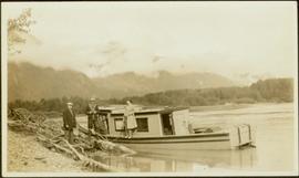
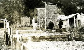
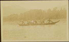
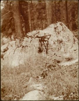
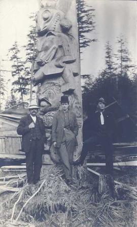
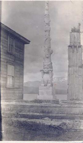
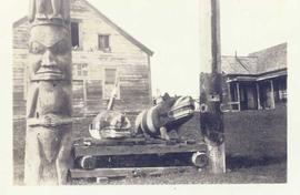
Photograph depicts (from left) Jack Lee and Gordon Wyness sitting on a car next to their equipment while surveying at an Indian Reserve. A cabin on the reserve is also depicted. According to the transcription on the photograph verso, they were surveying road through an "Indian Reserve South of South bank François Lake".
Boat floats close to shore in foreground, forest and hills on opposite shore in background. Joyce is the daughter of Bertha and W.E. Collison, and the granddaughter of Marion and Archdeacon W.H. Collison.
Handwritten annotation on verso reads: "Upper Nass River Sept. 1933. Joyce with Tom Moorhouse & the medical officer".
Photograph depicts a large totem pole next to groomed dirt paths. Power poles and river visible in background.
Handwritten annotation on verso reads: "Edenshaw pole in park at Prince Rupert."
Groups of men and women can be seen gathered on paths between two large totem poles.
Handwritten annotation on verso reads: "Totem Park Pr Rupert park."
Photograph depicts a totem pole standing on what appears to be a large wooden deck or boardwalk, view of the city in background.
Handwritten annotation on verso reads: "Totem pole in park in Prince Rupert".
Chief Allen sits in chair on raised wooden platform, with bear skin over his knee, and two more bear skins laid on wood blocks in front of him. House stands behind picket fence in background. Pot and pan sit to right of chair in foreground.
Handwritten annotation on verso reads: "Albert Allen Kincolith (Nisga Chief)".
Photograph depicts a First Nations family consisting of a woman and four children standing underneath or next to a lean-to style tent. Meat is drying above the campfire and a horse's head is visible in the foreground.
Photograph depicts a family consists of a woman and four children standing underneath or next to a lean-to style tent. Meat is drying above the campfire and the head of a horse is visible in the foreground.
Photograph depicts an unmarked First Nations gravesite featuring two crosses at Moberly Lake.
Group of six men sit and stand on small boat close to shore. Rev. W.E. Collison stands on far right (son of Marion and Archdeacon W.H. Collison).
Handwritten annotation on verso reads: "Dr. Macdonald Med officer (Kincolith) / Dr. [McQuarrie?] Med officer Victoria / Steven Clayton Native boat owner / Capt. Bary - Insp. of Indian Schools / W.E. Collison Indian agent. / Inspection trip to villages of upper Nass River".
Petroglyphs featuring coppers painting onto a rock face next to a lake.
Handwritten annotation in pencil on verso reads: “As seen from the R.R. track. By Harlan I. Smith. 4 poles E of 92 mile or about 1 ½ meter E. of Tyce, B.C., Red Pictograph, Note: head above and to the right at the left of log top in shadow of cedar.” Stamped annotation on verso reads: “Department of Mines Geological Survey Photographic Division, January 21 1926” – in pen above this stamped date is written “7-10-1925”.
Side view of a wooden church, possibly under construction, and other buildings. Printed annotation on recto reads: "Indian Village- Prince George."
Photograph depicts a group of 18 men wearing suits and ties, standing on front steps of large building with pillars.
Handwritten annotation on verso reads: "Conference of Sand Question Committee at Kincolith on Sunday, June 3rd 1923. Mr. [O'Heara?] present. [illegible initials]".
Photograph depicts 8 men posing in suits and ties, and a young girl, Ruth Adams, holding trophy seated in foreground. The group is gathered in open field, large building and hills visible in distance. Man on far right stands in uniform.
Handwritten annotation on verso reads: "Gitlakdamix Village Council 1923. [Charlie Morven] Chairman. / Geo. Manase. / John Davis. / Dennis Woods. / Andrew Nass. / James Adams. Secretary. / Frank Blackwing. Chief Constable. / Walter McMillan (Nass). Constable."
Photograph depicts a view of St'a7mes village looking north, taken from the original Government Wharf in Squamish (Newport). This wharf was built in 1902 and was temporarily replaced by other docks to the west built by the PGE Railway in 1913-14. This photograph was taken after 1914, since the houses in the photo were built by the PGE Railway Company as part of the 1914 reserves sale deal.
Further details that date this photograph between late 1914 and 1920:
- the Merrill & Ring logging operation beach camp is not depicted (opened in 1926)
- the dock from which the photo is taken fell into disrepair after 1914 and was not rebuilt until 1929.
Photograph depicts a group of Indigenous women and children in an unknown location, possibly Lillooet.
Photograph depicts three Indigenous totem carvings in front of various buildings on the shoreline.
Photograph depicts three First Nations women facing the camera.
Photograph depicts two First Nations boys posed for the camera in the forest.
Photograph depicts a young First Nations man and a First Nations boy posed for the camera.
Photograph depicts a First Nations women seated in front of a wooden lattice.
Photograph depicts a group seven of First Nations children seated on a dock with a woman standing in the background.
Photograph depicts a First Nations family with a father, mother, two young girls, and a dog seated on a porch in front of a house.
Photograph depicts a First Nations family with five young children, three women, and a man seated on the ground in front of a tent with wooden houses and trees in the background.
File includes "In the Wake of the War Canoe" Chapter XX revisions and a note from donor Jean Whiffin on behalf of Joyce Collison regarding the revisions.
Handwritten annotation on verso of photograph reads: "No. 54. Old tombs & totems. / to Haida graves Massett".
Two tombs stand in foreground, each consisting of a horizontal box held by two hollow posts sunk in the ground.
Photograph depicts large church in fenced area, mission house visible behind trees in background.
Printed on image: "The Church. Old Massett. Q.C.I. / J.D. Allen. Photo. C."
Totem poles (crest poles?) stand in front of forest trees, fallen logs on beach in foreground.
Handwritten annotation on verso reads: "Indian Totems along beach on Q.C. Islands"
Totem poles (crest poles?) stand in front of remains of wood structures, forest visible in background.
Handwritten annotation on verso reads: "A deserted Village, Q.C. Islands [...]" (various notes crossed through on verso).
Totem poles (crest poles?) stand in front of remains of wood structures built along sandy shore. View from above, forest on hill in background.
Handwritten annotation on verso reads: "[? illegible] Deserted village West Coast QCIs."
Photograph depicts narrow valley between steep cliffs.
Handwritten annotation on verso reads: "on left Vertical side of old Indian fort at Nagas W. Coast Q.C.I".
Buildings visible on shore in distance.
Handwritten annotation on verso reads: "Amidst drift ice on Fishing Bay Nass River. Insert at Page 38. Indian Fishing Encampment".
Photograph depicts two men handling fishing net in canoe full of fish. Hills visible on opposite shore in distance.
Handwritten annotation on verso reads: "Oolichan Fishing on Nass River".
Photograph depicts two men standing beside beds of fish laid out to dry. More oolichan fish hang on tall structures in background.
Handwritten annotation on verso reads: "Oolichan drying & [?] grease at Fishing Bay Nass River 'Winter food supply'".
Forest and hills on opposite shore in background.
Handwritten annotation on verso reads: "poling canoe up Nass River".
Carvings visible on a moss covered rocky outcrop. Handwritten annotation in pencil on verso reads: “Rock carvings. Copper Mountain, Al”.
Photograph depicts three unidentified men standing in front of an Indigenous totem pole.
Photograph depicts a totem pole and a tall wooden plant holder in front of a body of water.
Photograph depicts an elderly First Nations woman walking on a wooden walkway in front of a row of houses.
Photograph depicts two young First Nations women posed for the camera inside a house.
Photograph depicts four Indigenous totem carvings at Kitwanga with two wooden houses in the background.
Photograph depicts a First Nations family with a mother, father, and young girl posed for the camera in front of the house.
Hand coloured photograph of a cemetery in Gitxsan territory. Annotation on recto reads: "Indian Cemetery, Hazelton, BC."
Handwritten annotation on verso reads: "A very old Tsimpsion women - said to be over 110 yrs old."
Photograph depicts a large two-storey building with the sign: "CALEDONIA HOSPITAL". Fence crosses foreground, hills visible in background.
Handwritten annotation on verso reads: "Mission Hosp at Metlakatla B.C."
Photograph depicts a group of men, women, and children walking across beach towards water. Buildings visible on shore in left background.
Handwritten annotation on verso reads: "Funeral party - en route to boat Metlakatla BC (Taking body over to Grave Island".
The couple walks arm in arm along dirt path in grass, buildings visible in background.
Handwritten annotation on verso of photograph reads: "Joshua [Moody?] & Wife / ? Masset B.C."
Carvings sit among bushes in front of what appears to be a totem pole.
Handwritten annotation on verso reads: "Eagle & whale Monument Tanu".
Totem poles (crest poles?) stand in front of a line of houses. Sandy beach in foreground, forest on hill in background.
Handwritten annotation on verso reads: "Kai sun W. Coast Q.C.I."
Photograph depicts two men standing beside beds of fish laid out to dry. More oolichan fish hang on tall structures in background.
Handwritten annotation on verso reads: "'Food for winter' Oolichans drying at Fishing Bay, Nass River".