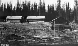
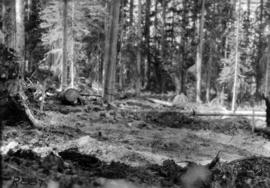
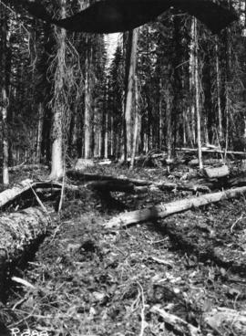
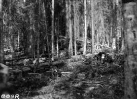
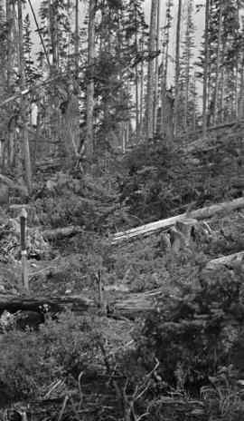
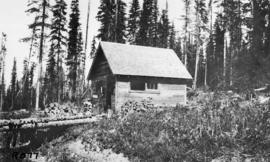
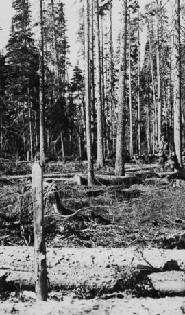
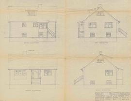
Caption of back of photograph states: "R877 Forest Branch Cabin X9696"
Photographer's photo number R878. No caption on back of photograph to glean further information. Title provided based on contextual information from related photographs and documents.
Photographer's photo number R879. No caption on back of photograph to glean further information. Title provided based on contextual information from related photographs and documents.
Photographer's photo number R880. Caption on back of photograph states: "Taken from near S.E. corner (most easterly corner) of Plot 15. Exp. Plot 160. X9696. See sketch of plot."
Photographer's photo number R881. Caption on back of photograph states: "Typical patch of reproduction left uninjured by logging. 2 [chains] NE of plot 15."
Photographer's photo number R882. Caption on back of photograph states: "Photo no. 1. Subplot 13. X-9696. Exp. Plot 160. See sketch of plot for location of photo."
Photographer's photo number R883. Caption on back of photograph states: "Typical patch of old windfall in cutting in X9696."
Photographer's photo number R884. No caption on back of photograph to glean further information. Title provided based on contextual information from related photographs and documents.
Photographer's photo number R885. Caption on back of photograph states: "Plot '9' X9696 --McCulloch"
Photographer's photo number R887. Caption on back of photograph states: "Plot '2' X9696 --McCulloch"
Photographer's photo number R888. No caption on back of photograph to glean further information. Title provided based on contextual information from related photographs and documents.
Photographer's photo number R889R. No caption on back of photograph to glean further information. Title provided based on contextual information from related photographs and documents.
Caption on back of photograph states: "Facing N on Sub Plot 16 showing [Reproduction] coming up"
No caption on back of photograph to glean further information. Title provided based on contextual information from related photographs and documents.
Caption on back of photograph states: "Facing N.W. on Sub Plot 10 showing patch of small timber left after logging still intact."
Caption on back of photograph states: "Facing W on Plot 13 showing windfall"
No caption on back of photograph to glean further information. Title provided based on contextual information from related photographs and documents. Photograph may depict windfall on Plot 13 similar to the previous photograph 2007.1.45.49.38.
Floppy contains the following files: AL94ENV.DAT, AL94VEG.DAT, ALZZ95.DOC, GISDAT.XLS.
Photograph depicts a Balsam timber pile adjacent to Aleza Lake Research Forest sign on the Giscome highway. Mark Clark is pictured.
Item is a 3.5 in. floppy containing Excel 4.0 files for the Aleza Lake polygon attributes by photo number. Files include: ALEZAENV.DAT, ALEZAENV.DOC, ALEZAPRO.DOC, ALEZASS.SRT, ALEZAVEG.DAT, ALEZAVEG.DOC, EDATOPE.CDR, FIELDF.XLS, POLY059.XLS, POLY061.XLS, POLY063.XLS, POLY101.XLS, POLY103.XLS, POLY105.XLS, POLY107.XLS, POLY127.XLS, POLY140.XLS, POLY142.XLS, POLY144.XLS, POLY146.XLS, POLY148.XLS, PROFILE.CDR.
Item is a photocopied map of the Aleza Lake area annotated to show transects.
Item is a reproduced map of Aleza Lake annotated to show a 1994 RFP study area.
Item is a photocopied Aleza Lake Forest map with forest cover labels annotated to show 1994 RFP study area.
Item is a photocopied and annotated Aleza Lake Forest map with forest cover labels.
Item is a photocopied Aleza Lake Forest map with forest cover labels, annotated to show 1995 sample transects.
Floppy contains the following files: AL52-55.dat, AL56-60.dat, AL61-65.dat, AL66-70.dat, AL71-75.dat, AL76-80.dat
Floppy contains the following files: AL52-55.wk1, AL56-60.wk1, AL61-65.wk1, AL66-70.wk1, AL71-75.wk1, AL76-80.wk1, ALX52-80.wk1
Floppy contains flag files (AL52-65F.dat, AL66-80F.dat) and Fortran programs (AES.for, AESEXT.for, AESFLG.for).
Map reflects reserve boundary, roads, trails, 20 feet contour intervals, air photo centre, declination, swamps, and mile post at the Aleza Lake Forest Reserve.
Diagram reflects outline for the proposed Ranger Station at the Aleza Lake Experimental Forest.
Technical drawing reflects depth of sand established as more and less than 6 feet.
Map reflects lot and STL lines, timber sale boundaries, Highway 16, roads, beetle infested areas, and plots X91971 to X91980, and X89946.
Map reflects soil and landforms of Giscome area.
Map reflects highways, main, branch and property roads, trails, public sustained yield unit boundaries, cutting permit boundary, contours, height of land, edge of lake, merchantable and immature timber, non-commercial cover, and swamps.
Map reflects forest type boundary line, bogs and swampy non-forested areas, creeks, lakes, rivers, tree species labels of spruce, balsam, and birch, stand descriptions, historical timber sale boundaries, stand history symbol, gravelled secondary roads, unimproved old roads, management compartment boundary, research forest boundary, ecological reserve boundary, and old growth emphasis areas.
Large scale map shows Aleza Lake Research Forest permanent sample plot 103. Includes information about live and dead trees and their species (spruce, balsam, birch, douglas fir). Also includes remeasurement history. Plot 103 was established in 1926 and is an unlogged, old growth, uneven aged, spruce-balsam stand.
Large scale map shows Aleza Lake Research Forest permanent sample plot 112. Includes information about live and dead trees and their species (spruce, balsam, birch, douglas fir). Also includes remeasurement history. Plot 112 was established in 1926 and is an unlogged, old growth, uneven aged, spruce-balsam stand.
Map commissioned from Ministry of Forests Prince George Region from Madrone Consultants shows Aleza Lake Research Forest Management Compartments and Administrative Boundaries. Map is 1 of 6. Map shows the Aleza Lake Ecological Reserve, Natural Forest Reserve, the Special Management Area, and Riparian Management Research Area.
Map commissioned from Ministry of Forests Prince George Region from Madrone Consultants shows Aleza Lake Research Forest Research Trials and Permanent Plots. Map is 2 of 6. Map shows permanent plot locations, historical timber sales areas, demonstration areas, and research plots.
Map commissioned from Ministry of Forests Prince George Region from Madrone Consultants shows Aleza Lake Research Forest Access and Access Management. Map is 3 of 6. Map shows the following road types: all weather 1-lane gravel road, dry weather road, and proposed road access. Also shows areas for parking/turnaround, toilets, and information signs.
Map commissioned from Ministry of Forests Prince George Region from Madrone Consultants shows an Aleza Lake Research Forest TRIM Base Map. Map is 4 of 6. Map shows the following: roads, old roads, buildings, rail line, transmission line, definite streams, intermittent streams, indefinite streams, marshes, swamps, lakes, wooded area boundaries, intermediate contour lines (20m intervals), and index contour lines (100m intervals).