Mostrando 3113 resultados

Archival description
Pack Train in High Country
2006.25.1.01 · Item · April 1963
Parte de Al Elsey Moving Images Collection

Footage of a pack train in the high country, which is likely an upper valley of the mountain foothills. Probable locations of this footage include Holt homestead, Rainbow Mountains or Tweedsmuir Provincial Park.

2012.13.1.50.115 · Item · 1980
Parte de J. Kent Sedgwick fonds

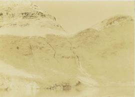
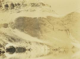
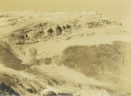
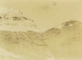
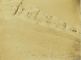
Image depicts the St. Joseph's Residential School in Williams Lake, B.C.

According to the National Centre for Truth and Reconciliation Archives (https://archives.nctr.ca/Cariboo-Residential-School) :

"Cariboo (Williams Lake) Indian Residential School (IRS) was located southwest of Williams Lake on highway #97 approximately halfway between Quesnel and Kamloops in the BC interior. The IRS operated from 1891 - 1981 (90 years) and closed on June 30, 1981.

Other names identifying the residential school include Williams Lake Industrial School and St. Joseph’s Industrial School from 1891 - 1920; Cariboo Industrial School and Cariboo Indian Industrial School from 1920 - 1927; Cariboo Residential School and Cariboo Indian Residential School from 1923 - 1981; St. Joseph’s Mission School (1929 - 1981), St. Joseph’s Indian Residential School (1932 and 1935), and St. Joseph’s Residential School (1963 and 1969); Cariboo Student Residence and Cariboo Indian Student Residence from 1967 - 1981. The school was also frequently referred to as the Indian School at 150 Mile House because of its location.

The Government of Canada was responsible for funding the school, which was managed and operated by the Roman Catholic Church from July 1891 - March 31, 1969. From April 1, 1969 - June 1981, the federal government managed and operated the IRS. In 1962, an agreement was signed between Her Majesty the Queen in Right of Canada represented by the Minister of Citizenship and Immigration and Indianescom (Oblate Indian and Eskimo Commission) for the management and operation of the Cariboo IRS.

No information regarding which grades were taught at the IRS exists.

Students were from the following bands: Alexandria, Alexis Creek, Alkali Lake, Anaham, Anderson Lake, Ashcroft, Bonaparte, Bridge River, Canim Lake, Canoe Creek, Clinton, Coldwater, Cowichan, Dog Creek, Euchinico, Fountain, High Bar, Kamloops, Kluskus Lake (Kluxkux Lake), Kuklinko, Lake Babine, Lillooet, Little Shuswap, Moricetown, Mount Currie, Natzoo, Nazko, Nemiah Valley, North Thompson, Pavillion, Pemberton, Quesnel, Redstone, Riske Creek, Seton Lake, Skwah, Soda Creek, Squamish, Stone (Stoney), Taodistan, Toosey, Ulkatcho (Ulgatcho), and Williams Lake. "was opened was opened by Roman Catholic missionaries in 1891. In 1902 nine boys ran away from the school, one of them dying of exposure. In 1920, nine boys ate poisonous water hemlock in what parents believed to be a response to discipline at the school. One of these boys died. The school closed in 1981. In the 1980s and 1990s two former staff members pled guilty to charges of sexually abusing students in the 1950s and 1960s. In 1998, a former principal apologized to a former student and school employee who had charged him with a series of sex offences. "

Oscar Peak
2012.13.1.57.24 · Item · 1982
Parte de J. Kent Sedgwick fonds

Image depicts the north aspect of Oscar Peak overlooking Lava Lake in the Nass Valley.

Oscar Peak
2012.13.1.57.25 · Item · 1982
Parte de J. Kent Sedgwick fonds

Image depicts the north aspect of Oscar Peak overlooking Lava Lake in the Nass Valley.

2008.27.3 · Dossiê · 1935-1997
Parte de Knox McCusker Collection

File consists of the following items:

  • "Mac" by D.L. Surveyor
  • "Knox (Mac) McCusker: Dominion Land Surveyor" by E.L. Rutherford, V.C. Brink, R.S. Silver and M.Z. (Smokey) Neighbour
  • Excerpts from Men and Meridians by Don W. Thomson
  • Article re: Knox McCusker written on the occasion of his death (April 14, 1955)
  • "McKusker (sic) to open up Blueberry Mountain Area" (Alaska Highway News, June 8, 1950)
  • "McCusker was surveyor, big game guide….also rancher and trail blazer"
  • "Knox Freeman McCusker" written on the occasion of his death (The Canadian Surveyor, July 1955)
  • "Veteran Surveyor - Alaska Highway Stories"
  • Memories of Knox McCusker by his oldest niece Betty (McCusker) Rutherford
  • "Veteran Surveyor prefers horses for long bush treks" by Eric Young (Edmonton Journal)
  • Eulogy for Knox McCusker read by Stanley D. Seif at Burch Presbyterian Church in Fort St. John, B.C.
  • Eulogy for Gwendolyn Dorothy McCusker (July 1997)
  • "Tropical Valley No Myth: amazing story of woman who lived there" by Thomas A. Wayling (Vancouver Sun)
  • Photocopy of section of map: "Topographical sketch map showing route traversed by the Bedaux Sub-Arctic Expedition 1934 through the Rocky Mountains" (by Frank Swannell, March 27, 1935)
  • Memories of Knox McCusker by Bill McCusker, his oldest nephew
  • "There is always a reason; destiny made it a date. The corridor of the Alcan didn’t just happen" (Fort St. John publication)
  • Article on Knox McCusker (ALS News, Winter 1983)
Three Men in Relief Camp at Penny
2009.5.3.92 · Item · [ca. 1935]
Parte de Taylor-Baxter Family Photograph Collection

Photograph depicts three men standing in dirt area near fire wood. Tent building semi-visible on left, forest trees behind snow pile in background. Handwritten annotation on recto of photograph: "Relief camp at Penny. 100 men - A.K. Bourchier Foreman - Dixon Taylor timekeeper. [Ted Nevan?] purchasing agent - hungry thirties. Construction days. Mile 29 - A.K. Bourchier J.P." Man in middle is believed to be A.K. Bourchier.

2019.10.4.41404 · Item · 8 Sept. 1969
Parte de Lockwood Survey Corporation Ltd. collection

This remote-sensing aerial photograph was taken by Lockwood Survey Corporation Ltd. under contract for the B.C. Forest Service. This historically important aerial photograph depicts the headwaters of Williston Reservoir soon after its creation in 1968 with the building of the W.A.C. Bennett Dam on the Peace River.

The identification coding on these photographs can be interpreted as follows:

  • The largest number on the leftmost side is the frame number for the photograph.
  • The following code to the right in the format B) 69-53 is currently unknown, but may refer to an internal project number for the Lockwood Survey Corporation.
  • The 6" may refer to the camera's focal length in inches.
  • Next is "17,150 ASL" which is 17,150 feet Above Sea Level.
  • Following is "152.52" which refers to the camera's focal length in millimeters, which equals 6 inches.
  • The "W1307" may refer to the reel, but that is unconfirmed.
  • "8 SEP 69" is the date the photo was taken.
Photo 41407 - W.A.C. Bennett Dam
2019.10.4.41407 · Item · 8 Sept. 1969
Parte de Lockwood Survey Corporation Ltd. collection

This remote-sensing aerial photograph was taken by Lockwood Survey Corporation Ltd. under contract for the B.C. Forest Service. This historically important aerial photograph depicts the W.A.C. Bennett Dam and Williston Reservoir soon after its flooding in 1968.

The identification coding on these photographs can be interpreted as follows:

  • The largest number on the leftmost side is the frame number for the photograph.
  • The following code to the right in the format B) 69-53 is currently unknown, but may refer to an internal project number for the Lockwood Survey Corporation.
  • The 6" may refer to the camera's focal length in inches.
  • Next is "17,150 ASL" which is 17,150 feet Above Sea Level.
  • Following is "152.52" which refers to the camera's focal length in millimeters, which equals 6 inches.
  • The "W1307" may refer to the reel, but that is unconfirmed.
  • "8 SEP 69" is the date the photo was taken.
Photo 41406 - W.A.C. Bennett Dam
2019.10.4.41406 · Item · 8 Sept. 1969
Parte de Lockwood Survey Corporation Ltd. collection

This remote-sensing aerial photograph was taken by Lockwood Survey Corporation Ltd. under contract for the B.C. Forest Service. This historically important aerial photograph depicts the W.A.C. Bennett Dam and Williston Reservoir soon after its flooding in 1968.

The identification coding on these photographs can be interpreted as follows:

  • The largest number on the leftmost side is the frame number for the photograph.
  • The following code to the right in the format B) 69-53 is currently unknown, but may refer to an internal project number for the Lockwood Survey Corporation.
  • The 6" may refer to the camera's focal length in inches.
  • Next is "17,150 ASL" which is 17,150 feet Above Sea Level.
  • Following is "152.52" which refers to the camera's focal length in millimeters, which equals 6 inches.
  • The "W1307" may refer to the reel, but that is unconfirmed.
  • "8 SEP 69" is the date the photo was taken.
Photo 41405 - W.A.C. Bennett Dam
2019.10.4.41405 · Item · 8 Sept. 1969
Parte de Lockwood Survey Corporation Ltd. collection

This remote-sensing aerial photograph was taken by Lockwood Survey Corporation Ltd. under contract for the B.C. Forest Service. This historically important aerial photograph depicts the W.A.C. Bennett Dam and Williston Reservoir soon after its flooding in 1968.

The identification coding on these photographs can be interpreted as follows:

  • The largest number on the leftmost side is the frame number for the photograph.
  • The following code to the right in the format B) 69-53 is currently unknown, but may refer to an internal project number for the Lockwood Survey Corporation.
  • The 6" may refer to the camera's focal length in inches.
  • Next is "17,150 ASL" which is 17,150 feet Above Sea Level.
  • Following is "152.52" which refers to the camera's focal length in millimeters, which equals 6 inches.
  • The "W1307" may refer to the reel, but that is unconfirmed.
  • "8 SEP 69" is the date the photo was taken.
Hagwilget Bridge, Bulkley River
2004.2.1.80 · Item · 1898-1920
Parte de Reverend R.W. Large fonds

Photograph depicts the wooden Hagwilget Bridge spanning a rocky gorge over the Bulkley River. Forested area visible in the background. Annotation on recto of photograph states: "W.W.W. Old Indian Bridge, Bulkley River"

2000.19.2.183 · Item · 29 Aug. 1927-26 Sept. 1927
Parte de Prentiss Gray Collection

Photograph depicts a mountain ridge rising our of an alpine lake that is visible in the foreground. The photograph location is the Mt. Petrie area from the north and northwest.

Pack horses taking a break by a stream
2000.19.2.172 · Item · 29 Aug. 1927-26 Sept. 1927
Parte de Prentiss Gray Collection

Photograph depicts seven pack horses grazing in grass by a stream. In the background the tree line of a forest is visible with mountain peaks rising in the distance.