2012.13.1.51.134
·
Item
·
Aug. 1979
Part of J. Kent Sedgwick fonds
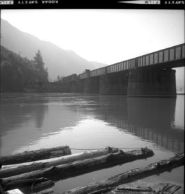
Image depicts two bridges in Telkwa, B.C. One is for trains.