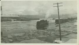
Mostrar 887 resultados

Archival description
887 resultados com objetos digitais Mostrar resultados com objetos digitais
P.G. Logging
2012.13.1.122.01 · Item · June 1975
Parte de J. Kent Sedgwick fonds

Image depicts an aerial view of areas that have been used for logging around Prince George, B.C.

Peden Hill
2012.13.1.3.020 · Item · Oct. 1975
Parte de J. Kent Sedgwick fonds

Image depicts a view of Peden Hill in Prince George, B.C.

Parkside Intermediate Care Home
2012.13.1.3.101 · Item · 12 Oct. 1989
Parte de J. Kent Sedgwick fonds

Image depicts Parkside Intermediate Care Home on Ospika Boulevard in Prince George. Map coordinates 53°55'02.6"N 122°47'41.6"W

Parkside Intermediate Care Home
2012.13.1.3.099 · Item · 12 Oct. 1989
Parte de J. Kent Sedgwick fonds

Image depicts Parkside Intermediate Care Home on Ospika Boulevard in Prince George. Map coordinates 53°55'02.6"N 122°47'41.6"W

Parkside Intermediate Care Home
2012.13.1.3.102 · Item · 12 Oct. 1989
Parte de J. Kent Sedgwick fonds

Image depicts Parkside Intermediate Care Home on Ospika Boulevard in Prince George. Map coordinates 53°55'02.6"N 122°47'41.6"W

Paddlewheel Park
2012.13.1.7.202 · Item · Nov. 2000
Parte de J. Kent Sedgwick fonds

Image depicts the Fraser River at Paddlewheel park, with a train on the other side of the river, in Prince George B.C.

Paddlewheel Park
2012.13.1.7.201 · Item · Nov. 2000
Parte de J. Kent Sedgwick fonds

Image depicts the Fraser River at Paddlewheel park, with a train on the other side of the river, in Prince George B.C.

Outside Spee-Dee Printers
2012.13.1.128.04 · Item · 1994
Parte de J. Kent Sedgwick fonds

Image depicts a group of individuals on the sidewalk outside Spee-Dee Printers on Brunswick Street in Prince George, B.C.

Outhouse?
2012.13.1.22.08 · Item · 1970
Parte de J. Kent Sedgwick fonds

Image depicts what is likely an outhouse at Island Cache.

Northwood Pulpmill
2012.13.1.3.160 · Item · Nov. 2000
Parte de J. Kent Sedgwick fonds

Image depicts the Northwood Pulpmill in Prince George, B.C. taken from above the Nechako River looking east. Map coordinates 53°56'00.0"N 122°44'29.7"W

Northern Rooms
2012.13.1.7.002 · Item · Oct. 1975
Parte de J. Kent Sedgwick fonds

Image depicts an old building with a sign labelled "Northern Rooms" in an uncertain location somewhere in Prince George, B.C.

Nechako River?
2012.13.1.23.08 · Item · 1973
Parte de J. Kent Sedgwick fonds

Image depicts what is possibly a small section of the Nechako River on Cottonwood Island.

Nechako River?
2012.13.1.22.19 · Item · 1970
Parte de J. Kent Sedgwick fonds

Image depicts a body of water in Island Cache. It is possibly a small section of the Nechako River.

Nechako Cutbanks Trail
2012.13.1.3.092 · Item · 12 Oct. 1989
Parte de J. Kent Sedgwick fonds

Image depicts the cutbanks on the other side of the Nechako, taken from the nature trail at Island Cache. Map coordinates 53°55'34.6"N 122°45'52.4"W

Nechako Cutbanks Trail
2012.13.1.3.091 · Item · 12 Oct. 1989
Parte de J. Kent Sedgwick fonds

Image depicts the cutbanks on the other side of the Nechako, taken from the nature trail at Island Cache. Map coordinates 53°55'34.6"N 122°45'52.4"W