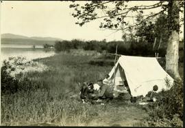
Typed annotation on recto: "Camping at Stuart Lake - B.C." Two men and one woman kneeling among miscellaneous equipment on ground in front of small tent on the lake side. Large tree and bushes behind tent, hills in distance.
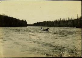
Typed annotation on recto: "Cottonwood dugout on Tachi River Stuart Lake Section of B.C." Two people sit in dugout canoe, tree-covered banks in background.
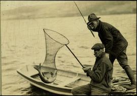
Typed annotation on recto: "Fishing action - Stuart Lake, B.C." Two men fishing in a canoe, with one fish caught in net. Hillside in background. It is speculated that the seated man with fish may be Vivian Grey.
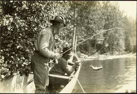
Typed annotation on recto: "Rainbow Trout fishing (Fly fishing) Tachi River - Stuart Lake, B.C." Two men fishing in a canoe with rope tied to another object, and one fish caught in net. Trees on shore in background.
Photographs within this file document natural and artificial features across the landscape of Northern British Columbia. This landscape also includes the physical, built, urban and industrial landscapes; topography; site plans; boundaries, districts, reserves, parks, sanctuaries, towns, villages and cities, etc.
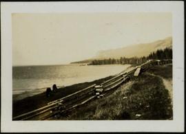
Photograph depicts two horses grazing behind log fence along the beach of Stuart Lake. Forested peninsula and distant hills are visible in background. Handwritten photo caption below photograph reads: "Stuart Lake, BC".
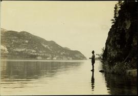
Typed annotation on recto: "Stuart Lake B.C." Man standing in water close to cliff which is reflected in water on right. Hills on opposite shore can be seen in background.
Typed annotation on recto: "Stuart Lake Scene - British Columbia." Man stands in water close to cliff which is reflected in water on right. Hills on opposite shore can be seen in background.
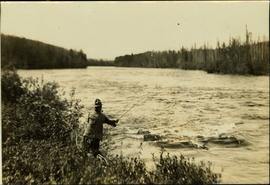
Typed annotation on recto: "Tachi River, Stuart Lake, B.C." Man in tall hat, smoking from a pipe, and standing on shore with fishing rod extended over water. Tree-covered banks in background.
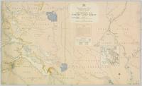
Colour-coded map depicting lands open for preemption, in “University Reserve,” or reserved for public auction. Depicts land recording divisions, communities, bodies of water, and transport routes.
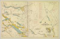
Colour-coded topographic map depicting lands surveyed as alienated, reserved, or statutory timber land. Depicts land district boundaries, land recording divisions, HBC posts, triangulation stations, telephone lines, communities, bodies of water, and transport routes. Defines resource type areas (“Land Form,” “Soil,” “Forest Cover,” “Grazing,” “Geological & Mineralogical,” “Fur-Bearing Animals & Game”). Includes explanatory “Natural Resources Reference.”
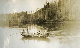
Photograph depicts ten men aboard a scow on a river or lake. The scow is equipped with long poles and may be propelled by steam.
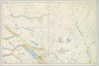
Colour-coded topographic map depicting lands surveyed as alienated, available for purchase or lease under Land Act, or reserved. Depicts land district boundaries, land recording divisions, provincial forest boundaries, HBC posts, triangulation stations, telephone lines, communities, bodies of water, and transport routes.
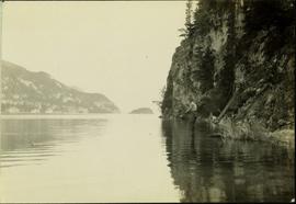
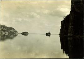
Typed annotation on recto: "Stuart Lake - British Columbia." The hills on left, cliff on right, and two small islands on horizon are reflected in the lake.
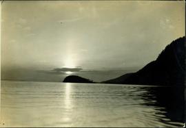
Typed annotation on recto: "Sunset at Stuart Lake, B.C." Hills on shore in midground, sun behind clouds reflected in rippled water.
