2002.17.2
·
Series
·
1913-1914
Part of Henderson-Roe collection
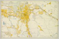
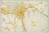
Consists of legal records and documents related to the holdings and activities of J. B. Henderson-Roe and his father, C.H. Henderson-Roe, including a hand-drawn map of Prince George, Fort George, and South Fort George, as well as a surveyor's plan for a subdivision.