Geographic Features

Elements area

Taxonomy

Code

Scope note(s)

  • Includes both natural and artificial features
  • Physical landscape, built landscape
  • Urban and industrial landscapes
  • Topography
  • Site plans
  • Boundaries, districts, reserves, parks, sanctuaries, towns, etc.
  • NOTE: Mainly but not exclusively pertaining to photographic and cartographic records
  • SEE ALSO: Land, Settlement and Immigration

Source note(s)

  • MemoryBC Subject Groups

Display note(s)

    Hierarchical terms

    Geographic Features

      Equivalent terms

      Geographic Features

        Associated terms

        Geographic Features

          8 Archival description results for Geographic Features

          8 results directly related Exclude narrower terms
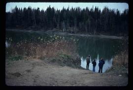
          Penny - Fraser River?
          2012.13.1.88.02 · Item · 1975
          Part of J. Kent Sedgwick fonds

          Image depicts four unidentified individuals standing on the bank of a river, possibly the Fraser, somewhere in or near Penny, B.C.

          Kent Sedgwick
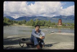
          2012.13.1.88.35 · Item · 1980
          Part of J. Kent Sedgwick fonds

          Image depicts Kent Sedgwick sitting on the bank of a river. An old beehive burner is visible in the background. Located somewhere in or near Penny, B.C.

          East Line (Misc.)
          2012.13.1.088 · Subseries · [between 1975 and 2004]
          Part of J. Kent Sedgwick fonds

          File contains slides depicting places along the east line of the BC Railway.

          East Line
          2012.13.2.17 · Subseries · 1972-2011
          Part of J. Kent Sedgwick fonds

          Subseries consists of material collected by Kent Sedgwick for research regarding the communities along the East Line of the Grand Trunk Pacific Railway in Central British Columbia, particularly between Prince George and McBride. These communities and locations include, among others, Shelley, Willow River, Sinclair Mills, Longworth, Dunster, Tete Jaune, Valemount, Mount Robson, and the Yellowhead Pass. Research on these communities was conducted during Kent Sedgwick's involvement in the UNBC-led Upper Fraser Historical Geography Project. The files primarily consist of research notes, audio and transcripts of oral interviews, and photographs of the East Line communities.