Land, Settlement and Immigration

Elements area

Taxonomy

Code

Scope note(s)

  • Claiming, settling, and moving to a new land
  • Land titles, distribution, grants, etc.
  • Community and regional settlement patterns
  • Land settlement companies
  • Land surveys and surveyors
  • Real estate companies and activities
  • Organizations involved in sponsoring and supporting immigrants

Source note(s)

  • MemoryBC Subject Groups

Display note(s)

    Hierarchical terms

    Land, Settlement and Immigration

      Equivalent terms

      Land, Settlement and Immigration

        Associated terms

        Land, Settlement and Immigration

          1211 Archival description results for Land, Settlement and Immigration

          1211 results directly related Exclude narrower terms
          Cariboo region
          2000.23.1.018 · File · 1977-1986
          Part of Audrey Smedley L'Heureux fonds

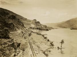
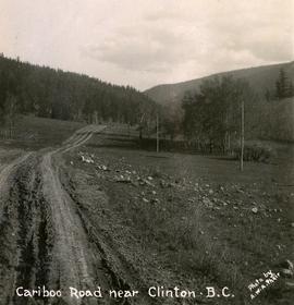
          File consists of material relating to the Cariboo District and reproductions of articles and newspaper clippings. Highlights include:

          • Reproduction of Isabel M.L. Bescoby, "Some Aspects of Society in Cariboo from it's discovery until 1871", 1932 (booklet)
          • "Gold Country '86", a commemorative Expo 86 supplement to the Quesnel Cariboo Observer, 25 June 1986
          2013.15 · Collection · 1991-2001

          Collection consists of various originals, drafts, and photocopies of development planning reports for the Cariboo-Chilcotin region of British Columbia. Many of the reports were authored by the Cariboo Economic Action Forum.

          Carmella Canino
          2003.11.1.03 · File · 1999-2000
          Part of Island Cache Recovery Project Collection

          File consists of an oral history given by Carmella Canino, which was gathered as part of Dr. Mike Evan's Island Cache Recovery Project. Includes consent forms, transcripts, and the recorded oral history on the original media.

          Cassiar Land
          2000.1.1.3.25 · File · 1979 - 1983
          Part of Cassiar Asbestos Corporation Ltd. fonds

          This file contains images of a land dispute around Cassiar. The photographs depict a cabin on a lot, a destroyed cabin, and outhouses. The accompanied documents in the original file refer to the subjects of "Claims, Leases, and Land lots," and it is implied that there were issues of squatters, illegal occupation, and mineral claims.

          Cecil Nicholls
          2003.11.1.32 · File · 1999-2000
          Part of Island Cache Recovery Project Collection

          File consists of an oral history given by Cecil Nicholls, which was gathered as part of Dr. Mike Evan's Island Cache Recovery Project. Includes consent forms, transcripts, and the recorded oral history on the original media.

          2020.4.2.3.126 · Item · 2008
          Part of G. Gary Runka fonds

          Item is an original copy of the presentation booklet "Celebrating 35 Years of the Agricultural Land Reserve: 1973-2008" created by Farmland Defence League of BC for an anniversary event. Includes an article by G. Gary Runka entitled "BC's Agricultural Land Reserve - Its Historical Roots".

          2020.4.3.25 · File · 2006-2008
          Part of G. Gary Runka fonds

          File consists of working records of the Central Coast Plan Implementation Monitoring Committee. The purpose of the committee was to monitor and report progress toward implementation of the British Columbia Central Coast land use plan and make recommendations on plan revisions to Provincial and First Nation governments. The land and resource management planning (LRMP) process in the Central Coast area began in 1996. In April 2001, an interim agreement was signed by the Province and stakeholders. Includes a promotional DVD created by the provincial government.

          Centre Street Prince Rupert
          2009.7.1.251 · Item · ca. 1880-1920
          Part of Archdeacon W. H. Collison fonds

          Photograph of residents in motion on Centre Street in Prince Rupert. Buildings are visible on either side of the street and a railway track runs down the length of the road. Annotation on recto reads: "Centre Street, Prince Rupert, BC. 1664."

          Charles Horetzky
          2000.23.1.062 · File · 1978-1980
          Part of Audrey Smedley L'Heureux fonds

          File consists of material relating to Charles George Horetzky or Horetsky (20 July 1838 - 30 April 1900). Horetzky was a Canadian surveyor and photographer noted for his work in western Canada as a member of the Canadian Pacific Survey under Sir Sandford Fleming and Frank Moberly. Materials included a summary write-up by L'Heureux, correspondence, newspaper clippings, and reproductions of articles.

          Chasm
          2020.05.48 · Item · 1936
          Part of Gordon Wyness Album

          Photograph depicts "The Chasm" or "The Painted Chasm", located 11 miles north of Clinton, adjacent to the route of the Cariboo Road. In 1940, four years after this photograph was taken, Chasm Provincial Park was created in 1940 to preserve and promote the Painted Chasm feature, a gorge created from melting glacial waters eroding a lava plateau over a 10 million year span.

          Chasm, BC
          2020.05.47 · Item · 1936
          Part of Gordon Wyness Album

          Photograph depicts "The Chasm" or "The Painted Chasm", located 11 miles north of Clinton, adjacent to the route of the Cariboo Road. In 1940, four years after this photograph was taken, Chasm Provincial Park was created in 1940 to preserve and promote the Painted Chasm feature, a gorge created from melting glacial waters eroding a lava plateau over a 10 million year span.

          Chester Jeffery
          2003.11.1.17 · File · 1999-2000
          Part of Island Cache Recovery Project Collection

          File consists of an oral history given by Chester Jeffery, which was gathered as part of Dr. Mike Evan's Island Cache Recovery Project. Includes consent forms, transcripts, and the recorded oral history on the original media.

          2023.5.1.29 · Item · 1 Nov. 1993
          Part of UNBC School of Planning and Sustainability fonds

          This map is part of Schedule B of the 1993 Official Community Plan, Bylaw No. 5909 for the City of Prince George. This particular map depicts the northeast area of the City of Prince George, including the industrial areas on Prince George Pulpmill Road and Northwood Pulpmill Road along the Fraser River.

          2023.5.1.24 · Item · [after 1975]
          Part of UNBC School of Planning and Sustainability fonds

          Item is Map 2 of a group of five maps relating to a City of Prince George Study of Construction Aggregates by the firm Willis, Cunliffe, Tair & Company Limited. Map 2 shows development areas and aggregate requirements for 1984 and 1994. As the map is undated, it is unclear whether the 1984 and 1994 dates are future estimates.

          2023.5.1.23 · Item · [after 1975]
          Part of UNBC School of Planning and Sustainability fonds

          Item is Map 1 of a group of five maps relating to a City of Prince George Study of Construction Aggregates by the firm Willis, Cunliffe, Tair & Company Limited. Map 1 shows development areas and population for 1984 and 1994. As the map is undated, it is unclear whether the 1984 and 1994 dates are future estimates.

          2023.5.1.26 · Item · [after 1975]
          Part of UNBC School of Planning and Sustainability fonds

          Item is Map 4 of a group of five maps relating to a City of Prince George Study of Construction Aggregates by the firm Willis, Cunliffe, Tair & Company Limited. Map 4 shows development areas, aggregate sources, and requirements for 1984 and 1994. As the map is undated, it is unclear whether the 1984 and 1994 dates are future estimates.

          2003.11.2 · Series · 1999-2000
          Part of Island Cache Recovery Project Collection

          Series consists of copies of City of Prince George records photocopied and organized by Island Cache Recovery Project researchers. Includes incoming and outgoing correspondence between the city and Island Cache residents, legal real estate and building inspection documents for Island Cache properties, and reports regarding Island Cache (Cottonwood Island).

          2020.4.6 · Series · 1976-2012
          Part of G. Gary Runka fonds

          Series consists of the client file project records of G.G. Runka Land Sense Ltd., Gary Runka's consultancy business (co-owned with Joan Sawicki until 1991). G.G. Runka Land Sense Limited was incorporated as a company on 30 Nov. 1978 and dissolved on 30 Nov. 2018. Most business activity ceased after Gary Runka's death in July 2013. The company provided comprehensive professional services in land inventory, environmental assessment, integrated resource management, land and water use conflict resolution and interdisciplinary land use planning. Over the course of the company's operation, Gary Runka and his firm consulted on 681 assignments ranging from very large projects (such as the Site C project) to small residential/commercial land capability assessments.

          The Land Sense Ltd. client files generally include records such as correspondence, contracts, invoices, project reports, publications, ephemera, memoranda, map excerpts, legal documents, meeting materials, clippings, and handwritten notes. Some client files are accompanied by related maps, photographs, aerial photographs, and/or digital records on storage media.

          2020.4.2.3.119 · Item · 2000
          Part of G. Gary Runka fonds

          This unpublished document from the BC Ministry of Environment, Lands and Parks Communications Branch collates information about the issue of climate change circa the year 2000. Includes polling highlights from a poll of BC residents about climate change in 1998; a summary of points about media interest in climate change circa 1998-2000; and a short listing of supportive business comments on climate change circa 1999-2000.

          Collected Works
          2020.4.2.3 · Subseries · 1945-2009
          Part of G. Gary Runka fonds

          Subseries includes works collected by G. Gary Runka. Runka collected a comprehensive resource library of publications, reports, and rare grey literature that reflected the depth and breadth of natural resource issues in British Columbia. Material from this resource library was intrinsically tied to Runka's work; selected unique items from the resource library are contained within this sub-series to contextualize the scope of land management issues.