Showing 24 results

Archival description
2 results with digital objects Show results with digital objects
5810 Bench Plan for 1972
2000.1.2.6.3 · Item · November 30, 1972
Part of Cassiar Asbestos Corporation Ltd. fonds

This map depicts the generalized pit layout and estimated waste extraction areas for 5810 bench. Annotated details include numerical bench markers, extraction dates and approximate ore extraction amounts. The hand drawn plan consists of solid and dotted lines drawn with green, orange and lead pencil.

2000.1.2.6.2 · Item · November 30, 1972
Part of Cassiar Asbestos Corporation Ltd. fonds

This map depicts the generalized pit layout and estimated waste extraction areas for benches 5840 and 5870. Annotated details include numerical bench markers as well as extraction dates. The hand drawn plan consists of solid and dotted lines drawn with green and red pencil.

2000.1.2.6.7 · Item · October 1972
Part of Cassiar Asbestos Corporation Ltd. fonds

This map depicts the pit layout and estimated waste extraction areas for 5840 bench for the end of September to November. Extraction dates, approximate extraction tonnages and ore, waste and talus locations are included throughout the plan. Annotated details include numerical bench markers, extraction dates, approximate total tonnages as well as waste and ore tonnage calculations for October. The hand drawn plan consists of solid and broken lines drawn with red, blue, orange and lead pencils as well as black ink.

2000.1.2.6.8 · Item · October 1972
Part of Cassiar Asbestos Corporation Ltd. fonds

This map depicts the pit layout and estimated waste extraction areas for 5870 bench for the end of August to November. Extraction dates, approximate extraction tonnages and ore, waste and talus locations are included throughout the plan. Annotated details include numerical bench markers, extraction dates, approximate extraction tonnages, ore, waste and talus locations as well as waste, ore, talus and total tonnage calculations for October. The hand drawn plan consists of solid and broken lines drawn with red, blue, orange and lead pencils as well as black ink.

2000.1.2.6.4 · Item · November 1972
Part of Cassiar Asbestos Corporation Ltd. fonds

This map depicts the generalized pit layout and estimated waste extraction areas for 6290 bench for the month of November. Annotated details include numerical bench markers and waste extraction dates. The hand drawn plan consists of solid and dotted lines drawn with green, orange, red, blue and lead pencil.

2000.1.2.6.5 · Item · October 1, 1972
Part of Cassiar Asbestos Corporation Ltd. fonds

This map depicts the generalized pit layout and estimated waste extraction areas for 6290 bench for the month of October and November. Extraction dates as well as total unbroken tonnages are included within certain portions of the plan. Annotated details include numerical bench markers, extraction dates, total tonnages to be extracted and approximate waste tonnage calculations for October. The hand drawn plan consists of solid and broken lines drawn with red, green, orange and lead pencils as well as black ink.

6320 Bench Plan for 1972
2000.1.2.6.12 · Item · October 4, 1972
Part of Cassiar Asbestos Corporation Ltd. fonds

This map depicts the pit layout and estimated waste extraction areas for 6320 bench. Extraction dates accompanied by its total tonnages are located within each planned area. Certain extraction dates are labeled with bench numbers. Annotated details include extraction dates, approximate total tonnages per area accompanied by extraction dates, total planned tonnages, total tonnages from December 31, 1971 as well as a rough colored legend depicting extraction month by color. The hand drawn plan consists of solid lines drawn with green, red, orange and lead pencils.

2000.1.2.6.6 · Item · October 1972
Part of Cassiar Asbestos Corporation Ltd. fonds

This map depicts the pit layout and estimated waste extraction areas for 6320 bench for the end of September to October. Extraction dates are included within certain portions of the plan. Annotated details include numerical bench markers, extraction dates, and approximate waste tonnage calculation for October. The hand drawn plan consists of solid and broken lines drawn with red, orange and lead pencils as well as black ink.

6350 Bench Plan for 1972
2000.1.2.6.9 · Item · October 4, 1972
Part of Cassiar Asbestos Corporation Ltd. fonds

This map depicts the pit layout and estimated waste extraction areas for 6350 bench. Extraction dates accompanied by its total tonnages are located within each planned area. Annotated details include extraction dates, approximate total tonnages per area as well as extraction dates, total planned and broken tonnages and total tonnages from December 31, 1970 from a survey done in September 30. The hand drawn plan consists of solid lines drawn with red, green and orange colored pencils.

6380 Bench Plan for 1972
2000.1.2.6.10 · Item · October 4, 1972
Part of Cassiar Asbestos Corporation Ltd. fonds

This map depicts the pit layout and estimated waste extraction areas for 6380 bench. Extraction dates accompanied by its total tonnages are located within each planned area. Certain extraction dates are labeled with bench numbers. Annotated details include extraction dates, approximate total tonnages per area as well as extraction dates, total planned and broken tonnages, total tonnages from December 31, 1970 from a survey done in September 1, numerical bench markers as well as a rough colored legend depicting extraction month by color. The hand drawn plan consists of solid lines drawn with green, yellow, red and lead pencils.

6410 Bench Plan for 1972
2000.1.2.6.11 · Item · October 4, 1972
Part of Cassiar Asbestos Corporation Ltd. fonds

This map depicts the pit layout and estimated waste extraction areas for 6410 bench. Extraction dates accompanied by its total tonnages are located within each planned area. Certain extraction dates are labeled with bench numbers. Annotated details include extraction dates, approximate total tonnages per area as well as extraction dates, total planned and broken tonnages, total tonnages from December 31, 1970 and numerical bench markers. The hand drawn plan consists of solid lines drawn with green, yellow, orange and lead pencils.

6440 Bench Plan for 1972
2000.1.2.6.1 · Item · October 4, 1972
Part of Cassiar Asbestos Corporation Ltd. fonds

This map depicts a drawn bench plan for the estimated excavated waste for bench 6440 during the first quarter of 1972. Annotated details include the approximate excavated ore tonnages, broken and planned values for the first quarter and revised calculations from previous years values. Planned excavated areas are drawn with different colors.

Alaska Trip, August 1985
2020.09.01 · File · Aug. 1985
Part of Jill Singleton Collection

This travel scrapbook was created by Jill Singleton to document a trip to Alaska, Yukon, Haida Gwaii, and northern BC. Jill Singleton and Eric Stathers embarked on a 1985 car camping trip using the BC Ferries and Alaska Ferry systems. Includes postcards, ephemera, handwritten notes, pamphlets, issues of local newspapers, and maps. Also includes 37 photographs.

Includes the following:

  • "Queen Charlotte Islands Observer" newspaper issue for August 8, 1985
  • "A Walking Tour and Business Directory for Queen Charlotte City", June 1985
  • "A Walking Tour and Business Directory for Tlell + Port Clements", June 1985
  • "A Walking Tour and Business Directory for Skidegate Landing, Skidegate and Sandspit", June 1985
  • "A Walking Tour and Business Directory for Masset", June 1985
  • "Explorations Q.C.I." pamphlet advertising guiding, outfitting, and touring
  • "Sandspit Inn, Queen Charlotte Islands" pamphlet
  • "Visit the Queen Charlottes" pamphlet
  • Queen Charlotte Islands map, circa 1985
  • BC Ferries pamphlet "New in 1985... Inside Passage Day Cruise"
  • BC Ferries pamphlet "Tickets and Boarding Information, Inside Passage"
  • "Alaska Marine Highway" pamphlet
  • "Discover Southeast Alaska, Ketchikan" pamphlet
  • "Alaska State Parks" pamphlet/map
  • "Tongass National Forest, Alaska" pamphlet/map
  • "Alaska Marine Highway Summer Schedule - May 1, 1985 through September 30, 1985" pamphlet
  • History leaflet for St. Michael's Cathedral, Sitka, AK
  • Alaska Seafood Marketing Institute leaflets, 1984
  • Anchorage 1984 Visitors Guide, Anchorage Convention & Visitors Bureau
  • "Skagway... some Steps on the Gold Rush Trail... walking Tour of the Historic District - Klondike Gold Rush National Historical Park"
  • "Skaguay Alaskan" newspaper issue, Vol. VIII, No. 1880 (1985)
  • "Klondike Gold Rush" pamphlet for tourists
  • "Broadway, Skagway, Alaska" pamphlet
  • "S.S. Tutshi, Carcross" pamphlet
  • "Moon Watching" pamphlet by BC Ministry of Lands, Parks and Housing (1980)
  • "Some Insects of Provincial Parks" pamphlet by BC Ministry of Lands, Parks and Housing (1980)
  • "Stewart, British Columbia - Hyder, Alaska... Your Gateway to Alaska and the Yukon!" pamphlet
  • "Stewart-Cassiar Highway 37" map
  • "Prince Rupert City Map & Guide" pamphlet
  • "Explore Canada's Yellowhead, Western Canada's New Interprovincial Highway" pamphlet (1983)
  • "101 Things To Do in Yukon" booklet published by Tourism Yukon (1985)
  • "Your Guide to B.C. Ferries' Inside Passage" booklet by British Columbia Ferry Corporation (1985)
  • "Port Alberni, British Columbia, Canada" booklet (1981)

Trip itinerary:

  • Vancouver, BC
  • Nanaimo, BC
  • Port Hardy, BC
  • Prince Rupert, BC
  • Yakoun River, BC
  • Haida Gwaii, BC (formerly Queen Charlotte Islands)
  • Rennell Sound, BC
  • Graham Island, BC
  • Queen Charlotte City, BC
  • Sandspit, BC
  • Prince Rupert, BC
  • Ketchikan, AK
  • Sitka, AK
  • Tenakee Springs, AK
  • Juneau, AK
  • Skagway, BC
  • Carcross, YK
  • Atlin, BC
  • Telegraph Creek, BC
  • Kitwanga, BC
  • Prince Rupert, BC
  • Prince George, BC
  • Lillooet, BC
  • Vancouver, BC
2009.7.3 · Series · 1878-1929
Part of Archdeacon W. H. Collison fonds

Maps within this series document the placer streams, islands and harbours of the Queen Charlotte Islands; as well as the mining properties located within the vicinity of Stewart, BC.

2000.1.2.6 · File · 1972
Part of Cassiar Asbestos Corporation Ltd. fonds

A set of 13 maps showing approximate waste extraction areas for different benches during certain months of 1972. Extraction dates are included accompanied by estimated total tonnages for each planned extraction area. All plans are hand drawn using colored pencils, lead and black ink. Approximate calculations of extraction tonnages are included within certain months. Numerical bench markers are included. Total tonnages from the previous year and previous surveys are included within certain plans.

Duke of Sutherland
2012.13.2.20 · Subseries · 1980-2011
Part of J. Kent Sedgwick fonds

Subseries includes material collected by Kent Sedgwick regarding the Duke of Sutherland. The Duke of Sutherland is a title in the Peerage of the United Kingdom. The fourth Duke of Sutherland was Cromartie Sutherland-Leveson-Gower who lived from 1851 to 27 June 1913. Toward the end of his life, the 4th Duke began moving his wealth and life to Canada. The Duke owned land across British Columbia and Alberta and contributed to various settlements, including Strathnaver, BC; Windermere, BC; Brooks, AB; and Clyde, AB. The Duke of Sutherland owned the Sutherland Land Company, creating and selling plots in BC and Alberta. He also worked closely with the Canadian Pacific Railway to support immigration and settlement of the area.

Jill Singleton Collection
2020.09 · Collection · Aug. 1985

Collection consists of a travel scrapbook created by Jill Singleton documenting a trip to Alaska, Yukon, Haida Gwaii, and northern BC. Includes photographs, ephemera, handwritten notes, pamphlets, issues of local newspapers, and maps.

Ore Type and Geology Map
2000.1.2.6.13 · Item · December 31, 1972
Part of Cassiar Asbestos Corporation Ltd. fonds

This map depicts the ore type and geology that can be found among each of the bench layers. Classifications and grades of ore are included within it. Different bench layers are included in the map. Annotations include a title in the back of the map written out as "1972 BENCH PLANS".

2002.1 · Collection · 1887-1999

The Prince George Railway & Forestry Museum Society Collection consists primarily of textual, photographic, and cartographic records related to the regional developments of the railway industry in Northern BC. A predominant portion of the collection is made up of material from the Canadian National Railway; other railways represented include the Pacific Great Eastern Railway, the British Columbia Railway (BC Rail), the Grand Trunk Pacific Railway, the Grand Trunk Railway, the Intercolonial Railway, and the Okanagan Express. Significant geographical areas covered include Prince George, the Peace River Region, Terrace, Bulkley Valley, Hazelton and Prince Rupert.

The forestry industry is represented in the collection with operational and financial records from Fyfe Lake Sawmill Ltd., which operated southwest of Prince George in the 1950s.

The collection has been organized into series according to creator, each of which also has been arranged to subseries, file and item level, where applicable. This collection consists of eight series, as follows:

1) Canadian National Railway
2) Grand Trunk Railway
3) Pacific Great Eastern Railway
4) British Columbia Railway (BC Rail)
5) Canadian Pacific Railway (CPR)
6) Intercolonial Railway
7) Fyfe Lake Sawmill ltd.
8) PGRFM
9) Photographs
2012.13.2.19.04 · File · 1968, 1980, 2002-2010
Part of J. Kent Sedgwick fonds

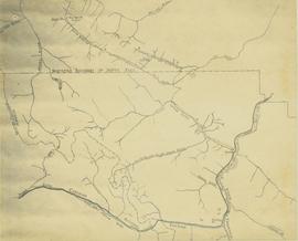
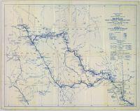
File consists of notes, clippings, and reproductions relating to Quesnel, Barkerville, and Wells. Includes: "An Historic Walk of Carson Avenue, Quesnel, B.C". pamphlet prepared by the Quesnel Branch Cariboo Historical Society (1990); "Wells, B.C". pamphlet by the Wells Historical Society (1980); "Cottonwood House Provincial Historic Park" pamphlet by the Province of British Columbia (1980); and vol. 1 of the Cariboo Gazette newspaper (2002). Also includes a map depicting Bowron Lake Park in British Columbia (1968).