Showing 46 results
Archival description
Pre-Emptor’s Map, Stuart Lake Sheet
Plan showing provincial government property in the subdivision of Lots 933 & 934, Group 1, Cariboo District, South Fort George, British Columbia, to be offer for sale at public auction
Plan showing provincial government property in the subdivision of Lots 933 & 934, Group 1, Cariboo District, South Fort George, British Columbia, to be offer for sale at public auction

Pre-Emptor’s Map, Fort George Sheet
Limits of Principal Trees in British Columbia
Limits of Principal Trees in British Columbia
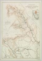
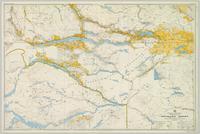
Topographical Sketch Map of Omineca and Finlay River Basins, British Columbia
Northern British Columbia
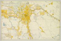
Forest Stand Types in British Columbia
Forest Stand Types in British Columbia
Union Steamship Company of British Columbia Map No. 2 Northern Run
Union Steamship Company of British Columbia Map No. 2 Northern Run
Taseko River Area, Lillooet District, British Columbia
Taseko River Area, Lillooet District, British Columbia

Pre-Emptor’s Map, Tête Jaune Sheet

Pre-Emptor’s Map, Fort George Sheet
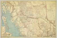
Commercial Map of British Columbia
Commercial Map of British Columbia

Pre-Emptor’s Map, Stuart Lake Sheet

Preliminary Map, Grenville Channel
Zymoetz River Area, Coast District, British Columbia
Zymoetz River Area, Coast District, British Columbia
Eutsuk Lake Area, Coast District, British Columbia
Eutsuk Lake Area, Coast District, British Columbia

Pre-Emptor’s Map, Nechako Sheet

Pre-Emptor’s Map, Peace River Sheet

Stikine River, Preliminary Map

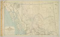
Pre-Emptor’s Map, Prince Rupert Sheet

Pre-Emptor’s Map, Tête Jaune Sheet
Northern British Columbia
Stikine River Area, Cassiar District, British Columbia
Stikine River Area, Cassiar District, British Columbia
Bulkley Sheet

Stuart Lake Sheet
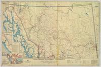
Central British Columbia
Nechako Sheet
Trans-Canadian Alaska Railway Survey: Plan showing progress of survey parties
Trans-Canadian Alaska Railway Survey: Plan showing progress of survey parties
Trans-Canadian Alaska Railway Proposed Route
Trans-Canadian Alaska Railway Proposed Route
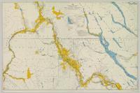
Fort George

Peace River
Physiographic Subdivisions of the Canadian Cordillera North of the Fifty-Fifth Parallel
Physiographic Subdivisions of the Canadian Cordillera North of the Fifty-Fifth Parallel
Fort George
Cassiar District mining claims
Cassiar District mining claims
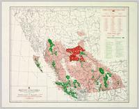
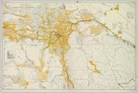
Status of Sustained-Yield Forestry Programme
Northern BC Cartographic Collection
Northern BC Cartographic Collection
Maps
Maps
Proposed Alaska-Canada Rail Corridor: Showing utilities and pipelines
Proposed Alaska-Canada Rail Corridor: Showing utilities and pipelines
Powder King Ski Lodge, Building Section Details, 4 of 7
Powder King Ski Lodge, Building Section Details, 4 of 7
Powder King Ski Lodge, Elevations, 2 of 7
Powder King Ski Lodge, Elevations, 2 of 7
Powder King Ski Lodge, Floor Plans, 1 of 7
Powder King Ski Lodge, Floor Plans, 1 of 7
Powder King Ski Lodge, Millwork Details, 6 of 7
Powder King Ski Lodge, Millwork Details, 6 of 7
Williams Creek Mining Map
Williams Creek Mining Map
Powder King Ski Lodge, Roof Plan, 7 of 7
Powder King Ski Lodge, Roof Plan, 7 of 7
Powder King Ski Lodge, Building Section, 3 of 7
Powder King Ski Lodge, Building Section, 3 of 7
Powder King Ski Lodge, Reflected Ceiling Plan, Window Schedule, Door Schedule, Room Finish Schedule, 5 of 7
Powder King Ski Lodge, Reflected Ceiling Plan, Window Schedule, Door Schedule, Room Finish Schedule, 5 of 7