Showing 7 results
Archival description
Alaska Trip, August 1985
Alaska Trip, August 1985
Archdeacon W. H. Collison fonds
Archdeacon W. H. Collison fonds
Cartographic Materials Series
Cartographic Materials Series
Jill Singleton Collection
Jill Singleton Collection
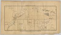
Map showing locations of placer streams in British Columbia south of latitude 54 degrees North, with Queen Charlotte Islands inset in north east corner
Map showing locations of placer streams in British Columbia south of latitude 54 degrees North, with Queen Charlotte Islands inset in north east corner

