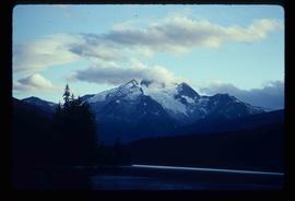
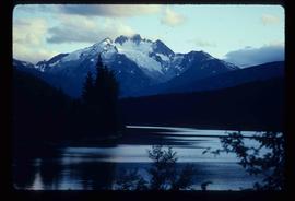
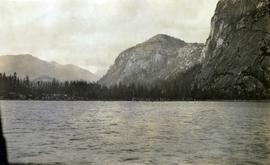
Image depicts the north aspect of Oscar Peak overlooking Lava Lake in the Nass Valley.
Image depicts the north aspect of Oscar Peak overlooking Lava Lake in the Nass Valley.
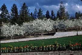
Slide depicts a row of red and yellow tulips in front of a row of blossoming cherry trees. Original slide index description: "Tulips & Chery Blossoms Ok. Mission."
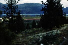
Slide depicts orchards surrounding Mount Boucherie. The Okanagan Lake and mountains can be seen in the background. Original slide index description: "Orchards & sunflowers from Mt. Boucherie."
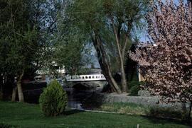
Slide depicts the park entranceway to Kelowna on the East side of the Okanagan Lake Bridge. Original slide index description: "Park entrance to Kelowna."
Item is a hand drawn and coloured map by the City of Prince George Planning Department depicting Hart Highway neighbourhood area existing land use in 1976.
Zonder titelFile consists of the following materials:
- Letter to Vernon C. Brink from the National Archives of Canada re: Knox McCusker holdings (March 1, 1999)
- Photocopy of article: "Living Landscapes: Exploring the wilds of northeaster BC" by Ross Peck and Brian Apland
- Some materials for an article on Knox McCusker, D.L.S.
- Material about the life of Knox Freeman McCusker
- Letter to Mrs. Rutherford (Oct. 5, 1999) re: access to interview of Knox McCusker by Frank Willis
- Accession information print-out re: interview of Knox McCusker by Frank Willis in 1954
- National Archives of Canada accession information print-out re: Dominion Land Surveyor Diaries, 1881-1930
- Mary Henry / Knox McCusker "Team" (April 19, 1998)
- Letter to Mrs. Rutherford from George Ungar re: background information on Knox McCusker
File consists of the following articles and speeches written by Knox McCusker:
- "Reminiscences of Knox McCusker" (63 typewritten pages)
- "Back and Beyond the Peace" by K.McCusker (taken from the Toronto Star Weekly Saturday May 5, 1928) – retyped
- "The Alaska Highway" by Knox F. McCusker, D.L.S. (The Canadian Surveyor, July 1943)-photocopy
- Mr. McCusker's speech (5 pages)
- “Tropical Valleys of B.C.” (4 pages)
- "The president has called me an old old surveyor…" speech written by K. McCusker
- "In the early days of my career in the Surveying profession…" written by K. McCusker
File consists of the following items:
- "Mac" by D.L. Surveyor
- "Knox (Mac) McCusker: Dominion Land Surveyor" by E.L. Rutherford, V.C. Brink, R.S. Silver and M.Z. (Smokey) Neighbour
- Excerpts from Men and Meridians by Don W. Thomson
- Article re: Knox McCusker written on the occasion of his death (April 14, 1955)
- "McKusker (sic) to open up Blueberry Mountain Area" (Alaska Highway News, June 8, 1950)
- "McCusker was surveyor, big game guide….also rancher and trail blazer"
- "Knox Freeman McCusker" written on the occasion of his death (The Canadian Surveyor, July 1955)
- "Veteran Surveyor - Alaska Highway Stories"
- Memories of Knox McCusker by his oldest niece Betty (McCusker) Rutherford
- "Veteran Surveyor prefers horses for long bush treks" by Eric Young (Edmonton Journal)
- Eulogy for Knox McCusker read by Stanley D. Seif at Burch Presbyterian Church in Fort St. John, B.C.
- Eulogy for Gwendolyn Dorothy McCusker (July 1997)
- "Tropical Valley No Myth: amazing story of woman who lived there" by Thomas A. Wayling (Vancouver Sun)
- Photocopy of section of map: "Topographical sketch map showing route traversed by the Bedaux Sub-Arctic Expedition 1934 through the Rocky Mountains" (by Frank Swannell, March 27, 1935)
- Memories of Knox McCusker by Bill McCusker, his oldest nephew
- "There is always a reason; destiny made it a date. The corridor of the Alcan didn’t just happen" (Fort St. John publication)
- Article on Knox McCusker (ALS News, Winter 1983)
File consists of photocopies of various report front covers and references to Knox McCusker from 1926-1931.
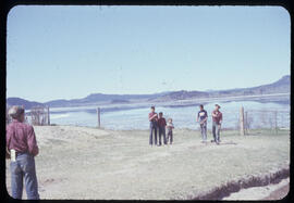
Photograph depicts a game of horseshoes in foreground. Fence crosses midground in front of water, and hills can be seen on opposite shore in background. Handwritten annotation on recto of mounted slide reads: "Playing horse [shoes?] in Legac".
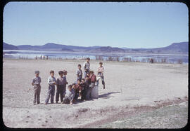
Group stands in foreground on what appears to be a wooden teeter totter. Fence crosses midground in front of water, and hills can be seen on opposite shore in background. Handwritten annotation on recto of mounted slide reads: "play ground in Legak [sic]".
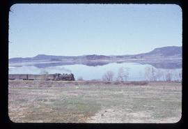
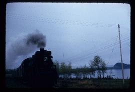
Photograph depicts the engine and first two cars of a railway train in left foreground. Water crosses midground, hills stand on opposite shore in background. Handwritten annotation on recto of mounted slide reads: "Lejak [sic] & Fraser Lake in [?]" See also item 2006.20.1.196 for image featuring similar content.
Front view of railway train. Fraser Lake believed to be visible in background, behind power lines. Handwritten annotation on recto of mounted slide reads: "Train coming to Lejak [sic]" See also item 2006.20.1.195 for image featuring similar content.
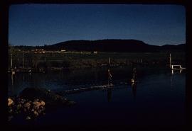
Photograph depicts two boys standing on platform extending into lake. Buildings and fenced areas can be seen on shore in background. Handwritten annotation on recto of mounted slide reads: "boys playing on the lake / Legac".
Photograph depicts a view of St'a7mes village looking north, taken from the original Government Wharf in Squamish (Newport). This wharf was built in 1902 and was temporarily replaced by other docks to the west built by the PGE Railway in 1913-14. This photograph was taken after 1914, since the houses in the photo were built by the PGE Railway Company as part of the 1914 reserves sale deal.
Further details that date this photograph between late 1914 and 1920:
- the Merrill & Ring logging operation beach camp is not depicted (opened in 1926)
- the dock from which the photo is taken fell into disrepair after 1914 and was not rebuilt until 1929.
Drawing depicts visual notes taken at the 2020 Public Health Summer Institute with the theme "Think Globally, Act Locally: Public Health and the Anthropocene". Themes related to the COVID-19 pandemic are depicted.
This map is the May 2008 amendment (Bylaw 8061) of the Schedule C of the 2001 Official Community Plan, Bylaw No. 7281 for the City of Prince George. This Schedule C map shows the long range land use for the City of Prince George.
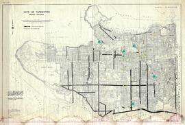
This municipal map of the City of Vancouver from 1987 shows street names and street widening information.
This map is the October 2006 amendment (Bylaw 7807) of the Schedule C of the 2001 Official Community Plan, Bylaw No. 7281 for the City of Prince George. This Schedule C map shows the long range land use for the City of Prince George.
This map is Schedule C of the 2001 Official Community Plan, Bylaw No. 7281 for the City of Prince George. This Schedule C map shows the long range land use for the City of Prince George.
This map is the May 2006 amendment (Bylaw 7807) of the Schedule C of the 2001 Official Community Plan, Bylaw No. 7281 for the City of Prince George. This Schedule C map shows the long range land use for the City of Prince George.
This street map of the VLA area in Prince George includes property outlines and street numbers.
This map is part of Schedule B of the 1993 Official Community Plan, Bylaw No. 5909 for the City of Prince George. This particular map reflects the 1998 amendment to the Official Community Plan.
This map is the Schedule A accompanying map for the City of Prince George's Soil Removal and Deposit Bylaw No. 7022 of 1999. It depicts designated soil removal areas and M.O.T.H. gravel reserves.
This map depicts the City of Prince George's plan for soil removal and deposit.
This map is part of Schedule B of the 1993 Official Community Plan, Bylaw No. 5909 for the City of Prince George. This particular map reflects the 1998 amendment to the Official Community Plan.
This map is part of Schedule B of the 1993 Official Community Plan, Bylaw No. 5909 for the City of Prince George. This particular map depicts the east area of the City of Prince George, including the Prince George Airport (YXS) and the Blackburn area.
This map is part of Schedule B of the 1993 Official Community Plan, Bylaw No. 5909 for the City of Prince George. This particular map depicts the southwest area of the City of Prince George, including College Heights, UNBC, University Heights, and Vanway.
This map is part of Schedule B of the 1993 Official Community Plan, Bylaw No. 5909 for the City of Prince George. This particular map depicts the northwest area of the City of Prince George, including the North Nechako neighbourhood and the Hart.
This map is part of Schedule B of the 1993 Official Community Plan, Bylaw No. 5909 for the City of Prince George. This particular map depicts the central area of the City of Prince George, including the Bowl area, the VLA, the Crescents, South Fort George, Heritage, and Peden Hill.
This map is part of Schedule B of the 1993 Official Community Plan, Bylaw No. 5909 for the City of Prince George. This particular map depicts the northeast area of the City of Prince George, including the industrial areas on Prince George Pulpmill Road and Northwood Pulpmill Road along the Fraser River.
Item is Map 5 of a group of five maps relating to a City of Prince George Study of Construction Aggregates by the firm Willis, Cunliffe, Tair & Company Limited. Map 5 shows drill hole locations.
Item is Map 1 of a group of five maps relating to a City of Prince George Study of Construction Aggregates by the firm Willis, Cunliffe, Tair & Company Limited. Map 1 shows development areas and population for 1984 and 1994. As the map is undated, it is unclear whether the 1984 and 1994 dates are future estimates.
Item is Map 2 of a group of five maps relating to a City of Prince George Study of Construction Aggregates by the firm Willis, Cunliffe, Tair & Company Limited. Map 2 shows development areas and aggregate requirements for 1984 and 1994. As the map is undated, it is unclear whether the 1984 and 1994 dates are future estimates.
Item is Map 3 of a group of five maps relating to a City of Prince George Study of Construction Aggregates by the firm Willis, Cunliffe, Tair & Company Limited. Map 3 shows geology of the Prince George area and known sources of construction aggregates.
Item is Map 4 of a group of five maps relating to a City of Prince George Study of Construction Aggregates by the firm Willis, Cunliffe, Tair & Company Limited. Map 4 shows development areas, aggregate sources, and requirements for 1984 and 1994. As the map is undated, it is unclear whether the 1984 and 1994 dates are future estimates.
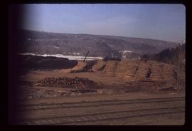
Image depicts numerous wood piles near the sawmill somewhere in Quesnel, B.C.
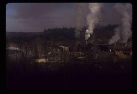
Image depicts a sawmill somewhere in Quesnel, B.C.
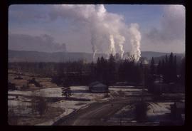
Image depicts a sawmill somewhere in Quesnel, B.C.
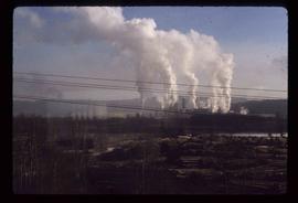
Image depicts a sawmill somewhere in Quesnel, B.C.
Item is the Proposed Land Use Map, 1978-2012, referred to in By-law No. 3138, the City of Prince George Official Community Plan. The original draft of this map was completed on October 24, 1977. This version of the map was amended in July 1982.
Item is a map depicting proposed land use between 1978 and 2012 in the City of Prince George. This map was drawn for the City of Prince George Community Plan; this particular version of the map was displayed in City of Prince George council chambers through 1979.
Item is a map depicting land use in the Vancouver Carney study neighbourhood area in Prince George. Also includes two mylar overlays that show the outlines of "unit 2" and "unit 3" development areas.
Item is a map depicting the Vancouver Carney study neighbourhood area in Prince George.
Item is a map depicting the areas of winter shadow in the Peden Hill neighbourhood in Prince George.
Item is a map depicting the areas of spring and fall shadow in the Peden Hill neighbourhood in Prince George.
Item is a map depicting a future high density development plan for the Peden Hill neighbourhood in Prince George.
Item is a map depicting a future medium density development plan for the Peden Hill neighbourhood in Prince George.
Item is a map depicting a future low density development plan for the Peden Hill neighbourhood in Prince George.


![City of Prince George - Schedule C of the Official Community Plan - Long Range Land Use Map [May 2008 Amendment]](/uploads/r/northern-bc-archives-special-collections-1/4/3/a/43a9e75941f1542735d999de340307d163e79dffdadbf4546bb9346b63f7e734/2023.5.1.41_-_2008_May_-_City_of_Prince_George_Long_Range_Land_Use_Map_JPG85_tb_142.jpg)
![City of Prince George - Schedule C of the Official Community Plan - Long Range Land Use Map [October 2006 Amendment]](/uploads/r/northern-bc-archives-special-collections-1/6/d/6/6d643c10801eba2ac493689972e57429dba42ec7592f54cb55151b96362d7048/2023.5.1.40_-_2006_Oct_-_City_of_Prince_George_Long_Range_Land_Use_Map_JGP85_tb_142.jpg)

![City of Prince George - Schedule C of the Official Community Plan - Long Range Land Use Map [May 2006 Amendment]](/uploads/r/northern-bc-archives-special-collections-1/6/5/5/65536bc04aa97580c140131651dc357dfe5c3a1315822394f388d96940bc39cb/2023.5.1.39_-_2006_May_-_City_of_Prince_George_Long_Range_Land_Use_Map_JPG85_tb_142.jpg)

![City of Prince George - Schedule B of the Official Community Plan, Bylaw No. 5909 [2001 Amendment]](/uploads/r/northern-bc-archives-special-collections-1/c/3/6/c36392b90696286cc6281e8cc2efbf7691c2617726495fa28db2cbdcc20e4e4c/2023.5.1.36_-_Official_Community_Plan_City_of_PG_Schedule_B_2001_JPG85_tb_142.jpg)


![City of Prince George - Schedule B of the Official Community Plan, Bylaw No. 5909 [1998 Amendment]](/uploads/r/northern-bc-archives-special-collections-1/d/6/d/d6d1c4e7e37fc948b97b3caa36447b52f7d2b76b13d45e3710aefee7b13840f0/2023.5.1.33_-_1998_Official_Community_Plan_City_of_PG_JPG85_tb_142.jpg)


![Proposed Land Use 1978-2012, Official Community Plan, City of Prince George [1982 Amendment]](/uploads/r/northern-bc-archives-special-collections-1/6/6/9/669fc9dc3b840a6896f6a2a968a948283a3c5d972b6b48d718b427a57ebbe67f/2023.5.1.22_-_1982_-_Proposed_Land_Use_1982-2012_JPG85_tb_142.jpg)
![Proposed Land Use 1978-2012, Official Community Plan, City of Prince George [1979 Amendment]](/uploads/r/northern-bc-archives-special-collections-1/c/e/d/ced2c18ae074ee79ace57d0454f038b5e09774ff682567e053093476af37c166/2023.5.1.14_-_1979_-_1978-2012_Official_Community_Plan_City_of_Prince_George_JPG85_tb_142.jpg)
![Vancouver Carney Study [Existing Land Use]](/uploads/r/northern-bc-archives-special-collections-1/d/8/4/d841cd29016ddb96663d51e137bd7a3b7c4dfe3ec645baca199615e3e4464da3/2023.5.1.21a_-_Vancouver_and_Carney_Study_Area_Existing_Land_Use_JPG85_tb_142.jpg)


