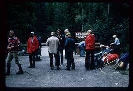
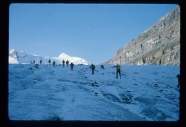
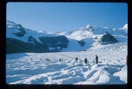
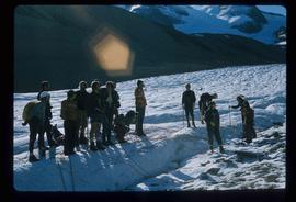
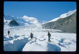
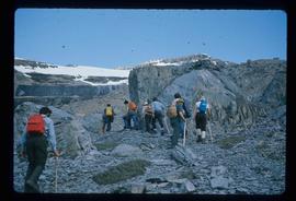
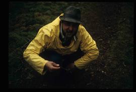
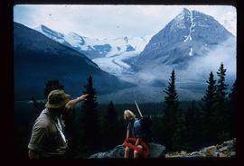
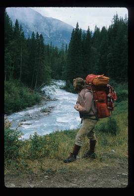
Image depicts a man on the hiking trail near Mt. Robson, with a river in the background; it is possibly the Robson River.
Image depicts a marker for aerial photography at an uncertain location. The slide labels it as "Elizabeth Station."
File consists of notes, clippings, and reproductions relating to the Alexander Mackenzie monument in Prince George. Includes a photograph depicting Judge Howay at the unveiling of the original National Historic Monument to Alexander Mackenzie in Prince George on 13 June 1925 (reproduced 2009).
File consists of notes, clippings, and reproductions relating to the new Alexander Mackenzie monument in Fort George Park (renamed Lheidli T'enneh Memorial Park). Includes: "British Columbia Heritage Brigade Journey" pamphlet from Parks Canada and Canoe Sport B.C. (1985); "Alexander Mackenzie Trail Association" newsletter No. 9 (1987); "Alexander Mackenzie Voyageur Association" newsletter No. 36 (1994); and correspondence letters between John D. Adams, Supervisor of Interpretation and Heritage Site operations for the Province of British Columbia and Kent Sedgwick (Apr.- May 1986). Also includes photographs depicting the new Alexander Mackenzie monument and people at the unveiling (1985).
File consists of notes, letters, and reproductions relating to the "Arrival of Steel" CN Railway plaque in Prince George. Includes: "Invitation" from the City of Prince George for the unveiling of the CN plaque (27 Jan. 1989) and correspondence letters between CN and the City of Prince George (1987-1989). Also includes photographs depicting the CN plaque and the unveiling ceremony (Jan. 1989).
Image depicts Sue and Kent Sedgwick with two dogs, standing with the Bear Glacier in the background.
Image depicts Sue Sedgwick with a dog, standing with the Bear Glacier in the background.
Image depicts a campsite somewhere near Berg Lake.
Image depicts a group of individuals at camp somewhere in Mt. Robson Provincial Park.
Image depicts a camp and what is likely Mt. Robson in the background.
Image depicts a camp of people with Mt. Robson and the Berg Glacier in the background.
File consists of notes, clippings, and reproductions relating to the Cariboo region of British Columbia. Includes: "Walking Tour of Historic Clinton" pamphlet prepared by Clinton Museum Society and Clinton & District Chamber of Commerce (1980); "Central Cariboo British Columbia, Canada" pamphlet approved by Tourism British Columbia (2010); and "Cariboo field trip" duotang with typescript notes (1978). Also includes photographs depicting Quesnel Forks, British Columbia (2010).
Image depicts an individual crouching in an old cemetery located somewhere in the coastal forest on Haida Gwaii, B.C.
Image depicts a group of hikers hiking towards what is possibly the Chilcotin River.
Image depicts a climbing either up or down a rock face.
Image depicts a group of unidentified individuals walking along a crevasse filled ridge somewhere in the vicinity of Smithers, B.C. The slide also labels it as a "drift ridge."
Image depicts an unknown individual and a dog on a bridge over what is possibly the Robson River.
File consists of notes and reproductions relating to the Duke of Sutherland. Also includes photographs depicting the area of White's Landing in Strathnaver (2010).
Subseries includes material collected by Kent Sedgwick regarding the Duke of Sutherland. The Duke of Sutherland is a title in the Peerage of the United Kingdom. The fourth Duke of Sutherland was Cromartie Sutherland-Leveson-Gower who lived from 1851 to 27 June 1913. Toward the end of his life, the 4th Duke began moving his wealth and life to Canada. The Duke owned land across British Columbia and Alberta and contributed to various settlements, including Strathnaver, BC; Windermere, BC; Brooks, AB; and Clyde, AB. The Duke of Sutherland owned the Sutherland Land Company, creating and selling plots in BC and Alberta. He also worked closely with the Canadian Pacific Railway to support immigration and settlement of the area.
Image depicts a large number of felled trees, and an unknown individual standing on the path.
Image depicts five unknown individuals somewhere near Mt. Robson.
File consists of notes and reproductions relating to Fort Alexandria (later renamed Alexandria). Fort Alexandria was an HBC trading post, ferry site, and steamboat landing in the North Cariboo, 45 km south of Quesnel. File contains photographs depicting Fort Chilcotin, the landscape and buildings (Sept. 1983 and Aug. 2006).
File consists of notes, clippings, and reproductions relating to the Fort George Canyon. Includes: "City of Prince George" typescript letter from Kent Sedgwick to Mr. Ron Drane, Manager of Pine Centre (7 June 1984) and "Fort George Canyon Hiking Trail" pamphlet published by the Fraser-Fort George Regional Museum (July 1984). Also includes photographs depicting the Fort George Canyon and men hiking the trail (1985).
Image depicts four unknown individuals studying a plant.
Subseries consists of materials collected and created by Kent Sedgwick for research regarding fur trade history in British Columbia. Includes histories of the Hudson's Bay Company; historic trails utilized for fur trade; fur trade by the North West Company in the interior of British Columbia; Simon Fraser, a Canadian explorer and fur trader with the North West Company; and David Thompson, a surveyor, cartographer, and fur trader with the Hudson's Bay Company.
File consists of notes and reproductions relating to George Dawson and the Geological Survey of Canada. Includes: "Museum Mirror" Fraser-Fort George Regional Museum newsletter vol. 1 no. 2 (June 1986). File also includes photographs depicting various sights around British Columbia from George Dawson's explorations (1983 reproduced).
File consists of notes, clippings, and reproductions relating to the gold rush in Quesnel and Likely, British Columbia. Includes: "Guide to the Goldfields: Cariboo Country" newspaper edition (1998); "Cariboo, Chilcotin Coast, Likely" brochure published by Likely & District Chamber of Commerce [199-]; "The UNBC Quesnel Rover Research Centre" pamphlet published by the University of Northern British Columbia (2002); "New Nugget Restaurant" paper placemat (1972); and "Likely" brochure from the Likely Chamber of Commerce [198-]. Also includes photographs depicting a camping trip in Likely, British Columbia (2010).
Image depicts a group of people standing near a river. A glacier is visible in the background.
Image depicts a group of hikers listening to a man, possibly a guide, speak. The location is possibly near Riske Creek, B.C.
Image depicts a group of people hiking, possibly somewhere near Riske Creek, B.C.
Image depicts a group of hikers standing on a slope.
Image depicts a group of people hiking up a mountain side, possibly Mt. Robson.
Image depicts a large group of individuals preparing to hike up Mt. Robson.
Image depicts a group of people hiking up a glacier, possibly the Robson Glacier.
Image depicts a group of people hiking on a glacier, possibly the Robson Glacier.
Image depicts a group of people hiking through trees somewhere in Mt. Robson Provincial Park.
Image depicts a group of hikers hiking up a slope.
Image depicts an unidentified individual drilling into the ice.
Image depicts Kent Sedgwick speaking to a group of hikers.
Image depicts Kent Sedgwick crouching and holding a stick; the slug on the end is barely visible. Located somewhere on Haida Gwaii.
Image depicts Kent Sedgwick pointing out what is possibly the Robson Glacier in the background. Another, unknown individual is also present in the image.
Image depicts Kent Sedgwick smoking a pipe at camp, with two other unknown individuals nearby.
Image depicts Kent Sedgwick standing in a forest somewhere on Haida Gwaii.
File consists of notes and reproductions relating to land exploration and surveying in British Columbia by Alfred R.C. Selwyn, who was a British geologist and public servant, director of the Geological Survey of Victoria from 1852 to 1869, director of the Geological Survey of Canada from 1869 to 1894, and President of the Royal Society of Canada from 1895 to 1896. Includes: "Photography: Mirror of the Past" American History magazine special edition (Sept. 1989) and a photocopied article "Ninety Years Later" by F.C. Swannell from The Beaver magazine (1956). File also includes reproduced photographs depicting scenes from Selwyn's exploration around British Columbia (1989).
File consists of notes and reproductions relating to Luther Collins Gunn and L.C. Gunn Park. Luther Colins Gunn was a survey engineer who had done work for the Grand Trunk Pacific Railway and the Pacific Great Eastern Railway when he arrived in Prince George. The L.C. Gunn trail follows the same route used by Gunn when surveying the rail routes in the Prince George area. Includes: "Gunn Point" typescript document by Ted Williams for the Heritage Advisory Committee (1985); "A Proposal - The L.C. Gunn Viewpoint" typescript letter to Mr. Mac Norris, president of the B.C.R. Company from Ted Williams and the Heritage Advisory Committee (27 Jan. 1987); and "Item of business, proposed use of District Lot # 486" typescript letter from the Heritage Advisory Committee to Beverley Pitman, Planning Assistant (31 May 1979). Also includes photographs depicting the Moffat farm (2005).