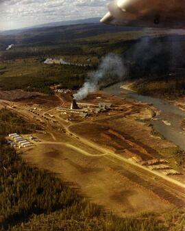
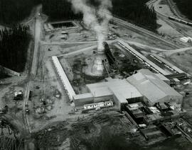
The photograph depicts an ariel view of the Anzac Sawmill. The sawmill is next to the Anzac River. Mutiple stacks of lumber are next to the mill. Seven mobile homes are on the outskirts of the mill. Annotations on reverse side of the photograph state, "The Pas Lumber Co. Ltd, Anzac Sawmill, Anzac, BC. early '70's"
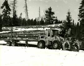
The photograph depicts a Mooney Brothers logging truck and loader in a snowy area. There is a man walking next to the truck approaching the loader. Annotations on reverse side of the photograph state, "March 73. Crooked River Logging near Davie Lake, B.C. Mooney Brothers truck + loader, early '70's"
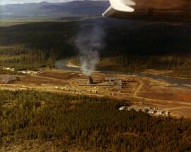
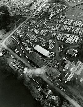
The photograph depicts an ariel view of the Anzac Sawmill along the Anzac River. A train and multiple living residences can be seen on the outskirts of the mill. Annotation on reverse side of the photograph state, "The Pas Lumber Co. Ltd. Anzac Sawmill, Anzas Siding, B.C. early 1970's"
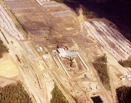
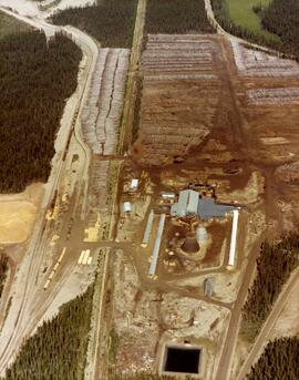
The photograph depicts an ariel view of the Hart Sawmill at Bear Lake, B.C. Multiple lumber stacks and a train can be seen. Annotation on reverse side of the photograph state, "The Pas Lumber Co. Ltd. Hart Sawmill, Bear Lake, B.C. mid 1970's"
The photograph depicts an ariel view of the Hart Sawmill at Bear Lake, B.C. Annotation on reverse side of the photograph state, "The Pas Lumber Co. Ltd. Hart Sawmill, Bear Lake, B.C. mid 1970's"
The photograph depicts an ariel view of the Hart Sawmill at Bear Lake, B.C. Multiple lumber stacks and a train can be seen. Annotation on reverse side of the photograph state, "The Pas Lumber Co. Ltd. Hart Sawmill, Bear Lake, B.C. mid 1970's"
The photograph depicts an ariel view of planer operations at The Pas Company Planer Mill in Prince George, B.C. Multiple stacks of lumber, a train and multiple cars can be seen. Annotation on reverse side of the photograph state, "Doug Weller, Apr. 1974, The Pas Lumber Company Ltd Planer Operations River Road - April 1974"
File contains set of images taken in Faro, Y.T. Annotation on photo envelope reads: “Visit to / CYPRUS ANVIL / FARO Y.T. / SEPT 1975 / BY DALE CARIN / R. WILSON.” Images depict the pit mine operated by Cyprus Anvil Corporation, including a grader, ore hauling truck (likely a Wabco), an explosives transport truck, and unidentified equipment including an electrical utility box and some type of rotating wheel in the mill building.
The file contains photographs originally found in an unmarked and undated black binder depicting colour-coded mill equipment and machinery. Several of these images are annotated “Bell”, “Bell Asbestos”, and “National”. It is speculated that these images originate from the underground asbestos mine in Thetford Mines, Quebec operated by Bell Asbestos Mines Ltd. and the National Mine in Quebec. One image appears to be, or looks similar to the new mill at Cassiar, built in 1971.
File contains photographs annotated Nordenham, presumably indicating that these images were taken in the Asbestos Corporation's plant in Nordenham Germany. The images depict bagging machinery in the mill, including a palletizer, automatic sewing machine, packer, shrinkwrap machine, glue applicator and cement bags. Some of the images include detailed annotations.
This file contains photograph from early construction of Cassiar Mine and townsite. Photographs were stapled to inter-office correspondence paper and sent with pages of photo descriptions. Photographs have been removed and rehoused, maintaining original order.
Photograph depicts men on power house scaffolding, mountains in background. Corresponding note on accompanying photo description page: "Pictures taken July 2nd, 1952. 2. Power House. Looking West."
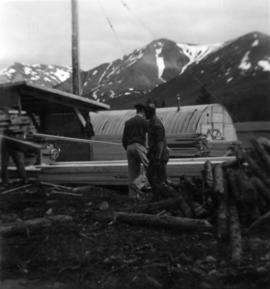
Photograph depicts two men in plant site, mountains in background. Corresponding note on accompanying photo description page: "Pictures taken July 3rd, 1952. 3. Quonset warehouse in background. Temporary set-up for circular saw in foreground."
Corresponding note on accompanying photo description page: "Pictures taken July 3rd, 1952. 4. Putting on roof of Power House in foreground. Temporary Camp & Service garage in background. Taken from top of water tower and looking east."
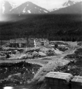
Photograph depicts mill building under construction, mountains in background. Corresponding note on accompanying photo description page: "Pictures taken July 3rd, 1952. 5. Mill. Truck Dump and concrete mixers in foreground. Taken from top of water tower and looking south."
Photograph depicts men working on buildings under construction, mountains in background. Corresponding note on accompanying photo description page: "Pictures taken July 3rd, 1952. 6. Truck Dump foreground. Power House background. Looking north."
Corresponding note on accompanying photo description page: "Pictures taken July 5th, 1952. 7. Tentsite. Looking east."
Photograph depicts small building built into dirt landscape, mountains in background. Corresponding note on accompanying photo description page: "Pictures taken July 5th, 1952. 8. Root House. Looking north."
Photograph depicts building materials and men working in plant site, mountains in background. Corresponding note on accompanying photo description page: "Pictures taken July 5th, 1952. 9. Power house. On the right is location for sub-station. Truck dump in foreground. Looking north."
Photograph depicts building materials in framework room. Corresponding note on accompanying photo description page: "Pictures taken July 5th, 1952. 10. Mill. Second floor. Looking south."
Photograph depicts man in distance on scaffolding. Corresponding note on accompanying photo description page: "Pictures taken July 5th, 1952. 11. Mill construction. Looking west."
Photograph depicts buildings in plant site, mountains in background. Corresponding note on accompanying photo description page: "Pictures taken July 5th, 1952. 12. Mill, Power House & Water Tank."
Photograph depicts power house under construction. Temporary camp, service garage, and mountains in background. It is believed that this photograph was taken from top of the plant water tower.
Photograph depicts power house under construction. Temporary camp, service garage, and mountains in background. It is believed that this photograph was taken from top of the plant water tower.
Photograph depicts men working on truck dump construction, mountains in background.
Photograph depicts men working on truck dump construction, mountains in background.
Photograph depicts interior framework of building under construction, speculated to be mill building.
Photograph depicts two men on upper floor of building under construction, speculated to be mill building.
Photograph depicts two men on upper floor of building under construction, speculated to be mill building.
Photograph depicts interior framework of building under construction, mountains in background.
Photograph depicts mill building under construction, mountains in background. Photograph is speculated to be taken from top of water tower.
Photograph depicts mill in distance, mountains in background, rocks in foreground. Corresponding note on accompanying photo description page: "Pictures taken June 11th: (1) Erecting timber in mill construction. Tractor in foreground. Looking west."
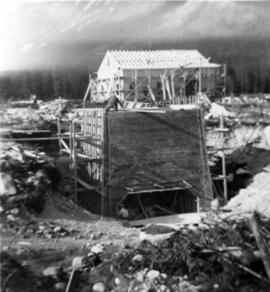
Photograph depicts building materials and men working in construction area on plant site. Corresponding note on accompanying photo description page: "Pictures taken June 11th: (2) Walls for power house poured. Oil tank foundations in foreground and mill in background. Looking south."
Photograph depicts men building truck dump in foreground, building believed to be power house in background. Corresponding note on accompanying photo description page: "Pictures taken June 11th: (3) Framing water tank tower. Water well in foreground and tower timbers and oil tanks in background. Looking east." [Note believed to be incorrect.]
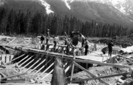
Photograph depicts men on mill scaffolding, mountains in background. Corresponding note on accompanying photo description page: "Pictures taken June 11th: (4) Mill construction. Looking north."
Corresponding note on accompanying photo description page: "Pictures taken June 11th: (5) Drilling big boulders in truck dump excavation. Looking north."
Photograph depicts mill framework in distance, mountains in background. Corresponding note on accompanying photo description page: "Pictures taken June 28th, 1952: (6) Mill construction. Looking west."
Photograph depicts men working on plant site, mountains in background. Corresponding note on accompanying photo description page: "Pictures taken June 28th, 1952: (7) Power house construction. Oil tanks in background. Looking west."
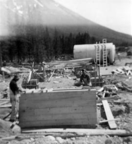
Photograph depicts water tower framework. Building materials, truck, and oil tanks in foreground; mountains in background. Corresponding note on accompanying photo description page: "Pictures taken June 28th, 1952: (8) Water tower erection. Looking northwest."
Photograph depicts men on plant site. Corresponding note on accompanying photo description page: "Pictures taken June 28th, 1952: (9) Truck dump with concrete poured in foreground. Power house in background. Looking north from mill."
Photograph depicts foundations and framework from interior of building. Corresponding note on accompanying photo description page: "Pictures taken June 28th, 1952: (10) Dryer foundations in mill."
Photograph depicts small building in plant site, mountains in background. Corresponding note on accompanying photo description page: "Pictures taken June 28th, 1952: (11) Commissary. Warehouse in background. Looking west. (Truck in background)."
Photograph depicts black dog and tractor tire in foreground, ladder resting on side of quonset building, mountain in background. Corresponding note on accompanying photo description page: "Pictures taken June 28th, 1952: (12) Erecting quonset from Utah Camp. Located south of 30 KW power plant. looking southwest from No. 1 bunkhouse."
Photograph depicts 9 men working on building speculated to be foundation for diesel engine. (See also items 2000.1.1.2.216 and 2000.1.1.2.217).
Photograph depicts 4 men working on building speculated to be foundation for diesel engine. Oil tanks and mountains in background.
Photograph depicts 7 men working on building speculated to be foundation for diesel engine. Oil tanks and mountains in background.
Photograph depicts two men working on early stages of building believed to be mill.
Photograph depicts early stages of building believed to be mill, piles of building supplies in foreground.
Photograph depicts early stages of building believed to be mill, mountains in background.
Photograph depicts 8 men working on top of unknown wooden structure, dog in foreground, mountain base in background. Corresponding note on accompanying photo description page: "1. Erecting 12"x12"s for mill walls. Looking west. Note boulders in foreground ready to be blasted to clear area."
