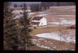
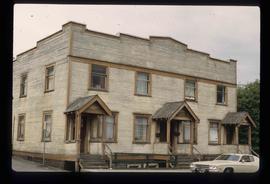
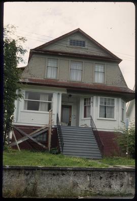
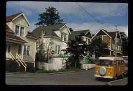
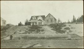
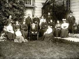
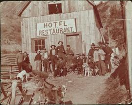
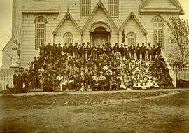
Affichage de 4327 résultats

Archival description
3211 résultats avec objets numériques Afficher les résultats avec des objets numériques
Manager's Progress Photographs
2000.1.1.2.01 · Dossier · [195-]
Fait partie de Cassiar Asbestos Corporation Ltd. fonds

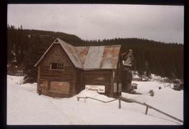
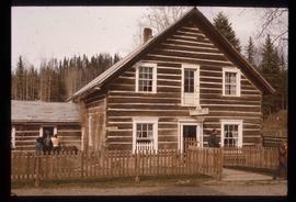
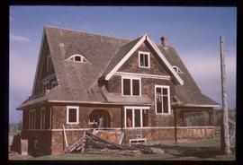
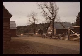
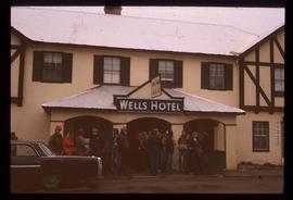
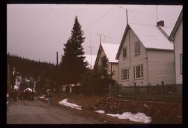
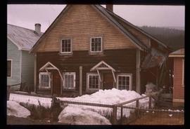
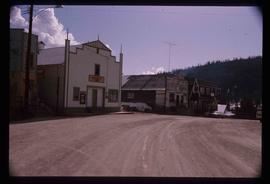
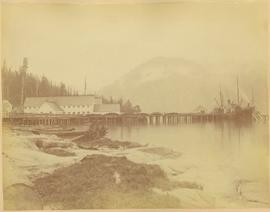
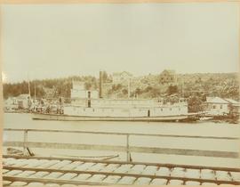
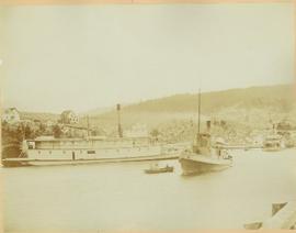
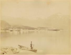
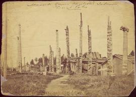
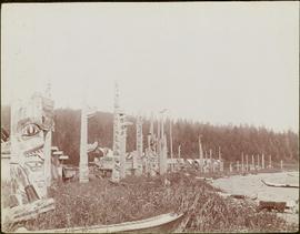
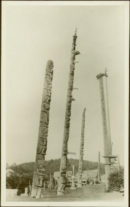
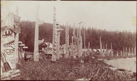
This file contains photograph from early construction of Cassiar Mine and townsite. Photographs were stapled to inter-office correspondence paper and sent with pages of photo descriptions. Photographs have been removed and rehoused, maintaining original order.

Wells Hotel
2012.13.1.37.46 · Pièce · [197-?]
Fait partie de J. Kent Sedgwick fonds

Image depicts a crowd of people outside the Wells Hotel in Wells, B.C.

Houses
2012.13.1.37.48 · Pièce · [197-?]
Fait partie de J. Kent Sedgwick fonds

Image depicts a row of houses in Wells, B.C.

Duplex
2012.13.1.37.49 · Pièce · [197-?]
Fait partie de J. Kent Sedgwick fonds

Image depicts a duplex in Wells, B.C.

A Street in Wells
2012.13.1.37.50 · Pièce · [197-?]
Fait partie de J. Kent Sedgwick fonds

Image depicts a street in Wells, B.C. The Sunset Theatre is located on the left of the image, and the Jack O' Clubs Hotel is the building with the green roof on the right. The hotel burned down on February 14th in 1994.

A House
2012.13.1.6.102 · Pièce · [198-?]
Fait partie de J. Kent Sedgwick fonds

Image depicts a house at an unknown location. It is possibly an old, Australian styled home.

Paul Aivazoff's Capitol Theatre
2012.13.1.6.278 · Pièce · [198-?]
Fait partie de J. Kent Sedgwick fonds

Image depicts an old theatre owned by Paul Aivazoff in Prince Rupert, B.C. It opened in 1935 and was closed in 1981; it has since been renovated for retail use.

Condominium
2012.13.1.6.279 · Pièce · [198-?]
Fait partie de J. Kent Sedgwick fonds

Image depicts a condominium, possibly in Prince Rupert, B.C.

A House
2012.13.1.6.282 · Pièce · [198-?]
Fait partie de J. Kent Sedgwick fonds

Image depicts a house which is possibly in Prince Rupert, B.C.

Row of Houses
2012.13.1.6.281 · Pièce · [198-?]
Fait partie de J. Kent Sedgwick fonds

Image depicts a row of houses; it is possibly in Prince Rupert, B.C.

Dining Lounge
2012.13.1.6.280 · Pièce · [198-?]
Fait partie de J. Kent Sedgwick fonds

Image depicts an old building with a sign labelling it as a "Dining Lounge," it is possibly in Prince Rupert, B.C.

Pineview
2012.13.1.3.144 · Pièce · [199-?]
Fait partie de J. Kent Sedgwick fonds

Image depicts Pineview on Buckhorn Lake Road, Prince George, B.C.

Pineview
2012.13.1.3.145 · Pièce · [199-?]
Fait partie de J. Kent Sedgwick fonds

Image depicts Pineview on Buckhorn Lake Road, Prince George, B.C.

Pineview
2012.13.1.3.146 · Pièce · [199-?]
Fait partie de J. Kent Sedgwick fonds

Image depicts Pineview on Buckhorn Lake Road, Prince George, B.C.

View of Wrangell, Alaska
2009.7.1.158 · Pièce · 1877
Fait partie de Archdeacon W. H. Collison fonds

Photograph depicts community buildings on shoreline, water in foreground.

Handwritten annotation on image reads: "Wrangle, Alaska."; on verso: "Fort Wrangle, Alaska Territory. visited by W.H.Collison, C.M.S. 1877. Prior to the establishment of any mission, [...? illegible] 1875 - 1876. Presbyterian. Insert this illustration of Wrangle on Page 77 as marked."

Shops along Shore at Port Essington, BC
2006.45.11 · Pièce · [ca. 1897]
Fait partie de Historical North Coast Photograph Album

Shops stand along riverside boardwalk. Storefront sign for R. Cunningham & Sons visible. Many people stand and sit on boardwalk, and canoes and small boats float in water in foreground.

Handwritten photo captions beside image read: "R. Cunningham & Sons - Probably Port Essington", "NW coast canoe".

View of Fort Wrangell, Alaska
2006.45.17 · Pièce · [ca. 1897]
Fait partie de Historical North Coast Photograph Album

View of town on shore, from above. Boats docked along piers and buildings. Hills visible on either side of water in background.

Handwritten photo captions with arrows pointing to sections of image read: "General Merchandise", "Fort Wrangell Hotel".

Historical North Coast Photograph Album
2006.45 · Fonds · [ca. 1897]

Contains photographs generally depicting landscapes, water scenes, and views of towns on British Columbia's north coast. Includes images featuring sternwheelers and other boats, canneries, fisheries, and individuals. Locations depicted include Port Essington and Port Simpson (Lax Kw’alaams) in BC, Fort Wrangell in Alaska, and other unknown towns. Includes one photograph of a man named Max Lohbrunner, and many other images depicting unidentified individuals.

Port Simpson, BC
2006.45.2 · Pièce · [ca. 1897]
Fait partie de Historical North Coast Photograph Album

Photograph depicts Port Simpson in winter. Water and shoreline in foreground, hill in distance.

Handwritten photo caption below image reads: "Port Simpson".

River Boats at Port Simpson, BC
2006.45.7 · Pièce · [ca. 1897]
Fait partie de Historical North Coast Photograph Album

Photograph depicts sternwheeler, smaller boat, and canoe in foreground. Second sternwheeler named the 'Caledonia' can be seen anchored to shore in background. Town buildings stand on hill in background. Photo believed to have been taken in Port Simpson, B.C.

2009.7.1.086 · Pièce · [1898?]
Fait partie de Archdeacon W. H. Collison fonds

Photograph depicts an unidentified individual leaning against a large overturned dugout canoe; barrel, bucket, and wood planks in foreground. Houses and other buildings can be seen on shore above beach, and two unidentified individuals stand in distance on far right.

Handwritten annotations on verso read: “Haida canoe on beach at Masset / ? 1898”; “No. 4 Page 5. Haida Canoe ready for steaming to [widen?] out and finish.”

An original negative of this photograph is held by the Canadian Museum of Civilization, no. 26664.

Pearl Street in Atlin, BC
2006.20.11.22 · Pièce · August 1899
Fait partie de Northern BC Archives Historical Photograph Collection

Photograph depicts buildings and signage on either side of dirt road. Unidentified man stands on far left, Atlin Lake and mountains can be seen in background.

Hand inscribed annotation on recto of photograph reads: “Pearl St., Atlin, B.C. Aug. 1899. A.C. Hirschfeld, No.74”.

Pearl Avenue in Atlin, BC
2006.20.11.23 · Pièce · [ca. 1899]
Fait partie de Northern BC Archives Historical Photograph Collection

Photograph depicts tent buildings on either side of dirt road. Unidentified men are visible on left, Atlin Lake and mountains can be seen in background.

Hand inscribed annotation on recto of photograph reads: “Pearl Av. looking towards Atlin Lake, Atlin, B.C., A.C. Hirschfeld, No. 174”

2009.7.1.037 · Pièce · [ca. 1900]
Fait partie de Archdeacon W. H. Collison fonds

Large group of women, men, and children pose on front steps of church. Some men standing in back hold brass instruments. Bishop Ridley (with long beard) sits in front centre between W.H. Collison (on right) and his son W.E. Collison. Photograph depicts the first church built in Metlakatla, which was burned in a fire in 1901, and replaced in 1903.

Handwritten annotation below image reads: "A gathering of Missionaries and Indians in front of Metlakahtla Church During Synod"; on verso: "[Ven?] Arch Collison & Mrs Collison".

2009.7.1.075 · Pièce · [ca. 1876 - ca. 1900]
Fait partie de Archdeacon W. H. Collison fonds

Handwritten annotation on verso of photograph reads: "W.E. Collison Masset. Interior of Chief [Weah's?] house".

Caption under printed version of photo in W.H. Collison's book 'In the Wake of the War Canoe': "The house is about 40 feet square, forming one large room. The upper cubicles are on a level with the ground, which in front of them is excavated so that the fireplace in the centre is twelve feet below the surface. A ledge, for the use of slaves and dependents, is left half-way down."

2009.7.1.074 · Pièce · [ca. 1876 - ca. 1900]
Fait partie de Archdeacon W. H. Collison fonds

Photograph depicts many crest poles in front of wooden homes. An unidentified family can be seen sitting by house in centre. Wood pile and path in foreground.

Handwritten annotation on image reads: "Masset Queen Charlotte's Islands, Crest Poles / Masset with Totems."; on verso: "Chap. XIII. No. 1 This photo to be copied as an illustration on 1st page or I Chapt. 'Section of Massett, Haida Encampment showing Totems. Queen Charlotte's Islands.' For heading of page 2 of Trophies."

2009.7.1.092 · Pièce · [ca. 1876 - ca. 1900]
Fait partie de Archdeacon W. H. Collison fonds

Totem poles (crest poles?) stand in front of a line of houses. Blanketed canoes sit on beach in right foreground; forest in background.

Handwritten annotations on verso read: “skidegate village Queen Charlotte Islands as it appeared forty years ago"; "Rev W.E. Collison Prince Rupert"; "Hughes"; "1".

2009.7.1.093 · Pièce · [ca. 1876 - ca. 1900]
Fait partie de Archdeacon W. H. Collison fonds

Totem poles (crest poles?) stand in front of a line of houses. Blanketed canoes sit on beach in right foreground; forest in background.

Handwritten annotations on verso read: “Haida Encampment [crossed through with line]"; "Skidegate Queen Charlottes Islands / To illustrate Introduction / Introduction Trophies from a Song [Trail?] Page 1 Heading."