File consists of records created and accumulated by Gary Runka over the course of his consultancy work for BC Ministry of Lands, Parks and Housing for the "Fort St. John North Deferred Planning Area (DPA)" project. This file was numbered as G.G. Runka Land Sense Ltd. client file #066; that client number may be seen referenced elsewhere in the G. Gary Runka fonds. The Land Sense Ltd. client files generally include records such as correspondence, contracts, invoices, project reports, publications, ephemera, memoranda, maps or map excerpts, legal documents, meeting materials, clippings, and handwritten notes. Includes the "Fort St. John North Deferred Planning Area for the Ministry of Lands, Parks & Housing, Peace Region - Final Report" by Talisman Land Resource Consultants, April 1983. File also includes 173 accompanying aerial photographs.
File consists of records created and accumulated by Gary Runka over the course of his consultancy work with Don Ference and Associates for Indian and Northern Affairs Canada for the "Analysis of Sequential Land Use Change - IR#172 (Montney Reserve)" project in relation to the legal case Apsassin et al v. Her Majesty. This file was numbered as G.G. Runka Land Sense Ltd. client file #162; that client number may be seen referenced elsewhere in the G. Gary Runka fonds. Includes correspondence, invoices, photocopied map areas, handwritten notes, photocopied legal documents, and photocopied government documents.
Includes the following:
- Photocopied history and compilation of government documents by A.F. Honner relating to the history of the St. John Indian Reserve, 1961
- Photocopied version of a report entitled "Peace River Agricultural Land Valuation" prepared by the Department of Finance, 1954.
Maps include:
- Canada Department of Agriculture, "Canada Land Inventory, Land Capability for Forestry - Fort St. John, British Columbia, Peace River Land District - 94 A/SE", 1973.
- Reproduction of BC Land Registry, "Plan of Subdivision of St. John Indian Reserve No. 172 Peace River District", Plan 3986, 1947.
- Agriculture Canada, "Soils of Fort St. John-Dawson Creek Area, British Columbia, Soil Survey Report No. 42", 1985.
- BC Ministry of Environment, "Climatic Capability for Agriculture - Fort St. John", 1983.
- Reproduction of NTS map of "North Pine, British Columbia" with annotated overlay. Date of base map 1956, date of overlay unknown.
- Reproduction of NTS map of "North Pine, British Columbia sheet 94 a/7 East Half" with annotated overlay. Date of base map 1956, date of overlay unknown.
- Reproduction of Canada Land Inventory Ungulate Capability for Fort St. John 94 A/SE, [197-?]
- NTS "Charlie Lake, Peace River Land District 94 A Edition 3", 1985.
File consists of records created and accumulated by Gary Runka over the course of his consultancy work for BC Ministry of Lands, Parks and Housing for the "Moberly DPA" project in Fort St. John. This file was numbered as G.G. Runka Land Sense Ltd. client file #079; that client number may be seen referenced elsewhere in the G. Gary Runka fonds. The Land Sense Ltd. client files generally include records such as correspondence, contracts, invoices, project reports, publications, ephemera, memoranda, maps or map excerpts, legal documents, meeting materials, clippings, and handwritten notes.
Maps include:
- "Moberly River" NTS map annotated with Soils & Landforms;
- "Moberly Crown Land Plan Area - Land Capability for Agriculture Interpretation" by G. G. Runka Land Sense Ltd., 1982;
- "Hudson Hope" 1964 NTS map annotated with Soils & Landforms;
- "Moberly Crown Land Plan Area", n.d. - 2 copies;
- "Climate Capability for Agriculture 94A-SW", 1970.

Image depicts an unidentified man in a greenhouse, possibly somewhere in Fort St. John, B.C.
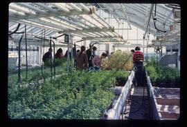
Image depicts a group of unidentified individuals in a greenhouse, possibly somewhere in Fort St. John, B.C.