2000.23.1.070.07
·
Item
·
1923
Part of Audrey Smedley L'Heureux fonds
236 results with digital objects
Show results with digital objects
2012.13.6.19
·
File
·
1949
Part of J. Kent Sedgwick fonds
Item is a photocopied 1949 pre-emptor's map of Fort George, published by the British Columbia Department of Lands.
2012.13.6.25
·
File
·
1943
Part of J. Kent Sedgwick fonds
Item is an original 1943 pre-emptor's map of Fort George, published by the British Columbia Department of Lands.
2012.13.6.15
·
File
·
1930
Part of J. Kent Sedgwick fonds
Item is a photocopied 1930 pre-emptor's map of Fort George, published by the British Columbia Department of Lands.
2012.13.6.20
·
File
·
1930
Part of J. Kent Sedgwick fonds
Item is a photocopied 1930 pre-emptor's map of Fort George, published by the British Columbia Department of Lands.
2012.13.6.14
·
File
·
1923
Part of J. Kent Sedgwick fonds
Item is a photocopied 1923 pre-emptor's map of Fort George, published by the British Columbia Department of Lands.
2012.13.6.13
·
File
·
1915
Part of J. Kent Sedgwick fonds
Item is a photocopied 1915 pre-emptor's map of Fort George, published by the British Columbia Department of Lands.
2020.4.6.021.01
·
Item
·
Sept. 1979
Part of G. Gary Runka fonds
2020.4.6.021.02
·
Item
·
Oct. 1979
Part of G. Gary Runka fonds
3 duplicate copies available.

2007.1.45.49
·
File
·
1929-1958
Part of Aleza Lake Research Forest fonds
File contains handwritten cross section book, original studies with handwritten measurement charts and black and white photos, loose pages of original correspondence, handwritten diagrams and measurement charts, loose handwritten tally sheets, black and white photographs, hand coloured plot diagrams, photocopies of aerial photographs, and original correspondence for Plot 160.
2009.6.13
·
Series
·
1973-1979
Part of The Honourable Iona Campagnolo fonds
This Political Papers series illustrates the Hon. Iona Campagnolo's political career as Member of Parliament for Skeena and Minister of State for Fitness and Amateur Sport. Types of records reflective of her political career include: speeches, correspondence, itineraries, memoranda, manuscripts, newspaper clippings, background material, photographs, and ephemera.
2016.5.1.45
·
File
·
1992-1994
Part of Harry Coates fonds
File consists of several maps indicating the locations of plots and 3 detailed maps of specific plots. File also includes photographs of cleared forests and a "P.G. District Demonstration Plots: Establishment Report".

2007.1.60.02.1
·
Item
·
Mar. 1993
Part of Aleza Lake Research Forest fonds
2013.6.35.13
·
Item
·
[after 1956]
Part of David Davies Railway Collection
Map depicts the growth of Vancouver's street car system as from the laying of the first tracks in 1889 to the last section laid (Clark Dr., Hastings to Venables).
2012.13.2.04.02.1
·
Item
·
[between 1990 and 2005]
Part of J. Kent Sedgwick fonds
The item is a reproduction of a map originally surveyed in 1984 by F. A. Deveraux. The map is a plan of the "Fort George Indian Reserves" in the Cariboo District. Annotations include the approved signatures of Leo. B. Martin and R. O'Reilly dated 21 September 1895.
2012.13.2.02.33.14
·
Item
·
[1990?]
Part of J. Kent Sedgwick fonds
The item is a reproduction of a survey map drafted on 27 July 1910. The reproduction was likely created in 1990. The area covered is South of Reserve Avenue, East of Victoria, North of Bird Avenue and West of 9th Street. Annotations state, "#796" and highlight the date and registered owner.
2012.13.3.1.01.1
·
Item
·
[between 1980 and 2000]
Part of J. Kent Sedgwick fonds
The map depicts Prince George lots alongside the Fraser River and has annotations by Kent Sedgwick outlining the location of the original cemetery. The map is a reproduction created in August 1910 and revised in 1965. Copy was produced between 1980 and 2000.
2012.13.2.02.33.07
·
Item
·
[1990?]
Part of J. Kent Sedgwick fonds
The item is a reproduction of a survey map drafted on 10 July 1956 and registered on 31 Oct. 1956. The reproduction was likely created in 1990. The plan number is 7782.
2012.13.2.02.33.13
·
Item
·
[1990?]
Part of J. Kent Sedgwick fonds
The item is a reproduction of a survey map likely drafted in the 1910s. The reproduction was likely created in 1990. The area covered is South of Baillie Street, East of 22nd Avenue, North of Princess Street and West of 7th Avenue. Annotations state, "Pl. 833" and various lot descriptions.
2012.13.2.02.33.17
·
Item
·
[1990?]
Part of J. Kent Sedgwick fonds
The item is a reproduction of a survey map drafted in 1909. The reproduction was likely created in 1990. The area covered are lots 931 and 417. Annotations state, "Plan 701," and various names are highlighted.
2012.13.2.02.33.03
·
Item
·
[1990?]
Part of J. Kent Sedgwick fonds
The item is a reproduction of a survey map drafted on 1 March 1910. The reproduction was likely created in 1990. The area highlighted is along the Fraser River. The map details subdivisions East of Ninth Street and South of Thapage Lane. Land Surveyor J. F. Templeton certified the plan. Annotation on the map states, "Pl. 727."
2012.13.2.02.33.16
·
Item
·
[1990?]
Part of J. Kent Sedgwick fonds
The item is a reproduction of a survey map drafted on 1 March 1910. The reproduction was likely created in 1990. The area covered is South of Bernhardt Avenue, East of Simpson Street, North of the Fraser River and West of 9th Street. Annotations state, "DL 1426 Plan 721."
2012.13.2.02.33.09
·
Item
·
[1990?]
Part of J. Kent Sedgwick fonds
The item is a reproduction of a survey map drafted in 1 Oct. 1913. The reproduction was likely created in 1990. The area covered is along the Fraser River and west of Linooln Avenue, south of Jackson Street and North of McKinley Street. Annotations state which maps and lots are adjacent to this one. An illegible signature is highlighted.
2012.13.2.02.33.12
·
Item
·
[1990?]
Part of J. Kent Sedgwick fonds
The item is a reproduction of a survey map drafted on 29 Oct. 1910. The reproduction was likely created in 1990. The area covered is South of Princess Street, East of James Avenue, North of 8th Street and West of Rupert Avenue. Annotations state, "Jesse Hodgeson Crown grand in 1910 for $800..."
2012.13.2.02.33.08
·
Item
·
[1990?]
Part of J. Kent Sedgwick fonds
The item is a reproduction of a survey map drafted in July 1914. The reproduction was likely created in 1990. The area covered is along the Fraser River and east of Guelph Street. Annotations state, "PL 1409 D. L. 417 HBCo." and highlight different scales of measurement and changed street names.
2012.13.2.15.29.1
·
Item
·
[before 1980]
Part of J. Kent Sedgwick fonds
The item is a map depicting townsite plans for South Hazelton, BC. Slight water damage on center of map.

2012.11.1.1
·
Item
·
[1911]
Part of Northern BC Archival Replica Access Collection
2012.13.6.03
·
File
·
1916
Part of J. Kent Sedgwick fonds
Item is a photocopy of Plan No. 1268 showing a subdivision of part of Indian Reserve no. 1 Lot 343 in the Cariboo District of British Columbia.
2012.13.6.04
·
File
·
1916
Part of J. Kent Sedgwick fonds
Item is a photocopy of Plan No. 1268 showing a subdivision of part of Indian Reserve no. 1 Lot 343 in the Cariboo District of British Columbia.
2012.13.2.02.33.15
·
Item
·
[1990?]
Part of J. Kent Sedgwick fonds
The item is a reproduction of a survey map likely drafted in the 1910s. The reproduction was likely created in 1990. The area covered is South of Anderson Street, East of Simpson Street, North of Van Bien Avenue and West of 9th Street. Annotations state, "Pl 721 DL 1426."

2013.6.35.48
·
Item
·
1978
Part of David Davies Railway Collection
Map depicts the Shuswap Lakes, Rogers Pass, Kamloops, Yellowhead Pass, Thompson Valley, and the Nicola Valley. Also includes the first clues to a treasure hunt.
2020.4.7.006
·
Item
·
[between 1965 and 1985]
Part of G. Gary Runka fonds

2019.10.4.41407
·
Item
·
8 Sept. 1969
Part of Lockwood Survey Corporation Ltd. collection
This remote-sensing aerial photograph was taken by Lockwood Survey Corporation Ltd. under contract for the B.C. Forest Service. This historically important aerial photograph depicts the W.A.C. Bennett Dam and Williston Reservoir soon after its flooding in 1968.
The identification coding on these photographs can be interpreted as follows:
- The largest number on the leftmost side is the frame number for the photograph.
- The following code to the right in the format B) 69-53 is currently unknown, but may refer to an internal project number for the Lockwood Survey Corporation.
- The 6" may refer to the camera's focal length in inches.
- Next is "17,150 ASL" which is 17,150 feet Above Sea Level.
- Following is "152.52" which refers to the camera's focal length in millimeters, which equals 6 inches.
- The "W1307" may refer to the reel, but that is unconfirmed.
- "8 SEP 69" is the date the photo was taken.

2019.10.4.41406
·
Item
·
8 Sept. 1969
Part of Lockwood Survey Corporation Ltd. collection
This remote-sensing aerial photograph was taken by Lockwood Survey Corporation Ltd. under contract for the B.C. Forest Service. This historically important aerial photograph depicts the W.A.C. Bennett Dam and Williston Reservoir soon after its flooding in 1968.
The identification coding on these photographs can be interpreted as follows:
- The largest number on the leftmost side is the frame number for the photograph.
- The following code to the right in the format B) 69-53 is currently unknown, but may refer to an internal project number for the Lockwood Survey Corporation.
- The 6" may refer to the camera's focal length in inches.
- Next is "17,150 ASL" which is 17,150 feet Above Sea Level.
- Following is "152.52" which refers to the camera's focal length in millimeters, which equals 6 inches.
- The "W1307" may refer to the reel, but that is unconfirmed.
- "8 SEP 69" is the date the photo was taken.

2019.10.4.41405
·
Item
·
8 Sept. 1969
Part of Lockwood Survey Corporation Ltd. collection
This remote-sensing aerial photograph was taken by Lockwood Survey Corporation Ltd. under contract for the B.C. Forest Service. This historically important aerial photograph depicts the W.A.C. Bennett Dam and Williston Reservoir soon after its flooding in 1968.
The identification coding on these photographs can be interpreted as follows:
- The largest number on the leftmost side is the frame number for the photograph.
- The following code to the right in the format B) 69-53 is currently unknown, but may refer to an internal project number for the Lockwood Survey Corporation.
- The 6" may refer to the camera's focal length in inches.
- Next is "17,150 ASL" which is 17,150 feet Above Sea Level.
- Following is "152.52" which refers to the camera's focal length in millimeters, which equals 6 inches.
- The "W1307" may refer to the reel, but that is unconfirmed.
- "8 SEP 69" is the date the photo was taken.

2019.10.4.41404
·
Item
·
8 Sept. 1969
Part of Lockwood Survey Corporation Ltd. collection
This remote-sensing aerial photograph was taken by Lockwood Survey Corporation Ltd. under contract for the B.C. Forest Service. This historically important aerial photograph depicts the headwaters of Williston Reservoir soon after its creation in 1968 with the building of the W.A.C. Bennett Dam on the Peace River.
The identification coding on these photographs can be interpreted as follows:
- The largest number on the leftmost side is the frame number for the photograph.
- The following code to the right in the format B) 69-53 is currently unknown, but may refer to an internal project number for the Lockwood Survey Corporation.
- The 6" may refer to the camera's focal length in inches.
- Next is "17,150 ASL" which is 17,150 feet Above Sea Level.
- Following is "152.52" which refers to the camera's focal length in millimeters, which equals 6 inches.
- The "W1307" may refer to the reel, but that is unconfirmed.
- "8 SEP 69" is the date the photo was taken.

2023.5.1.19
·
Item
·
[between 1976 and 1982]
Part of UNBC School of Planning and Sustainability fonds
Item is a map depicting the areas of winter shadow in the Peden Hill neighbourhood in Prince George.

2023.5.1.18
·
Item
·
[between 1976 and 1982]
Part of UNBC School of Planning and Sustainability fonds
Item is a map depicting the areas of spring and fall shadow in the Peden Hill neighbourhood in Prince George.

2023.5.1.16
·
Item
·
[between 1976 and 1982]
Part of UNBC School of Planning and Sustainability fonds
Item is a map depicting a future medium density development plan for the Peden Hill neighbourhood in Prince George.

2023.5.1.15
·
Item
·
[between 1976 and 1982]
Part of UNBC School of Planning and Sustainability fonds
Item is a map depicting a future low density development plan for the Peden Hill neighbourhood in Prince George.

2023.5.1.17
·
Item
·
[between 1976 and 1982]
Part of UNBC School of Planning and Sustainability fonds
Item is a map depicting a future high density development plan for the Peden Hill neighbourhood in Prince George.
2012.13.6.41
·
File
·
1986
Part of J. Kent Sedgwick fonds
Item is an original 1986 map depicting the Peace River to Liard region of British Columbia, published by the Outdoor Recreation Council of British Columbia.
2012.13.2.14
·
Subseries
·
1970-2011
Part of J. Kent Sedgwick fonds
Subseries consists of material collected and created by Kent Sedgwick for research regarding parks and outdoor recreation in Prince George. Material on parks includes Fort George Park (renamed to Lheidli T’enneh Memorial Park in 2015); Cottonwood Island Park; Connaught Hill; Moore's Meadow; L.C. Gunn Park; the Nechako Cutbanks; Paddlewheel Park; Monkman Provincial Park; Fraser Canyon Park; and Carp Lake. Also includes information on the creation of plaques and monuments, including the Alexander Mackenzie monument; the “Arrival of Steel” CN railway plaque; heritage interpretative signs for the Grand Trunk Pacific Railway; the Millar addition; and flooding and rivers. The files consists of various pamphlets and correspondence regarding the development of parks and the creation of interpretive materials.
2023.7.3
·
Series
·
1943-2005
Part of Grant Hazelwood fonds
Series consists of materials and records created or collected by Grant Hazelwood in relation to parks and conservation areas in British Columbia. Grant Hazelwood was a BC Parks wildlife biologist and later a consultant via his business, Alpenglow Resources Ltd.; much of his work was in relation to wildlife in parks and conservation areas.
2012.13.2.14.01.1
·
Item
·
8 Sept. 1981
Part of J. Kent Sedgwick fonds
The map depicts plans for Fort George Park in Prince George.
2012.13.2.02.33.02
·
Item
·
[1990?]
Part of J. Kent Sedgwick fonds
The item is a reproduction of a section of survey map drafted in 1915. The reproduction was likely created in 1990. The Plan Number is 1268 and highlights the area along the Nechako River. The map details subdivisions East of Carney Street and North of Fifth Avenue. Some original street and avenue names have been crossed out and replaced with handwritten names. Annotation on reverse side of map states, "D.L. 343 Pl. 1268."
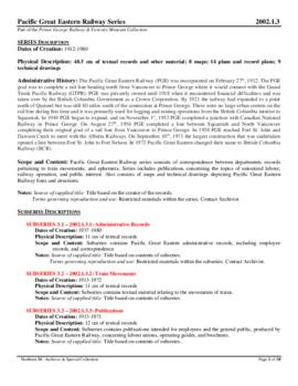
2002.1.3
·
Series
·
1912-1980
Part of Prince George Railway & Forestry Museum Collection
Pacific Great Eastern Railway series consists of correspondence between departments, records pertaining to train movements, and ephemera. Series includes publications concerning the topics of unionized labour, railway operation, and public interest. Also consists of maps and technical drawings depicting Pacific Great Eastern Railway lines and structures.
Pacific Great Eastern Railway
2013.6.35
·
Series
·
1909-2011
Part of David Davies Railway Collection
Series consists of large format maps and plans relating to railways in British Columbia and Canada. Also includes oversize documents.
2012.13.6.45
·
File
·
1985
Part of J. Kent Sedgwick fonds
Item is an original 1985 map depicting outdoor recreation in the 100 Mile House region of British Columbia, published by the Province of British Columbia Ministry of Environment and Outdoor Recreation Council of British Columbia.