Subseries consists of cartographic material separated from Campagnolo’s government textual record files. Includes government maps of British Columbia created by the Department of Energy, Mines and Resources Surveys and Mapping Branch; tourist road maps of BC, Prince Edward Island, Corner Brook, and Regina; maps relating to the oil and gas industry; maps of site plans for proposed developments; and a map of Edmonton for the XI Commonwealth Games.
Map depicts the City of Prince George in 1976, including the Fraser River, Nechacko River, Cariboo Highway, Carney St., and Patricia Blvd. where the electoral district boundary was proposed along for the two districts of Fort Nelson-Peace River and Prince George-Bulkley Valley.
Map depicts the city of Victoria and the electoral districts of Esquimat-Saanich, Victoria and Cowichan-Malahat-The Islands.
Map depicts the city of Vancouver, including the electoral districts of Comox-Powell River, Capilano, North Vancouver-Burnaby, Mission-Port Moody, Burnaby, Fraser Valley West, New Westminster-Coquitlam, Surrey-White Rock-North Delta, Richmond-South Delta, Vancouver South, Vancouver Kingsway, Vancouver Quadra, Vancouver Centre, and Vancouver East.
Map depicts Bee Peak, Golden Mountain, Mount Fetterly, Mount Brook, Ear Mountain, Sunday Peak, Graham Inlet, and Taku Arm of Tagish Lake.
Map depicts the Gulf of Alaska, Pacific Ocean, Chicagof Island, Baranof Island, Alaskan Boarder, Yukon Territory Boarder, Telegraph Creek, Dease Lake and "Mount Brook" along the Graham Inlet.
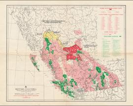
Map depicts British Columbia in its entirety as-well as smaller subsequent maps of Vancouver, Victoria and Vicinity, Prince George, Kamloops, Nelson, and Vancouver Island.
Map depicts the whole of Canada and notes: gas pipelines, gas gathering lines, proposed gas pipelines, oil pipelines, oil gathering lines, proposed oil pipelines, gas fields, oil fields, refining centres, extraction plants, and oil sands. There is a smaller subsequent map of Alberta highlighting these features in greater detail.
Map depicts proven on & offshore oil & gas areas, and probable oil & gas areas in less then 1000' water. The map conveys the North Pole in the centre and spans out to include Canada, Europe and the "Union of Soviet Socialist Republics."
Map depicts sea floor of the Beaufort Sea, fault lines, and diapirs.
Map depicts producing mines and prospects in British Columbia and parts of Alberta.
Map depicts existing oil lines, oil lines proposed or under construction, product lines, existing gas lines, gas lines proposed or under construction, LPG lines, and LPG lines proposed in Canada and Northern USA.
Map depicts the Coast of British Columbia and Federal and Provincial proposed fishing boundaries, including the 200 mile limit.
Map depicts Prince Edward Island noting the main highways, hospitals, airports, provincial parks, beaches, golf courses, tuna fishing, and camp grounds.
Map depicts the jurisdictions of the various Indian treaties in existence in 1966, including the boundaries of: no surrenders, exempted-royal proclamation, no valid surrenders, land and hunting rights surrenders, and land surrender only. The whole of Canada is depicted in this map.
Map depicts the regional district of Kitmat, but is extensively annotated showing the proposed route of the Kitmat Truck Ferry, running through Terrace and up into the "Yukon Markets," and the Kispiox Connector, running from Prince Rupert to Hazelton and further East along Highway 16 and north along the Kispiox River.
Map depicts annotations of the freight-way routes throughout British Columbia. These routes include: the Garnet Enterprise Truck Haul from Vancouver to Terrace, the Canadian Freightways from Vancouver to Edmonton to Alaska; the Lindsay Transfer from Terrace to Dease Lake and Telegraph Creek; and the Northland Navigation roll-on and roll-off service.
Map depicts the shipping highway routes across Canada. Primary, secondary, and access routes are noted as-well as proposed routes.
Map depicts Western Canada and annotations highlight the prospective members and the member centres of the Yellowhead Interprovincial Highway Association.
Map depicts the topography around the township of Terrace, British Columbia. The Skeena River is noted, as well as the Coast Mountains and the Kitimat Ranges.
Map depicts the city of Regina, Saskatchewan, noting main arterial, visitor centre, special interest points, parks and recreational areas, elementary and secondary schools, and shopping centres. A smaller subsequent map of the business district is provided as well.
Cartoon style map of Edmonton with listings of activities and locations for Commonwealth games on the reverse of the map.
Tourist map of Corner Brook, Newfoundland depicting the various parks, streets and attraction centres.
Map depicts proposed industrial area outside of Terrace, British Columbia.
Map depicts existing harbour development in Stewart, with an enlargement of the west side of the harbour.
Map includes an annotated line indicating the city limits and the crown land surrounding the village of Kitimat.
Map shows project boundaries in Mont Ste. Marie for proposed sports training centre at a ski resort.
The Archdeacon W.H. Collison fonds consists of textual materials, maps, published materials and photographs all documenting Collison’s life and work with North Coastal First Nations communities in British Columbia. Types of records found within this fonds include manuscripts, sermon notes, correspondence, oral history summaries, monographs, cartographic items, photographs and postcards. The Collison fonds also includes some records created by his children and grandchildren as well as a family tree created in 1986. The Collison fonds has been divided into four series.
Collison, W.H. (Archdeacon)Maps within this series document the placer streams, islands and harbours of the Queen Charlotte Islands; as well as the mining properties located within the vicinity of Stewart, BC.
Fonds consists of documents providing information on the Columbia Cellulose Company, Limited covering the period of 1959-1970. These documents detail the company’s history, historical and geographical context, and plans for the future. Files often include photographs, maps, and technical drawings of the mills.
Columbia Cellulose Company, LimitedSeries consists of documents providing information on the Columbia Cellulose Company, Limited including its history, historical and geographical context, and plans for the future. These documents often include photographs, maps, and technical drawings of the mills. Series consists of Skeena Kraft press kit; Feasibility Study of Nass River Valley Log Transport Systems; A Summary History and Progress; Development Study: Northern resources; Columbia Cellulose Company, Limited.
File consists of a folder containing documents describing Skeena Kraft Limited. Folder consists of:
- Svenska Cellulosa Aktiebolaget--A Forest Products Giant
- Columbia Cellulose Company, Limited--A Corporate History
- Two World-Wide Sales Organizations to Market Skeena Kraft Pulp
- Skeena Kraft Limited Adopts Distinctive Housemark Symbol Adapted from Sun Totem, Kee-War-Kow, Family Crest of Sky People
- The Nass and Skeena Valleys--A New Economic Region Terrace and Prince Rupert are Hubs in Finance and Services
- MISSING: Twinriver Timber Limited: New Company Created to Administer Two Tree Farm Licence Areas
- The Forests Behind the Coast Range Produce Superior Pulp
- Efficient New Woodroom Highlights Skeena Mill
- Integrating Two Power Systems--A Marriage with Convenience One Power Group Serves Two Mills
- Pulping Group Features Flexible Bleaching Sequence and World's Largest Flakt Drier
- New Dams Create Huge Storage Area for Skeena Water Supply
- Advanced Process Control Techniques Employ Computers Extensively
- Skeena Kraft Mill Quality Control and Process Control Tune Mill to Produce Prime Quality Pulps
- Co-ordination and Administration of Construction and Design of Skeena Kraft Shared by H.A. Simons and Central Engineering of Columbia Cellulose
- Purchasing and Traffic Departments Buy and Move More than 25,000 Tons of Materials During Skeena Kraft Construction Co-ordinated Sea and Land Transport System Introduced
- Skeena Kraft--Hundreds of New Jobs Canada-Wide Recruiting Programme Attracts New Workers to Growing Nass-Skeena Region;
- Also includes 19 photographs; 12 technical drawings and diagrams; 2 maps;
- Promotional pamphlet "The Skeena Kraft Story."
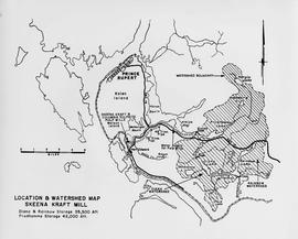
Item is a map showing the watersheds of Diana Lake, Rainbow Lake and Prudhomme Lake.
Item is a map that distinguishes the regions covered by Tree Farm Licence No. 1 granted to Columbia Cellulose and Three Farm Licence No. 40 granted to Skeena Kraft. Major locations indicated in this map include: Prince Rupert, Terrace, Hazelton, Smithers, Kitimat, Skeena River, and Nass River. Railway routes are also shown.
File consists of:
- "Development Study - Northern Resources" by the Columbia Cellulose Company, Limited, September, 1963. This report includes: background information on the company and a contextual background of forestry in British Columbia; a description of resources and proposed facilities, which covers northern wood resources and requirements for future sulphite and sulphate mills; an economic study for new Kraft operations.
- 2 maps: one of British Columbia entitled "Status of Sustained-Yield Forestry Programme as at 31 December 1962" by the Department of Lands, Forests, and Water Resources; the other of British Columbia Forest Service Forest: Surveys and Inventory Division, Key Map Showing: Maps published on scale 1 inch to 2 miles and summary zones of the provincial forest inventory by the Department of Lands and Forests (1957).
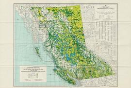
Item is a map of British Columbia and is a key map showing: maps published on scale 1 inch to 2 miles and summary zones of the provincial forest inventory. Map includes index of post offices correct to October 22, 1956.
Item is a map of British Columbia's Status of Sustained-Yield Forestry Programme as at 31 December 1962. The map has been annotated to show forest area surveyed by Celgar Ltd. as base for new kraft mill.
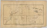
Pope, Frank L. “Sketch Map Showing the Proposed Route of the Western Union Telegraph Between Fort Frazer and the Stekine River, British Columbia. From exploration by the party under the command of Maj. Frank L. Pope Ass’t Engineer, 1866.
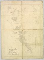
Wyld, James. "Map of the Colony of New Caledonia and the British & American Territory West of the Rocky Mountains including Vancouvers Island and the Gold Fields" by James Wyld, Geographer to the Queen & the Prince Consort, Charing Cross East & 2 Royal Exchange, London, July 16, 1858.
This fonds consists of material created and collected by Kent Sedgwick, author, professor, Prince George urban planner, and prominent local historian. This body of records documents Sedgwick’s research interests in the history and geography of the Central Interior of British Columbia. The fonds also reflects his work as a Prince George Senior City Planner, his involvement in local community organizations, and his teaching at the College of New Caledonia and the University of Northern British Columbia.
The fonds includes:
1) Photographs taken by Kent Sedgwick across British Columbia, predominantly in the Central Interior region;
2) Research subject files consisting of original research documentation and collected reference material, predominantly focusing on topics relating to local history, city planning, and geography in the Prince George area and the British Columbia Central Interior;
3) Documentation of Kent Sedgwick’s community involvement, including records created over the course of his work with the Prince George Heritage Commission, , the Alexander Mackenzie Heritage Trail Association, and other local organizations;
4) Writings, publications, and lectures written, edited, or conducted by Kent Sedgwick;
5) Professorial records consisting of lectures and material relating to Sedgwick’s teaching appointments at the College of New Caledonia and the University of Northern British Columbia;
6) Maps collected by Kent Sedgwick covering historical and contemporary British Columbia.
Kent Sedgwick’s research subject files contain original research notes, interviews and oral histories, news clippings, and collected primary and secondary sources. The series also includes both original and reproduction photographs, audio recordings, and maps. The subject files primarily relate to the history, urban planning, and historical geography of the Central Interior of British Columbia, especially Prince George area and the East Line communities over the course of the 20th century. They also include extensive notes on geographic features, landscapes, interpretative trails, architectural history, industrial history, history of Western exploration and land survey, and the First Nations history of the region.
Subseries includes research material created and collected by Kent Sedgwick relating to the incorporation of the City of Prince George. Topics include the naming of the City of Prince George, city boundaries, the city amalgamation with Fort George and South Fort George, city census records, and mayors of Prince George.
File consists of photocopies and notes relating to the boundary expansions of the city of Prince George since its incorporation. Includes a graph drawn by Kent Sedgwick regarding the addition of land and water each year of the boundary expansion and a "Proclamation" photocopy from the B.C. Gazette (23 Apr. 1953). Also includes 5 maps: "City of Prince George Boundary Expansions since Incorporation in 1915" (1979 or 1980); "City of Prince George" (Feb. 1979); "Map of Prince George" (between 1970 and 1985); "Study Area Boundaries" (Mar. 1977); and "City of Prince George" (Feb. 1972).
Map depicts the city of Prince George Boundary expansions since incorporation in 1915.
