Showing 658 results
Archival description
"Distribution of Uranium Exploration Mineral Claims and Radioactive Occurrences"
"Distribution of Uranium Exploration Mineral Claims and Radioactive Occurrences"
"Uranium Exploration Sites in BC"
"Uranium Exploration Sites in BC"

Map of the Colony of New Caledonia and the British & American Territory West of the Rocky Mountains
"Gold Regions of British Columbia"
"Gold Regions of British Columbia"

Sketch Map Showing the Proposed Route of the Western Union Telegraph between Fort Fraser and the Stikine River

Sketches of Harbours, Queen Charlotte Islands, 1878

Advanced Copy of a Map of the Queen Charlotte Islands
"Map of Northern British Columbia and the Peace River Country"
"Map of Northern British Columbia and the Peace River Country"
"British Columbia Railway Belt"
"British Columbia Railway Belt"
"Map of the Central Section of British Columbia Shewing the Country Served by the Grand Trunk Pacific Railway"
"Map of the Central Section of British Columbia Shewing the Country Served by the Grand Trunk Pacific Railway"

Plan of Carney Addition in the Heart of Fort George

Map of the Central Section of British Columbia shewing the country served by the Grand Trunk Pacific Railway
Henderson-Roe collection
Henderson-Roe collection
Plan showing provincial government property in the subdivision of Lots 933 & 934, Group 1, Cariboo District, South Fort George, British Columbia, to be offer for sale at public auction
Plan showing provincial government property in the subdivision of Lots 933 & 934, Group 1, Cariboo District, South Fort George, British Columbia, to be offer for sale at public auction
"Pre-Emptor's Map Fort George Sheet" 1915
"Pre-Emptor's Map Fort George Sheet" 1915
"Fort Fraser Division"
"Fort Fraser Division"
"Plan No. 1268 Subdivision of part of Indian Reserve No. 1 Lot 343 Cariboo District British Columbia"
"Plan No. 1268 Subdivision of part of Indian Reserve No. 1 Lot 343 Cariboo District British Columbia"
"Plan No. 1268 Subdivision of part of Indian Reserve No. 1 Lot 343 Cariboo District British Columbia"
"Plan No. 1268 Subdivision of part of Indian Reserve No. 1 Lot 343 Cariboo District British Columbia"
Forest Stand Types in British Columbia
Forest Stand Types in British Columbia
Union Steamship Company of British Columbia Map No. 2 Northern Run
Union Steamship Company of British Columbia Map No. 2 Northern Run
"Pre-Emptor's Map Tete Jaune Sheet" 1919
"Pre-Emptor's Map Tete Jaune Sheet" 1919
"Cariboo District of British Columbia"
"Cariboo District of British Columbia"
Pre-emptor's map of Fort George
Pre-emptor's map of Fort George
"Pre-Emptor's Map Fort George Sheet" 1923
"Pre-Emptor's Map Fort George Sheet" 1923
"Canadian Pacific Railway and Connecting Lines - Ticketing Routes"
"Canadian Pacific Railway and Connecting Lines - Ticketing Routes"

Sketch showing locations of elevations and benchmarks, Aleza Lake Forest, Cariboo
"Eagle Lake Spruce Mills Ltd. Giscome, British Columbia"
"Eagle Lake Spruce Mills Ltd. Giscome, British Columbia"

Map showing Jasper Park, Fraser River and Prentiss Gray's 1926 adventure

Proposed railway spur - Aleza Lake Forest Experiment Station
"Railroad Map of Washington"
"Railroad Map of Washington"

Aleza Lake timber reserve: Cariboo District, B.C.
Central British Columbia Map
Central British Columbia Map
Cartographic Materials Series
Cartographic Materials Series

Map showing Mining Properties in Vicinity of Stewart and Salmon River. Portland Canal Mining Division. British Columbia
"Pre-Emptor's Map Fort George Sheet" 1930
"Pre-Emptor's Map Fort George Sheet" 1930
"Pre-Emptor's Map Fort George Sheet" 1930
"Pre-Emptor's Map Fort George Sheet" 1930

Timber Sale X9696

TSX9696, Plot 160 - Sketches Showing Location of Plots, Roads, and Traverse Posts

Timber Sale X9696 Osoyoos District

Timber Sale X9696 Osoyoos District annotated
Maps and plans
Maps and plans

Preliminary Plan Showing Travelled Route of the Bedaux Sub-arctic Exploration
"Pre-Emptor's Map Quesnel Sheet" 1935
"Pre-Emptor's Map Quesnel Sheet" 1935
"Canadian National Railways Western Region: Plan of part of Central Fort George showing Hammond Street diversion as proposed"
"Canadian National Railways Western Region: Plan of part of Central Fort George showing Hammond Street diversion as proposed"
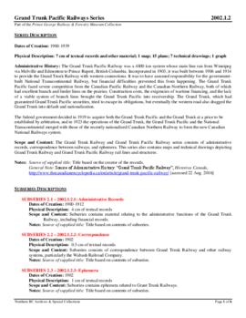
Grand Trunk Pacific Railway
Trans-Canadian Alaska Railway Survey: Plan showing progress of survey parties
Trans-Canadian Alaska Railway Survey: Plan showing progress of survey parties
Trans-Canadian Alaska Railway Proposed Route
Trans-Canadian Alaska Railway Proposed Route
"Pre-Emptor's Map Fort George Sheet" 1943
"Pre-Emptor's Map Fort George Sheet" 1943
River crossing exercise, Prince George, B.C.
River crossing exercise, Prince George, B.C.
"Fort George" 1944 map
"Fort George" 1944 map