Showing 5 results

Archival description
1 results with digital objects Show results with digital objects
Forestry Videos
2016.5.3.16 · File · 1959 & 1994
Part of Harry Coates fonds

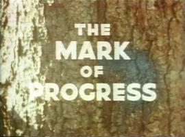
File consists of two videos:

  • A VHS video tape containing "Mark of Progress" promotional and possible training video for the BC forest industry in and around Prince George
  • A VHS tape "Reforestation in British Columbia: A Growing Success" published by the Province of British Columbia Ministry of Forests.
McNaughton Lake, B.C. Map
2016.5.5.05 · Item · 1984
Part of Harry Coates fonds

Item is McNaughton Lake, B.C. Map 83D and Part of 83C Second Status Edition (1975) from "Classification and Interpretation of some Ecosystems of the Rocky Mountain Trench, Prince George Forest Region, British Columbia: First Approximation" (1984).

Recreational Guides
2016.5.3.01 · File · [199-?]
Part of Harry Coates fonds

File consists of recreational guides from various places in British Columbia, especially Northern British Columbia. Guides include:

  • The North Ridge Ecr-Trail Guide: Aleza Lake Research Forest
  • Cluculz Lake Silviculture Demonstration Area: Trail Guide
  • Willow River Interpretive Trail
  • Crooked River Forest Self-Guided Circle Tour
  • Forests for the World Interpretive Trail Guide
  • Cottonwood Island Nature Park: Habitat Enhancement.
The Mark of Progress
2016.5.3.16.1 · Item · 1959
Part of Harry Coates fonds

A VHS tape containing "The Mark of Progress" film created by the British Columbia Forest Service and first played for a live audience in 1959 in Prince George, BC.

2016.5.5.01 · File · [19-?]
Part of Harry Coates fonds

File consists of trail maps and recreation guides from various places in British Columbia, especially Northern British Columbia. Maps include:

  • British Columbia Road Map and Parks Guide
  • Northwood Pulp and Timber Limited Forest Operations Recreation Map
  • Provincial Parks of Northern British Columbia
  • Visitor's Guide: Mackenzie Woodlands
  • Visitors Guide: Mackenzie Woodlands
  • Mackenzie Forest District Recreation Map
  • Dawson Creek Forest District Recreation Map
  • Morice Forest District Recreation Map
  • Fort St. James Forest District Recreation Map
  • Lakes Forest District Recreation Map
  • Cariboo Forest Region Recreation Map
  • Lakes District Visitors Map
  • Prince George Forest District Recreation Map
  • Vanderhoof Forest District Recreation Map
  • Fort St. John Forest District Recreation Map
  • Cariboo Forest Region Recreation Map (East)
  • Robson Valley Forest District Recreation Map
  • Fort Nelson Forest District Recreation Map
  • Forest Service Recreation Sites: Valemount - Blue River
  • Forest Service Recreation Sites: McBride - Goat River
  • Forest Service Recreation Sites: Prince George West
  • Forest Service Recreation Sites: Moberly - Sukunka
  • Forest Service Recreation Sites: Nation - Takla
  • Forest Service Recreation Sites: Murrat - Kiskatinaw
  • Recreation Road Map for the Prince George Forest Area (1987-1988)
  • Recreation Road Map for the Prince George Forest Area (1997)
  • The Bobtail Forest Service Road Tour
  • Forest Recreation Map: Northwood Pulp and Timber Limited
  • Forest Operations Recreation Map: Northwood pulp and timber limited
  • Forest Service: Recreation Sites Williston/Mackenzie
  • Forest Service Recreation Sites Prince George West
  • The Official Prince George Tourist Street Map
  • Ecological Reserves in British Columbia (July 1990)
  • Prince George Forest District map (April 1990) with annotations regarding trials.