2006.18.5
·
Series
·
1925-2016
Part of Aleza Lake Research Forest Society fonds
168 results with digital objects
Show results with digital objects
2020.4.7
·
Series
·
1965-2009
Part of G. Gary Runka fonds
Series consists of maps, technical drawings, and other oversize material collected by Gary Runka that are not associated with specific Land Sense Ltd. client jobs.
2016.5.5
·
Series
·
[1964-1999]
Part of Harry Coates fonds
Series consists of maps, and road maps, and trail guides from various communities and regions in Northern and Central BC. Series includes Forest Cover Maps and maps related to BC forest and natural resource management.
2016.5.5.06
·
Item
·
1984
Part of Harry Coates fonds
Item is McBride, B.C. Sheet 93H and Part of 83E Second Status Edition (1971) from "Classification and Interpretation of some Ecosystems of the Rocky Mountain Trench, Prince George Forest Region, British Columbia: First Approximation" (1984).

2006.18.5.20
·
Item
·
[197-?]
Part of Aleza Lake Research Forest Society fonds
Forest cover map showing a crossing area of the McGregor River is annotated with a road and ferry crossing.
2016.5.5.05
·
Item
·
1984
Part of Harry Coates fonds
Item is McNaughton Lake, B.C. Map 83D and Part of 83C Second Status Edition (1975) from "Classification and Interpretation of some Ecosystems of the Rocky Mountain Trench, Prince George Forest Region, British Columbia: First Approximation" (1984).
2020.4.7.018
·
Item
·
[198-?]
Part of G. Gary Runka fonds
Photocopied map depicts mineral and coal mining properties in north western British Columbia.

2006.18.5.15
·
Item
·
[1966?]
Part of Aleza Lake Research Forest Society fonds
Large-format map depicts the Monkman Public Sustained Yield Unit (PSYU) east of Prince George.

2006.18.5.14
·
Item
·
[1966?]
Part of Aleza Lake Research Forest Society fonds
Large-format map depicts the Monkman Public Sustained Yield Unit (PSYU) and Tree Farm Licence 30 east of Prince George.
2003.4.4.5
·
Subseries
·
1986-1998
Part of Kemano Completion Project Dispute Collection
Subseries consists of material relating to the Nechako Fisheries Conservation Program, predominantly publications and reports. Includes some correspondence between NFCP and the Department of Fisheries and Oceans. Also includes air photo maps of the Nechako River from 1990.
Shirvell, Cole
2020.4.7.022
·
Item
·
Dec. 2005
Part of G. Gary Runka fonds

2006.18.5.19
·
Item
·
1975
Part of Aleza Lake Research Forest Society fonds
Large-format map depicts Northwood Pulp & Timber operating areas in 1975.
2000.1.2.6.13
·
Item
·
December 31, 1972
Part of Cassiar Asbestos Corporation Ltd. fonds
This map depicts the ore type and geology that can be found among each of the bench layers. Classifications and grades of ore are included within it. Different bench layers are included in the map. Annotations include a title in the back of the map written out as "1972 BENCH PLANS".
2023.7.3
·
Series
·
1943-2005
Part of Grant Hazelwood fonds
Series consists of materials and records created or collected by Grant Hazelwood in relation to parks and conservation areas in British Columbia. Grant Hazelwood was a BC Parks wildlife biologist and later a consultant via his business, Alpenglow Resources Ltd.; much of his work was in relation to wildlife in parks and conservation areas.

2007.1.60.02.1
·
Item
·
Mar. 1993
Part of Aleza Lake Research Forest fonds
2016.5.1.45
·
File
·
1992-1994
Part of Harry Coates fonds
File consists of several maps indicating the locations of plots and 3 detailed maps of specific plots. File also includes photographs of cleared forests and a "P.G. District Demonstration Plots: Establishment Report".

2007.1.45.49
·
File
·
1929-1958
Part of Aleza Lake Research Forest fonds
File contains handwritten cross section book, original studies with handwritten measurement charts and black and white photos, loose pages of original correspondence, handwritten diagrams and measurement charts, loose handwritten tally sheets, black and white photographs, hand coloured plot diagrams, photocopies of aerial photographs, and original correspondence for Plot 160.
2016.5.1.95
·
File
·
1961-1992
Part of Harry Coates fonds
File consists of "History of the Buckhorn Research Demonstration Area Prince George Forest Region" by J. Revel Nov. 1988 and maps, diagrams, and documentation for:
- Sx 84119G
- Sx 87109G
- EP 976.02.02
- EP 697
- EP 1185
- File also include three large maps: a reproduction of a BC Forest Service Aleza Lake Research Forest map, North Eastern British Columbia Fire Location Map (1961), and map of Summit Lake, Cariboo District B.C. (1966).
2020.4.7.019
·
Item
·
1982
Part of G. Gary Runka fonds
2003.8.4.1.1.2.1
·
Item
·
[1971?]
Part of Adam Zimmerman fonds
Hand annotated map depicts the proposed location of the Northwood Pulp Ltd. Beaver Bridge over the Fraser River near Prince George.

2006.18.5.05
·
Item
·
[1928?]
Part of Aleza Lake Research Forest Society fonds
Reproduced map on mylar depicts a proposed railway spur for the Aleza Lake Forest Experiment Station.
2023.2.2.9.1
·
Item
·
22 June 2000
Part of Dr. Paul Sanborn fonds
Map depicts range reference area exclosure locations for livestock and wildlife in the Fort St. John Forest District.
2003.8.4.9.33.1
·
Item
·
1987
Part of Adam Zimmerman fonds
Map is a "Recreation and Logging Road Guide to the Forest Lands of Vancouver Island Alberni Valley and the Surrounding Area" created for the public.
2003.8.4.9.33.2
·
Item
·
1987
Part of Adam Zimmerman fonds
Map is a "Recreation and Logging Road Guide to the Forest Lands of Vancouver Island Alberni Valley and the Surrounding Area" created for the public. Backside states "Welcome to TFL 44", along with promotional imagery and information for backcountry travelers.
2023.7.3.08
·
Item
·
June 1989
Part of Grant Hazelwood fonds
Item is an original draft copy of "Regional Landscapes for the British Columbia Parks System".
2007.1.20
·
Series
·
1924-1999
Part of Aleza Lake Research Forest fonds
Series contains aerial photographs, stump data sheets, permanent sample plot summaries, correspondence, minutes from meetings, research proposals, budget reports, measurement charts, various historical documents, permits, field notes, overview diagrams, and an inventory of the 1994 Northwood Pulp and Timber donation to the Fraser Fort George Museum.
2023.2.2
·
Series
·
1960-2024
Part of Dr. Paul Sanborn fonds
Series consists of records created and collected in relation to research projects Dr. Paul Sanborn was engaged in, often with other colleagues, during his employment with the BC Ministry of Forests and/or the University of Northern British Columbia. These archival research records are predominantly unpublished documents, reports, data, and photographs. Some of Sanborn's research projects did not result in a formal scientific publication. In other instances, some of Sanborn's research projects resulted in only a portion of the collected data utilized for a formal publication.
Sanborn compiled details about each research project and its associated records in a summary note. Each of these notes is provided in PDF format along with its research project series. These notes serve as an essential guide for researchers who wish to interpret, utilize, and repurpose Sanborn's data for other future research projects.

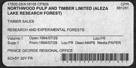
2006.18.5.18
·
File
·
1974
Part of Aleza Lake Research Forest Society fonds
File is a Resource Folio of maps and accompanying information created by Northwood Pulp & Timber regarding Timber Sale Harvesting Licence A01847, Willow River Block, Willow River P.S.Y.U. Includes maps that depict ungulates, waterfowl, recreation areas, special influence areas, and timber types. Most of the sheets have a duplicate, some with very slight variations. The following maps are supposed to be included in the but were missing upon arrival at the Archives: fish & topography, cutting permits & roads, and soils.

2006.18.5.17
·
Item
·
18 May 1971
Part of Aleza Lake Research Forest Society fonds
Map reproduction of the Sinclair Spruce Lumber Co. Ltd. T.S.H.L. A01848 C.P. 310 cutting area, likely in the Aleza Lake Research Forest.

2007.1.45.49.14
·
Item
·
20 Aug. 1957
Part of Aleza Lake Research Forest fonds
Logging plan of Sinclair Spruce Lumber Company's T.S.X. 73378 at Hubble Creek shows areas to be cut.

2007.1.45.49.15
·
Item
·
20 Aug. 1957
Part of Aleza Lake Research Forest fonds
Logging plan of Sinclair Spruce Lumber Company's T.S.X. 73378 at Hubble Creek shows areas to be cut. Annotations show areas logged.
2012.05.01.01
·
File
·
Jun. 1967
Part of Columbia Cellulose Company, Ltd. fonds
File consists of a folder containing documents describing Skeena Kraft Limited. Folder consists of:
- Svenska Cellulosa Aktiebolaget--A Forest Products Giant
- Columbia Cellulose Company, Limited--A Corporate History
- Two World-Wide Sales Organizations to Market Skeena Kraft Pulp
- Skeena Kraft Limited Adopts Distinctive Housemark Symbol Adapted from Sun Totem, Kee-War-Kow, Family Crest of Sky People
- The Nass and Skeena Valleys--A New Economic Region Terrace and Prince Rupert are Hubs in Finance and Services
- MISSING: Twinriver Timber Limited: New Company Created to Administer Two Tree Farm Licence Areas
- The Forests Behind the Coast Range Produce Superior Pulp
- Efficient New Woodroom Highlights Skeena Mill
- Integrating Two Power Systems--A Marriage with Convenience One Power Group Serves Two Mills
- Pulping Group Features Flexible Bleaching Sequence and World's Largest Flakt Drier
- New Dams Create Huge Storage Area for Skeena Water Supply
- Advanced Process Control Techniques Employ Computers Extensively
- Skeena Kraft Mill Quality Control and Process Control Tune Mill to Produce Prime Quality Pulps
- Co-ordination and Administration of Construction and Design of Skeena Kraft Shared by H.A. Simons and Central Engineering of Columbia Cellulose
- Purchasing and Traffic Departments Buy and Move More than 25,000 Tons of Materials During Skeena Kraft Construction Co-ordinated Sea and Land Transport System Introduced
- Skeena Kraft--Hundreds of New Jobs Canada-Wide Recruiting Programme Attracts New Workers to Growing Nass-Skeena Region;
- Also includes 19 photographs; 12 technical drawings and diagrams; 2 maps;
- Promotional pamphlet "The Skeena Kraft Story."

2006.18.5.04
·
Item
·
[1925?]
Part of Aleza Lake Research Forest Society fonds
Reproduced map on mylar depicts locations of elevations and benchmarks at the Aleza Lake forest.
2020.4.7.015
·
Item
·
1982
Part of G. Gary Runka fonds
2023.7.2.11
·
File
·
Mar. 1979
Part of Grant Hazelwood fonds
File consists of an original reproduction of a map entitled "Spatsizi Provincial Park Key Map" by BC Parks.

2012.05.01.02.02
·
Item
·
1962
Part of Columbia Cellulose Company, Ltd. fonds
Item is a map of British Columbia's Status of Sustained-Yield Forestry Programme as at 31 December 1962. The map has been annotated to show forest area surveyed by Celgar Ltd. as base for new kraft mill.

2008.6.01
·
Item
·
1969
Part of Dr. Philip Burton Forestry Collection
Item consists of a map of British Columbia showing Status of Sustained-Yield Forestry Programme as at December 31, 1969 with colour coded areas indicating Public Sustained Yield Units, Special Scale Areas, Tree Farm Licences, and Major Parks.
2023.7.1
·
Series
·
1991-2000
Part of Grant Hazelwood fonds
Series consists of records created and collected by wildlife biologist Grant Hazelwood in relation to his Tailed Frog (Ascaphus truei) research.
2007.1.28.29
·
File
·
1992-1994
Part of Aleza Lake Research Forest fonds
File contains pre-harvest silviculture prescription reports and related correspondence between the Ministry of Forests, the Prince George Forest Region, and Northwood Pulp and Timber Limited.

2007.1.45.49.07
·
Item
·
5 Oct. 1932
Part of Aleza Lake Research Forest fonds
Map of Timber Sale X9696 shows the area for the TSX with spruce balsam timber. Location is 4 miles from the Myra Station of the Kettle Valley Railway.

2007.1.45.49.09
·
Item
·
[1932?]
Part of Aleza Lake Research Forest fonds
Map of Timber Sale X9696 shows topography for the area. Location is 4 miles from the Myra Station of the Kettle Valley Railway.

2007.1.45.49.10
·
Item
·
[1932?]
Part of Aleza Lake Research Forest fonds
Map of Timber Sale X9696 shows topography for the area. Location is 4 miles from the Myra Station of the Kettle Valley Railway.
2007.1.28
·
Series
·
1919-1995
Part of Aleza Lake Research Forest fonds
Series consists of timber sale contracts, correspondence, logging inspection reports, diagrams, datasheets, prescription reports, and maps.
2016.5.5.01
·
File
·
[19-?]
Part of Harry Coates fonds
File consists of trail maps and recreation guides from various places in British Columbia, especially Northern British Columbia. Maps include:
- British Columbia Road Map and Parks Guide
- Northwood Pulp and Timber Limited Forest Operations Recreation Map
- Provincial Parks of Northern British Columbia
- Visitor's Guide: Mackenzie Woodlands
- Visitors Guide: Mackenzie Woodlands
- Mackenzie Forest District Recreation Map
- Dawson Creek Forest District Recreation Map
- Morice Forest District Recreation Map
- Fort St. James Forest District Recreation Map
- Lakes Forest District Recreation Map
- Cariboo Forest Region Recreation Map
- Lakes District Visitors Map
- Prince George Forest District Recreation Map
- Vanderhoof Forest District Recreation Map
- Fort St. John Forest District Recreation Map
- Cariboo Forest Region Recreation Map (East)
- Robson Valley Forest District Recreation Map
- Fort Nelson Forest District Recreation Map
- Forest Service Recreation Sites: Valemount - Blue River
- Forest Service Recreation Sites: McBride - Goat River
- Forest Service Recreation Sites: Prince George West
- Forest Service Recreation Sites: Moberly - Sukunka
- Forest Service Recreation Sites: Nation - Takla
- Forest Service Recreation Sites: Murrat - Kiskatinaw
- Recreation Road Map for the Prince George Forest Area (1987-1988)
- Recreation Road Map for the Prince George Forest Area (1997)
- The Bobtail Forest Service Road Tour
- Forest Recreation Map: Northwood Pulp and Timber Limited
- Forest Operations Recreation Map: Northwood pulp and timber limited
- Forest Service: Recreation Sites Williston/Mackenzie
- Forest Service Recreation Sites Prince George West
- The Official Prince George Tourist Street Map
- Ecological Reserves in British Columbia (July 1990)
- Prince George Forest District map (April 1990) with annotations regarding trials.

2007.1.25.8.1
·
Item
·
28 Nov. 1967
Part of Aleza Lake Research Forest fonds

2007.1.45.49.08
·
Item
·
[1932?]
Part of Aleza Lake Research Forest fonds
Map of Timber Sale X9696 shows the area for the TSX with the location of plots, roads, traverse posts, and the Forest Branch cabin. Location is 4 miles from the Myra Station of the Kettle Valley Railway.
2023.7.2
·
Series
·
1979-1986
Part of Grant Hazelwood fonds
Series consists of records created and collected by Grant Hazelwood for the BC Ministry of Environment's "Upper Nass Assessment Project", a project that included the biophysical mapping of the Northwest-Klappan Road Access Area. Grant Hazelwood (Alpenglow Resources) was hired as the wildlife biologist for to undertake project work.
2023.7.2.12
·
File
·
1979-1986
Part of Grant Hazelwood fonds
File consists of an original and photocopied maps collected by Grant Hazelwood primarily in conjunction with work for the Upper Nass Assessment Project. The majority consist of Canadian National Topographic System (NTS) maps annotated with draft biophysical mapping, collected species inventory data, area boundaries, or other information for the project.
2016.5.1.35
·
File
·
[19-?]
Part of Harry Coates fonds
File consists of photocopied data tables for Wansa Thinning Trials and map of Wansa Sanitation-Spacing Trials (Sx 80405).