Affichage de 221 résultats
Archival description
Coastal Forest - Trees

On Approach to Haida Gwaii

Docked Ferry
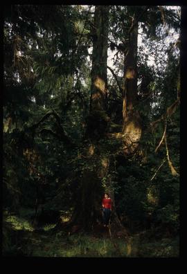
Person by a Tree

Person on a Path
Kent Sedgwick on a Log Bridge
Kent Sedgwick on a Log Bridge

Fence and Power Lines
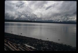
Coast of Haida Gwaii
Lake - Lily Pads
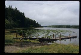
Dock on a Lake
Dock on a Lake

Side of the Road
Jill Singleton Collection
Jill Singleton Collection
Alaska Trip, August 1985
Alaska Trip, August 1985
Job 539 - Queen Charlotte Islands Forest District - Facilitation and Mediation of Local Resource Use Plan for Tlell Watershed - Tlell River
Job 539 - Queen Charlotte Islands Forest District - Facilitation and Mediation of Local Resource Use Plan for Tlell Watershed - Tlell River
Job 543 - Natural Resources Canada & BC Ministry of Forests - Facilitation of South Moresby Forest Replacement Account Strategic Plan Negotiations - Haida Gwaii
Job 543 - Natural Resources Canada & BC Ministry of Forests - Facilitation of South Moresby Forest Replacement Account Strategic Plan Negotiations - Haida Gwaii
Job 579 - BC Ministry of Sustainable Resource Management - Consultations on Land Use Planning Process Design Haida Gwaii/QCI Land Use Plan - Queen Charlotte City
Job 579 - BC Ministry of Sustainable Resource Management - Consultations on Land Use Planning Process Design Haida Gwaii/QCI Land Use Plan - Queen Charlotte City
Archdeacon W. H. Collison fonds
Archdeacon W. H. Collison fonds
Job 626 - Haida Tribal Society - Facilitation and Process Advice on Development of a Marine Use Strategic Plan - Haida Gwaii
Job 626 - Haida Tribal Society - Facilitation and Process Advice on Development of a Marine Use Strategic Plan - Haida Gwaii
Job 664 - Misty Isles Economic Development Society - Food Planning Presentations on Haida Gwaii - Haida Gwaii
Job 664 - Misty Isles Economic Development Society - Food Planning Presentations on Haida Gwaii - Haida Gwaii
Notes and drafts
Notes and drafts
Map showing locations of placer streams in British Columbia south of latitude 54 degrees North, with Queen Charlotte Islands inset in north east corner
Map showing locations of placer streams in British Columbia south of latitude 54 degrees North, with Queen Charlotte Islands inset in north east corner