Showing 4951 results

Archival description
3026 results with digital objects Show results with digital objects
2012.13.2.09 · Deelreeks · 1967-2005
Part of J. Kent Sedgwick fonds

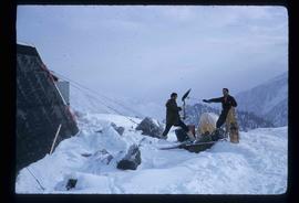
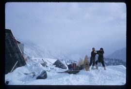
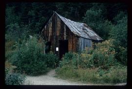
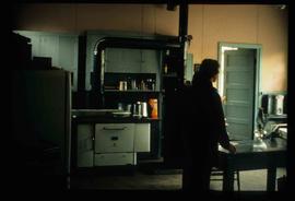
Subseries contains secondary material collected by Kent Sedgwick for research on the history and geography of Prince George and its region. Includes secondary sources and bibliographic references regarding the history and geography of Prince George and the Central Interior of British Columbia. The files primarily consist of photocopied articles and printed bibliographies.

2012.13.2.09.03 · Bestanddeel · 1967-2005
Part of J. Kent Sedgwick fonds

File consists of notes, clippings, and reproductions relating to British Columbia historical bibliographies and reference material. Includes: "Rural British Columbia: A Bibliography of Social and Economic Research" typescript document compiled by Dean S. Goard (1967); "Photo chronicler of B.C. a century ago" clipped article from Canadian Photography magazine (Feb. 1977); and "A Guide to British Columbia Stop of Interest Plaques" pamphlet by the Parks Branch of British Columbia (1969).

Pretty Pics
2012.13.1.134 · Deelreeks · [between 1967 and 1993]
Part of J. Kent Sedgwick fonds

File contains slides depicting scenery at various locations.

"Prince George B.C."
2012.13.2.21.08.1 · Stuk · 26 Apr. 1967
Part of J. Kent Sedgwick fonds

This very large drawing shows CN leases and private property buildings on Island Cache in detail.

Zonder titel
Peyto Glacier
2012.13.4.42 · Bestanddeel · 1967-2008
Part of J. Kent Sedgwick fonds

File consists of notes, reproductions, pamphlets, and postcards relating to the Peyto Glacier, situated in the Canadian Rockies in Banff National Park, Alberta. Includes: "Inland Waters Branch" handwritten letter to Kent Sedgwick (4 Sept. 1970); "Peyto Glacier general information" pamphlet prepared by the Inland Waters Directorate, Water Resources Branch of Environment Canada (1975); and photographs depicting a Peyto Glacier workshop with Kent Sedgwick and colleagues (1996) and personal photographs depicting Kent Sedgwick, his wife, and friends visiting and hiking Peyto Glacier (1990).

"Prince George" 1967 map
2012.13.6.64 · Bestanddeel · 1967
Part of J. Kent Sedgwick fonds

Item is an original 1967 map depicting Prince George in British Columbia, published by the British Columbia Department of Lands, Forests and Water Resources. Map includes pen markings.

Trip to Birken
2012.13.1.47.01 · Stuk · 1967
Part of J. Kent Sedgwick fonds

Image depicts a snow-covered cabin and a mountain in the distance. It is located somewhere near Birken, B.C.

Snow Sounding
2012.13.1.121.02 · Stuk · 1967
Part of J. Kent Sedgwick fonds

Image depicts an unidentified individual setting up some sort of pole in the snow for a process the slide labels as "snow sounding." The location is uncertain.

Physical Landscape Features
2012.13.1.125 · Deelreeks · [between 1968 and 1982]
Part of J. Kent Sedgwick fonds

File contains slides depicting physical landscape features at various locations, most are from outside Northern B.C.

"Bowron Lake Park"
2012.13.2.19.04.1 · Stuk · June 1968
Part of J. Kent Sedgwick fonds

The item is a map depicting Bowron Lake Park in British Columbia, the park boundary, the patrol cabin, roads, campsites, glaciers, and trails. Various handwritten annotations are written on the map and Public Shelters are circled in red pen.

Stake on Bare Ice
2012.13.1.121.03 · Stuk · 1968
Part of J. Kent Sedgwick fonds

Image depicts an unidentified individual standing next to a marker and a stake at an uncertain location.

Survey Equipment
2012.13.1.121.06 · Stuk · [1968?]
Part of J. Kent Sedgwick fonds

Image depicts objects, including a flag pole, that the slide labels as "survey equipment." The slide also places it as a "Peyto icefall," on the Peyto Galcier in the Banff National Park in Alberta, B.C.

2012.13.6.50 · Bestanddeel · 1968
Part of J. Kent Sedgwick fonds

Item is an original 1968 map depicting British Columbia and its reliefs, including hills, valleys, and mountains across the province. The map was published by the British Columbia Department of Lands, Forests and Water Resources.

2012.13.2.19.04 · Bestanddeel · 1968, 1980, 2002-2010
Part of J. Kent Sedgwick fonds

File consists of notes, clippings, and reproductions relating to Quesnel, Barkerville, and Wells. Includes: "An Historic Walk of Carson Avenue, Quesnel, B.C". pamphlet prepared by the Quesnel Branch Cariboo Historical Society (1990); "Wells, B.C". pamphlet by the Wells Historical Society (1980); "Cottonwood House Provincial Historic Park" pamphlet by the Province of British Columbia (1980); and vol. 1 of the Cariboo Gazette newspaper (2002). Also includes a map depicting Bowron Lake Park in British Columbia (1968).

Scenery
2012.13.1.47.18 · Stuk · 1968
Part of J. Kent Sedgwick fonds

Image depicts a scenic view of a mountain and forest at an uncertain location.

2012.13.2.11.04 · Bestanddeel · 1969-1989
Part of J. Kent Sedgwick fonds

File consists of maps and aerial photographs of Prince George. Includes: "Record of gift" typed document to Kent Sedgwick (10 July 1989); "Map showing topography of the incorporated area of Prince George" reproduction of a map depicting topography and lot areas of Prince George, originally drawn 1926; BC5553 No 237" aerial photo reproduction depicting Prince George [ca. 1980]; "Prince George September 1969" aerial photo reproduction (Sept. 1969); and "3rd and Johnson" reproduction of an aerial photo depicting 3rd Avenue and Johnson St in Prince George [ca. 1970]."

2012.13.2.01 · Deelreeks · 1970-2011
Part of J. Kent Sedgwick fonds

Subseries includes research material created and collected by Kent Sedgwick relating to the incorporation of the City of Prince George. Topics include the naming of the City of Prince George, city boundaries, the city amalgamation with Fort George and South Fort George, city census records, and mayors of Prince George.

2012.13.2.01.03 · Bestanddeel · [between 1970 and 1980]
Part of J. Kent Sedgwick fonds

File consists of photocopies and notes relating to the boundary expansions of the city of Prince George since its incorporation. Includes a graph drawn by Kent Sedgwick regarding the addition of land and water each year of the boundary expansion and a "Proclamation" photocopy from the B.C. Gazette (23 Apr. 1953). Also includes 5 maps: "City of Prince George Boundary Expansions since Incorporation in 1915" (1979 or 1980); "City of Prince George" (Feb. 1979); "Map of Prince George" (between 1970 and 1985); "Study Area Boundaries" (Mar. 1977); and "City of Prince George" (Feb. 1972).

Fraser River
2012.13.1.3.002 · Stuk · Oct. 1970
Part of J. Kent Sedgwick fonds

Image depicts the Fraser River from Northwood Road in the Prince George area.

A Kitchen
2012.13.1.87.110 · Stuk · [between 1970 and 1990]
Part of J. Kent Sedgwick fonds

Image depicts the interior of a kitchen at an uncertain location.

Demolished House
2012.13.1.22.05 · Stuk · 1970
Part of J. Kent Sedgwick fonds

Image depicts the rubble of a demolished house at Island Cache, with several other buildings in the background.