Aperçu avant impression Fermer
Affichage de 2347 résultats
Archival description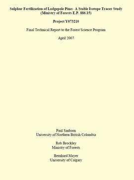
"Sulphur Fertilization of Lodgepole Pine: A Stable Isotope Tracer Study (Ministry of Forests E.P. 886.15) - Project Y051210 - Final Technical Report to the Forest Science Program"
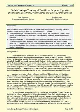
"Stable Isotope Tracing of Fertilizer Sulphur Uptake: Preliminary Data from Prince George and Nelson Forest Regions"
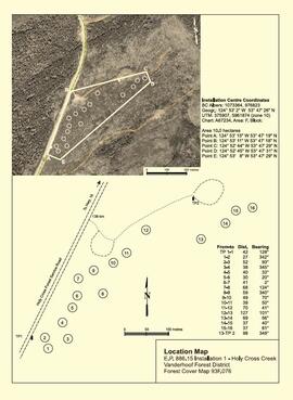
"Location Map - E.P. 886.15 Installation 1 - Holy Cross Creek"

"Location Map - E.P. 886.15 Installation 2 - Kenneth Creek"
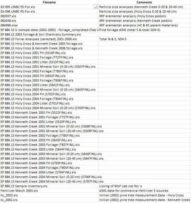
Data for Sulphur stable isotope tracer study (E.P. 886.15)
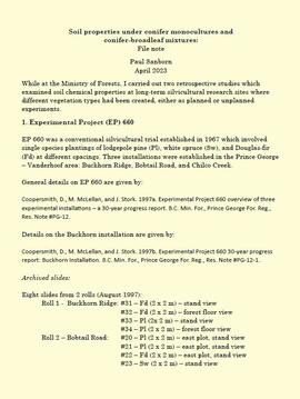
Soil properties under conifer monocultures and conifer-broadleaf mixtures
Experimental Project (EP) 660
Experimental Project (EP) 660

Forest Research Note #PG-12: "Experimental Project 660 - Overview of Three Experimental Installations - A 30-year Progress Report"

Forest Research Note #PG-12-1: "Experimental Project 660 - 30-year Progress Report - Buckhorn Installation"
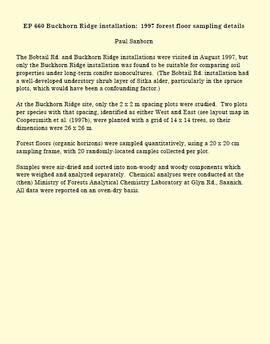
EP 660 Buckhorn Ridge installation: 1997 forest floor sampling details
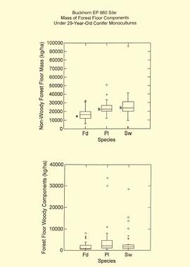
EP 660 Buckhorn 1997 forest floor graphs
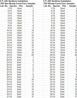
Experimental Project (EP) 660 data
Experimental Project (EP) 660 slides
Experimental Project (EP) 660 slides
Archie Creek Site
Archie Creek Site
Archie Creek site location map
Archie Creek site location map
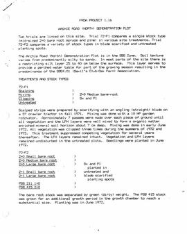
"FRDA Project 1.16 - Archie Road (North) Demonstration Plot"
"Some long term effects of scarification on soil properties and site productivity"
"Some long term effects of scarification on soil properties and site productivity"
"Forest Floor Development on Bladed Trails in the SBS: A retrospective study of the Archie Creek site"
"Forest Floor Development on Bladed Trails in the SBS: A retrospective study of the Archie Creek site"
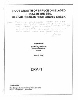
"Root Growth of Spruce on Bladed Trails in the SBS: 20-year results from Archie Creek"
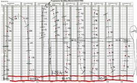
Archie Creek plot layout sketch map
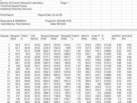
Archie Creek site data
Archie Creek slides
Archie Creek slides
Long-Term Soil Productivity Study (Experimental Project 1148)
Long-Term Soil Productivity Study (Experimental Project 1148)
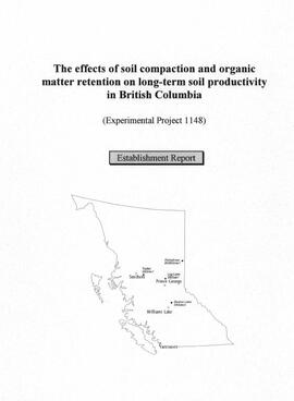
"The effects of soil compaction and organic matter retention on long-term soil productivity in British Columbia (Experimental Project 1148): Establishment Report"
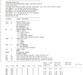
Experimental Project 1148 data
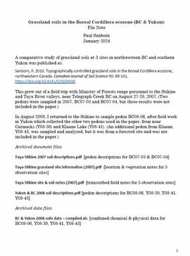
Grassland soils in the Boreal Cordillera Ecozone
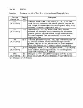
Tuya-Stikine 2007 soil descriptions
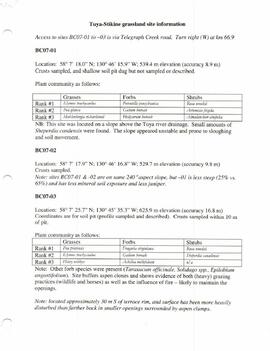
Tuya-Stikine grassland site information
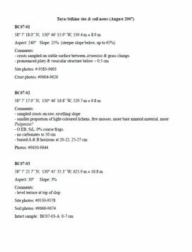
Tuya-Stikine site & soil notes
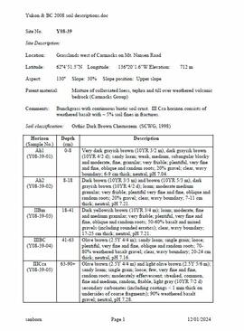
Yukon & BC 2008 soil descriptions
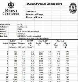
Grassland soils in the Boreal Cordillera Ecozone study data
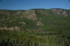
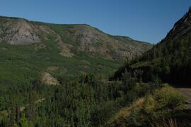
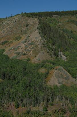
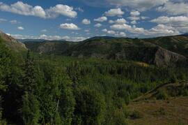
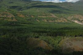
Grassland soils in the Boreal Cordillera Ecozone study images: Landscape overviews
Grassland soils in the Boreal Cordillera Ecozone study images: Landscape overviews

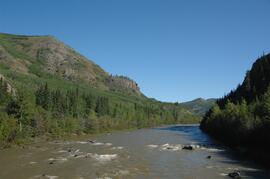
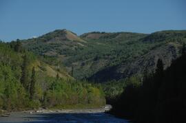
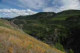
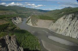
Lower Tuya River, facing downstream ~5 km above the Stikine River confluence
Lower Tuya River, ~5 km above the Stikine River confluence
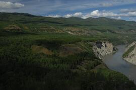
Lower Tuya River, facing upstream ~5 km above the Stikine River confluence
Lower Tuya River, ~5 km above the Stikine River confluence
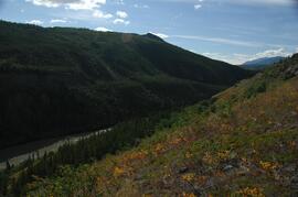
Lower Tuya River, facing upstream from bridge on Telegraph Creek Road
Lower Tuya River, facing downstream from bridge on Telegraph Creek Road
Untitled
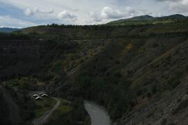
Tahltan River from Telegraph Creek Road, near Stikine River confluence
Tahltan River from Telegraph Creek Road, near Stikine River confluence
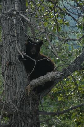
Black bear in tree

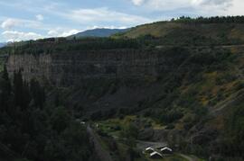
Basalt flows, north side of Stikine River along Telegraph Creek Road
Untitled
Untitled
Untitled
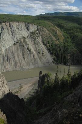
Stikine River, facing upstream ~8 km northeast of Telegraph Creek
Stikine River, facing upstream ~8 km northeast of Telegraph Creek
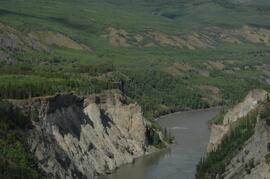
Stikine River, facing upstream ~8 km northeast of Telegraph Creek
Stikine River, facing upstream ~8 km northeast of Telegraph Creek