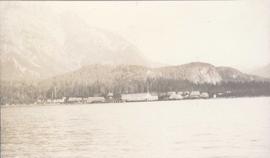
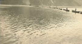
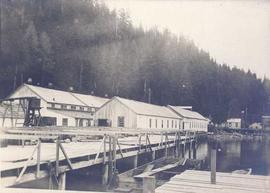
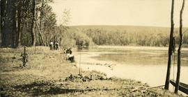
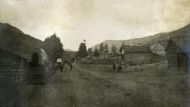
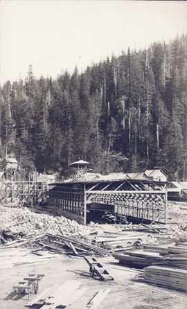
Photograph depicts a building under construction with wood planks on the dock in the foreground and a forested area in the background.
Photograph depicts a distance perspective of several cannery buildings with a body of water in the foreground and a mountain range in the background.
Photograph depicts a line of cannery fishing boats being towed across the water with the base of a mountain in the background.
Photograph depicts a cannery on pilings over the water with other cannery buildings in the background.
Photograph depicts an empty canoe floating directly in front of small white tents on opposite shore. Forest trees in background.
Photograph depicts seven or more persons, some standing on river bank with ropes, some standing in a loaded canoe with poles, forest in the background, grass, river shore and anchored boat in foreground.
Photograph depicts four men paddling a long canoe. The canoe is loaded with supplies and a dog, river and forest in the background.
Photograph depicts steep canyon wall with a river below, low mountains in the distance. Survey of 55th parallel.
File consists notes, correspondence, summary reports, inventory data, and a map regarding capability classification for Bowser Lake. The map is a "clean copy" of Grant Hazelwood's ungulate biophysical map without symbols. Summary reports include:
- Grant Hazelwood, "Ungulate Capability Classification"
- Grant Hazelwood, "Winter Flights, February 1986"
- "Ungulate Biophysical Mapping in the Stikine-Iskut Area"
Item is an original booklet entitled "Cape Scott Park Proposal" issued by the BC Parks Branch, Department of Recreation and Conservation.
Photograph depicts a view from below, looking up at a suspension bridge. Three or more people are walking on the bridge. There is a forest and building in the background.
Photograph depicts a walkway view of a suspension bridge. Several people are walking on the bridge.
File consists of "Protocol for the Creation of Forest Carbon Offsets in British Columbia," a printed web resource: "Trees for Change," and presentation pages on "B.C. Forest Carbon Offset Investment Opportunities."
Series consists of records relating to Grant Hazelwood's career as a wildlife biologist.
Photograph depicts a road bordered by people, building and fences.
Photograph depicts a road bordered by people, building and fences. A stage coach is situated on the side of the road.
File consists of C.I.F. minutes from Annual General Meeting held on May 24, 1963.
File includes:
- Canadian Institute of Forestry By-laws of the Institute
- Constitution and By-Laws of the Cariboo Section of the Canadian Institute of Forestry
- Petition to the director of the Canadian Institute of Forestry for the formation of a new section to be called Cariboo Section
- By-laws of the Manitoba section of the Canadian Institute of Forestry
- related correspondence.
File includes:
- C.I.F. Annual General Meeting 1959 program
- Canadian Institute of Forestry - Cariboo Section "Sustained Yield Does Note Exist in Central British Columbia" March 1962 and related correspondence.
File consists of records and textual material related to caribou (predominantly in British Columbia) collected by Grant Hazelwood. Highlights include:
- BC Ministry of Environment, "Woodland Caribou in the Thompson-Nicola Resource Region", June 1981
- R.W. Ritcey, "Caribou and Forest Management in British Columbia", Jan. 1974
- W.G. Hazelwood, "Northern Tweedsmuir Park Flight - October 9, 1979"
- William Low, "A General Ecological Study of Mountain Caribou in Tweedsmuir Provincial Park, British Columbia", Mar. 1965 (reproduction)
- W.G. Hazelwood, Northwood Pulp and Timber, "Caribou Flight - March 19, 1980"
- Grant Hazelwood, manuscript notes for caribou flight over the Stikine, Mt. Edziza, Dease Lake areas, 9. Oct. 1979
- Report prepared for Dupont of Canada, "Caribou Studies in the Vicinity of Lawyers Pass, Northcentral B.C., Sept. 1980 to Aug. 1981", Mar. 1982 (reproduction)
- Spatsizi Association for Biological Research, "1980-81 Progress Report No. 8"
- Deborah Cichowski, "Habitat Use, Winter Feeding Ecology and Population Status of Woodland Caribou in West-Central British Columbia", 1990
- Dale R. Seip, "Ecology of Woodland Caribou in Wells Gray Provincial Park", Mar. 1990
Footage of a large caribou bull in what is believed to be the Rainbow Mountains.
Footage of a caribou herd.
Probable locations of filming include the Chilcotin area, Rainbow Mountains, or Tweedsmuir Provincial Park.
Photograph depicts a caribou head, velvet antlers intact. Head is resting in a snow patch, two men and alpine forest in the background.
Item is an original booklet entitled "Carp Lake Park Proposal" issued by the BC Parks Branch, Department of Recreation and Conservation.
Item is a reproduction of a report by Leon Pavlick entitled "Carp Lake Park Report: 1973". Includes accompanying original Carp Lake Provincial Park brochure from 1983.
File consists of outgoing correspondence from BCUC to the Carrier Sekani Tribal Council and the Cheslatta Carrier Nation. Also includes incoming correspondence to BCUC from tribal council and the Cheslatta Band, as well as their representatives.
File consists of the second draft of a transcript of the meeting between the Department of Fisheries and Oceans (represented by Bell-Irving, Fretwell, and Blacket), the Aluminum Company of Canada (represented by Bill Rich, Brian Hemmingway, Doug Bruchet, Bruce Jenkins, and Clyde Mitchell), and the Carrier Sekani Tribal Council (Edward John, Justa Monk, Morris Joseph, et al) regard studies conducted by the Department of Fisheries and Oceans and the Aluminum Company of Canada Ltd. on the Nechako River and its resources. Document sent to Hartman by John Hummel, Cheslatta Band researcher, who included an accompanying letter. Annotated by John Hummel.
File consists of a conference paper by Weller titled "Cascadia: Regional Trade and Separatist Politics." This file was originally numbered to correspond with conference paper number 87 listed in Weller's CV.
File consists of Canadian Technical Report of Fisheries and Aquatic Sciences No. 1477 entitled "Case Histories of Regulated Stream Flow and its Effects on Salmonid Populations" by D.W. Burt and J.H. Mundie.
File consists of a published copy of Burt and Mundie's Canadian Technical Report of Fisheries and Aquatic Sciences report entitled "Case Histories of Regulated Stream Flow and its Effects on Salmonid Populations". Includes accompanying correspondence related to the publication.
Photographs depict aerial views of the Cassiar townsite, plantsite, tailings pile, mine road, bench and pit mine, mine buildings (tramline loading station, crusher, shop, and garage), and surrounding mountain range. Here "aerial" refers to photos depicting a large area and taken from the air or from a high point of elevation.
A set of 13 maps showing approximate waste extraction areas for different benches during certain months of 1972. Extraction dates are included accompanied by estimated total tonnages for each planned extraction area. All plans are hand drawn using colored pencils, lead and black ink. Approximate calculations of extraction tonnages are included within certain months. Numerical bench markers are included. Total tonnages from the previous year and previous surveys are included within certain plans.
Fonds consists of textual, photographic, cartographic, electronic and promotional films/video recordings related to the mining operations of Cassiar Asbestos Mining Corporation (CAMC) and creation of Cassiar townsite. CAMC records primarily consist of records related to mining operations including construction, engineering, daily mining operations, administration of CAMC, tallies of extractions, labour and union activities, corporate events and visits by dignitaries. Townsite records are primarily visual representations of townsite construction, including the creation of health, education and community services including Cassiar's private hospital, school, library, as well as townsite images. Photographs include documentation of natural and man-made landscapes within the Cassiar region of Northern BC. Other holdings include a near complete run of Cassiar's community newspaper.
Cassiar Asbestos Corporation Ltd.Original linen map depicts mining claims in the Cassiar District of British Columbia that were located in 1900-1901: L. 115 Princess Louise, L. 310 North Star, L. 311 Bonanza, L. 309 Emerald, and L. 312 Emma.
Photograph depicts a caterpillar tractor and a bulldozer working on a ditch cut through a forested landscape. Handwritten annotation on recto reads: "see #1 cut go wide on top". Handwritten annotation on verso reads: "caterpiller tractor and bulldozer working on ditch"
Item is a reproduction of a report by Grant Hazelwood entitled "Cathedral Provincial Park Horse Trip Report - September 18-22, 1979".
Item is an aerial photograph of mill by a waterway.
File consists of notes, clippings, and reproductions relating to historical and contemporary natural resource surveys in British Columbia. Includes material on oil discovery, farming conditions, timber stands, the Alaskan Highway, and railway development. File predominantly consists of search results from the University of Northern British Columbia library, College of New Caledonia library, and Prince George Public Library regarding British Columbia's natural resource surveying.
File consists of notes, clippings, and reproductions relating to British Columbia's central interior forestry industry. Includes material regarding beehive burners; economic viability of timber in Prince George, Quesnel, Burns Lake, and Houston; the Canfor pulp mill in Prince George; and Carrier Lumber Ltd. mill in Prince George. File primarily consists of clipped articles from the Prince George Citizen newspaper, including "Forest Expo 2004" special edition of the Prince George Citizen newspaper (1 June 2004).
File consists of a licence and framed certificates and photographs for Harry Coates. File includes:
- Scaling Licence (1962)
- two certificates celebrating Harry Coates' 25 years of service with the Forest Service (1982)
- photograph of Harry Coates, [Ted or Jed?] Baker, and John Revel at Aleza Lake Research Forest Re-opening July 9, 1992.
- Photograph of Harry Coates and John Revel, identifying plaque reads "Buckhorn Lake E.P. 660".
File consists of memorandum to Deputy Minister from I.T. Cameron, Chief Forester, June 13, 1973.
File consists of a memorandum from E.L. Young, Chief Forester, September 11, 1974.
File consists of photocopied material regarding the Aleza Lake Experimental Station from the Canadian Forest Service Archives in Victoria. Also includes handwritten notes.
File consists mostly of lists of Canadian Forestry Service experiment sites and plots with some related maps and notes.
File consists of "Summary of CFS Prescribed Fire Research on Backlog NSR Land in Northern Interior B.C. Supported by the 1985-90 FRDA Agreement" prepared for the Research Silviculture's Field Tour July 25-28, 1988.