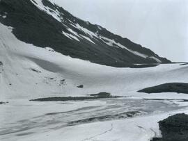
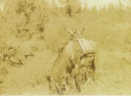
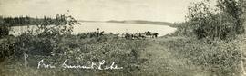
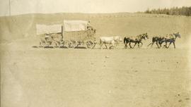
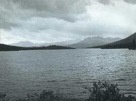
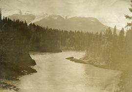
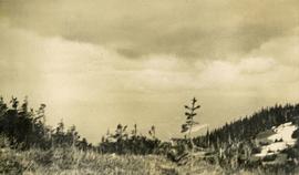
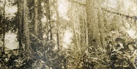
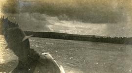
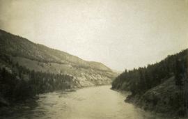
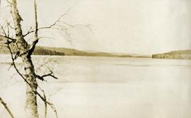
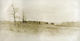
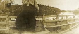
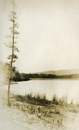
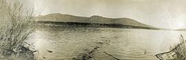
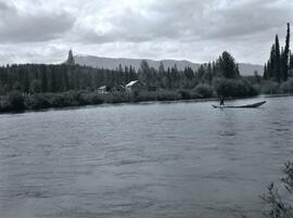
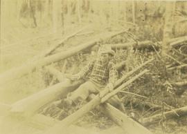
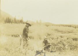
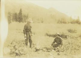
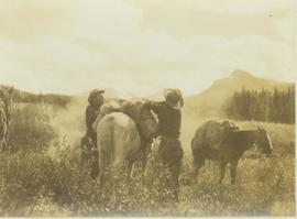
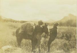
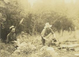
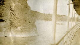
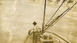
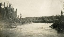
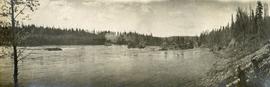
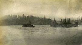
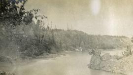
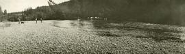
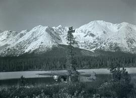
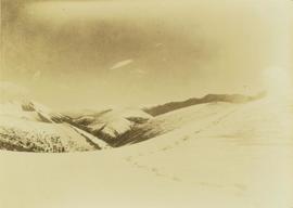
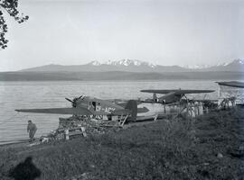
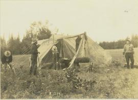
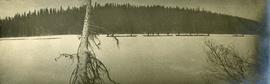
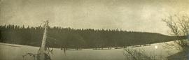
File consists of notes and reproductions relating to George Dawson and the Geological Survey of Canada. Includes: "Museum Mirror" Fraser-Fort George Regional Museum newsletter vol. 1 no. 2 (June 1986). File also includes photographs depicting various sights around British Columbia from George Dawson's explorations (1983 reproduced).
File consists of notes and reproductions relating to George Mercer Dawson (August 1, 1849 - March 2, 1901), a Canadian geologist and surveyor with the Geological Survey of Canada.
Handwritten annotation on verso reads: “The KGB + We in Vienna - World Hockey Championships 1977 - Geoff Gowen - Roger Jackson to left”. Building is the Museum of King Jan III's Palace at Wilanów, Warsaw, Poland
Subseries consists of materials collected and created by Kent Sedgwick for research regarding fur trade history in British Columbia. Includes histories of the Hudson's Bay Company; historic trails utilized for fur trade; fur trade by the North West Company in the interior of British Columbia; Simon Fraser, a Canadian explorer and fur trader with the North West Company; and David Thompson, a surveyor, cartographer, and fur trader with the Hudson's Bay Company.
Photograph depicts a frozen pond located in a snowy landscape on the east side of Copper Mountain.
Photograph depicts the front view of a pack horse bearing a Prentiss Gray's tripod and camera on a special saddle.
Photograph depicts two men preparing to load a canoe on a wagon. Two blanketed horses stand nearby with one person attending. There is a lake in the background, wild grasses and brush in the foreground.
Photograph depicts 2 large covered wagons pulled by a team of six horses, dry vegetation in the foreground & background.
Photograph depicts the south view of Fredricksen Lake with mountain ranges depicted in the background.
File consists of notes and reproductions relating to Fred Burden, a surveyor in British Columbia who surveyed tar sands in the Fort McMurray region and returned to Prince George in 1921 to complete a topographical survey of Prince George.
Photograph depicts a large river from a bird's eye view, forest and rocks on the water's edge, snow capped mountains in the background.
Photograph depicts view from a high mountain ridge. There is a river valley and clouds in the distance.
Photograph depicts lush forest growth, a tent or tarp is set up on the left of the photo.
Photograph depicts view of the river from a boat. There is a silhouette of a person wearing a hat in the foreground.
Photograph depicts a view of the Fraser River bordered by sparsely treed hills. Album notes: "views of Chilcotin".
Photograph depicts a lake. Photograph is framed by a deciduous tree on the left. Forest and rolling hills in the background.
Photograph depicts a view of the Fraser Lake ferry house from a distance.
Photograph depicts view from behind the ferryman and ship's wheel. Fraser Lake and treed hills in the background.
Photograph depicts roughly cleared land in the foreground, a lake and rolling forested hills in the background.
Photograph depicts the lake from the water's edge. Low forested hills in the background.
File consists of notes, clippings, and reproductions relating to Frank Swannell, who was a surveyor in British Columbia that surveyed many areas across the province between 1898 and 1908.
Photograph depicts Frank 'Shorty' Weber steering a dug-out canoe on the Omineca River. The background of the photograph depicts log cabins at Old Hogem built along the shoreline of the river in front of a forest with a mountain ridge in the background.
Frank ‘Shorty’ Weber had a trapline on the upper Ingenika for over 30 years. and he was well-known in the Finlay River area.
Photograph depicts Frank Dewing cutting a trail through an area covered with windfall consisting of fallen trees.
Photograph depicts Frank Dewing and Joe Callao next to a campfire in a bush covered field. In the background the tree line of a forest is visible.
Photograph depicts Frank Dewing and Joe Callao next to a campfire with travel packs in the foreground. In the background a forest tree line and mountain range is visible.
Photograph depicts Frank Dewing and Joe Callao in a bush covered field loading up a pack horse while another laden pack horse stands to the side. In the background a mountain range is visible.
Photograph depicts Frank Dewing and Joe Callao loading up a pack horse in a grassy field. In the background a mountain range is visible.
Photograph depicts Frank Dewing to the left and Elmer Keith on the right washing dishes in camp. In the background a densely forested area is visible.
File consists of material relating to Frank Cyril Swannell, a surveyor of British Columbia. Materials include a magazine, correspondence, newspaper clippings, photograph reproductions, journal articles, and journal notes compiled by Audrey L'Heureux. Highlights include:
- Swannell, F.C, "Report on Topographical Surveys in Omineca District", 1912 (reproduced journal article)
- Corporation of Land Surveyors, "The Link", Vol.1 No.2 , 1977 (magazine)
- BC Provincial Archives, "Exploring Surveyors Making Canoe Finlay River", 1913 (photograph reproduction)
- BC Provincial Archives, "Surveying Omineca Exploration", [191-?] (photograph reproduction)
Image depicts four unknown individuals studying a plant.
Photograph depicts four men pinning a "Union Jack" flag to the exterior of a building.
Unidentified adult and child can be seen on sidewalk of courtyard in distance at the Museum of King Jan III's Palace at Wilanów, Warsaw, Poland. Photograph taken during European Sports Tour with Team Canada.
Photograph depicts a view of the rocky shores of Fort George Canyon from the deck of a steamship.
Photograph depicts a view of the swirling waters of Fort George Canyon from the deck of a steamship.
Photograph depicts a view of Fort George Canyon.
Photograph depicts a view of Fort George Canyon from the shore. A steamship is in the centre of the river.
File consists of notes, clippings, and reproductions relating to the Fort George Canyon. Includes: "City of Prince George" typescript letter from Kent Sedgwick to Mr. Ron Drane, Manager of Pine Centre (7 June 1984) and "Fort George Canyon Hiking Trail" pamphlet published by the Fraser-Fort George Regional Museum (July 1984). Also includes photographs depicting the Fort George Canyon and men hiking the trail (1985).
Photograph depicts misty waters and small islands in the river.
Photograph depicts Fort George Canyon from a lofty view. A small building is situated on the river's edge.
File consists of notes and reproductions relating to Fort Alexandria (later renamed Alexandria). Fort Alexandria was an HBC trading post, ferry site, and steamboat landing in the North Cariboo, 45 km south of Quesnel. File contains photographs depicting Fort Chilcotin, the landscape and buildings (Sept. 1983 and Aug. 2006).
Photograph depicts three men and a dog on the streambank, several horses loaded with packs on the opposite bank.
Photograph depicts a CF-AAM float plane stopped after a forced landing on Sustut Lake in front of Sentinel Peak.
Photograph depicts an unidentified guide lying in the snow on top of a mountain peak searching for game through a pair of binoculars. In the foreground footprints in the snow are visible while the background features a snow-covered mountain range.
Footage of ducks on a lake and flying away, horses in a corral, a campsite, caribou in the high country of the mountains, probably the Rainbow Mountains, a campsite where men are packing horses and game kill and their journey home in pack train.
Possible locations of filming include Anahim Lake, Chilcotin area, Holt Homestead, Rainbow Mountains, Tweedsmuir Provincial Park, or Wells Gray Provincial Park.
Photograph depicts a man standing to the left of a CF-ABK float plane and a Fokker AAM float plane resting on the water on Takla Landing.
Image depicts five unknown individuals somewhere near Mt. Robson.
Photograph depicts five unidentified men setting up a tent on a grassy field.
Photograph depicts five long canoes with several men attending. The canoes are traveling through a narrow strip of open water. The majority of the river is covered in ice. Forested trees are on the far river shore.