Affichage de 66 résultats

Archival description
Autre
Aperçu avant impression Hierarchy Affichage :

66 résultats avec objets numériques Afficher les résultats avec des objets numériques

Bob Harkins television excerpts and UNBC Convocation address by Bridget Moran (1995)

File consists of recorded DVD, containing the following video recordings:

  • Harkins! - Nov. 23, 1990
  • CKPG-TV excerpt- Oct. 3, 1992
  • CKPG-TV: Bob Harkins Comments- Dec. 18, 1992
  • CKPG-TV: Bob Harkins Comments- April 5, 1993
  • UNBC Convocation Address by Bridget Moran – May 26, 1995

DVD Summary

Context: DVD contains recordings originally broadcast on CKPG-TV News, the Prince George CBC affiliate station. It contains multiple recordings of either interviews with Bridget Moran or TV broadcast announcements and news stories relating to Moran’s publications and awards; as well as an excerpt from the May 1995 UNBC Convocation Ceremony featuring Moran’s Convocation Address.

Individual video segments as follows:

(1) Harkins!
Date: 23 November 1990
Length: 30’ minutes
Scope and Content: Contains a recording of a Bob Harkins of Harkins! interviewing Bridget Moran on her books Stoney Creek Woman, Judgement at Stoney Creek and her upcoming publication A Little Rebellion.

(2) CKPG-TV News excerpt Date: 3 October 1992 Length: 2’46” minutes
Scope and Content: Recording of CKPG-TV News excerpt featuring Bridget Moran speaking about her latest publication A Little Rebellion while at a Mosquito Books book signing event.

(3) CKPG –TV News: Bob Harkins Comments
Date: 18 December 1992
Length: 3’minutes
Scope and Content: November weather forecast for Prince George and region, followed by Bob Harkins Comments featuring Bridget Moran and her new book A Little Rebellion.

(4) CKPG –TV News: Bob Harkins Comments
Date: 5 April 1993
Length: 1’35”minutes
Scope and Content: Bob Harkins Comments featuring Bob Harkins speaking about Mary John and Bridget Moran receiving the Governor General’s Award for Outstanding Community Service from MP Brian Gardiner at a ceremony at Mosquito Books in Prince George.

(5) UNBC Convocation Address Date: May 26, 1995
Length: 11’53”minutes
Scope and Content: UNBC president Geoffrey R. Weller introduces Bridget Moran who then delivers her Convocation Address to the students of the May 1995 graduating class. Her speech focuses on change
– positive change - in the realm of education.
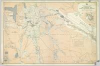
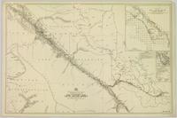
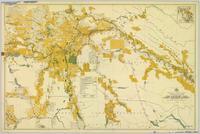
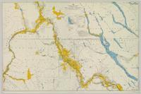
Pre-Emptor’s Map, Fort George Sheet

Colour-coded map depicting lands open for pre-emption, lands in “University Reserve,” and lands reserved for public auction. Depicts land recording divisions, communities, bodies of water, transport routes, and game reserves.

Pre-Emptor’s Map, Fort George Sheet

Colour-coded map depicting lands surveyed as alienated, reserved, Statutory Timber Lands, B.C. Land Settlement Board Area, or open for pre-emption. Depicts land districts, land recording divisions, communities, game reserves, bodies of water, transport routes, and communication lines.

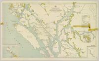
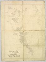
Preliminary Map, Grenville Channel

Colour-coded map depicting lands surveyed as alienated, reserved, and having a timber license, lease, or sale. Depicts land recording divisions, land district boundaries, communities, bodies of water, and transport routes. Includes insets of Stephens Island and Egeria Reach.

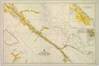
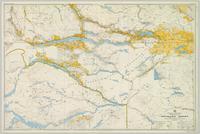
Bulkley Sheet

Colour-coded map depicts lands surveyed as alienated, available for purchase or lease under Taxation Act, or reserved. Depicts land district boundaries, land recording divisions, triangulation stations, telegraph/telephone lines, communities, bodies of water, and transport routes.

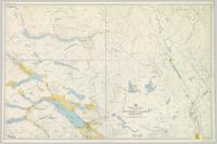
Stuart Lake Sheet

Colour-coded topographic map depicting lands surveyed as alienated, available for purchase or lease under Land Act, or reserved. Depicts land district boundaries, land recording divisions, provincial forest boundaries, HBC posts, triangulation stations, telephone lines, communities, bodies of water, and transport routes.

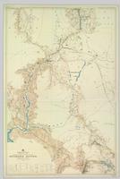
Nechako Sheet

Colour-coded topographic map depicts surveyed lands alienated, available for purchase or lease under Land Act, and available for pre-emption. Depicts land districts, land recording districts, provincial forests, parks, triangulation stations, communities, bodies of water, transport routes, and communication lines.

Peace River

Colour-coded topographic map depicting surveyed lands alienated, available for purchase or lease, or available for pre-emption. Depicts land districts, land recording districts, parks, communities, bodies of water, transport routes, communication lines, and triangulation stations.

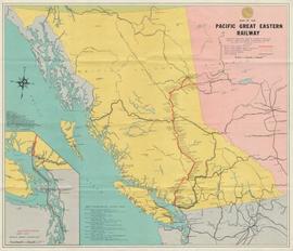
Pacific Great Eastern Railway (PGE) Track Inspection with V-8 Vehicle

This clip of original film footage depicts Pacific Great Eastern Railway (PGE) track inspection with a V-8 vehicle.

Clip description with timing reference to scenes:

  • 0.01 The Fraser River above Marble Canyon near Moran
  • 0.22 At the Tunnel at mile 168.9 between Fountain and Glenfraser
  • 0.25 Scenes at Moran mile 181
  • 0.37 Inspecting the 2 tunnels at mile 186.5
  • 0.44 Water tank just north of Kelly Lake and south of the wye at Kelly Lake Mile Mile 191.5
  • 1.04 Wood Trestle at 51 mile creek Mile 206
  • 1.15 Lac La Hache station and section house in the background
  • 1.30 Williams Lake station
  • 1.43 Lone Butte Water tower
  • 1.46 The Lone Butte rock formation
  • 2.01 Alta Lake station right and Water tower in distance
  • 2.06 Outside the east side of the Squamish roundhouse. Track ahead of car leads to yard. Water tower to right
  • 2.15 A shot of the back side of the Squamish roundhouse looking south. 563 has had its trucks converted from 6 wheel to 4 wheel and is looking real clean. This must be late 1954. Steam locomotive 163 in final months of service and was cut up for scrap in July 1956
  • 2.20 Cheakamus
  • 2.24 Garibaldi Mile 59.5. Line to the left goes to the sawmill there
  • 2.27 Inspecting the bridge at mile 55.6 in the Cheakamus canyon. Looking south from the south end of the bridge. Telegraph wires in the right of clip
  • 2.31 Same bridge looking north
  • 2.37 Bridge at mile 56.5 in the Cheakamus Canyon
  • 2.42 Stopped at the water tank at the place called Watertank mile 62.5. Section house to the right of tracks.
  • 2.58 Heading north around Pinecrest Mile 64 or 65
  • 3.07 Stopped at the mill at Parkhurst around mile 80 on the east side of Green lake
  • 3.23 Watching a south bound train pass at Tisdall
  • 3.32 Diesel hauled train coming to Tisdall at the old location of the north switch. Locomotives still with their 6 wheel trucks so before 1954. Note locomotives spread out in the train so all the weight was not on small bridges at one time
  • 3.50 In the canyon north of Lillooet; man in brown suit and fedora is W.H. (Harry) Nichols
  • 3.58 Along Alta Lake
  • 4.12 Scenes along Anderson Lake north of Darcy
  • 4.35 Royal Engineers bridge at Lillooet
  • 4.42 GE diesel with either steam ditcher or steam crane just north of Lillooet
  • 4.47 General Store at Pavillion Mile 178.2
  • 4.52 Quesnel Station
  • 5.04 Unknown Location
  • 5.20 Gang working with tamping machine?
  • 5.31 Cottonwood River Bridge. New just before the line to Prince George opened in 1952. Also scenes around the Cottonwood River
  • 5.57 Ahbau Creek Bridge Mile 406.1 Prince George Subdivision. The last spike to complete the line to Prince George was driven at the north end of this bridge. Ahbau Creek was named after a local Chinese prospector and trapper
  • 6.16 At the CN Prince George shops near to where the Correctional Facility is today. CN Bridge across the Fraser River in distance
  • 6.37 Construction of the PGE crossing of the Fraser River at Prince George
  • 6.59 PGE middle yard at Prince George
  • 7.10 Heading back south to the main yard. CN Fraser River bridge in shot
  • 7.22 Marguerite station
  • 7.35 Hawks Creek or Deep Creek Bridge mile 329.9. One of the worlds highest railroad bridges at 312 feet high

Note: The miles in the notes are the current mileages. At the time of the filming the line to North Vancouver had not been completed. The mileages at that time would have read 40 miles less in the mile boards.

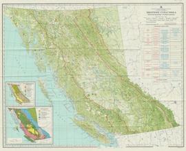
"British Columbia Physiographic Subdivisions"

Item is a map compiled and produced by Geographic Division, Surveys and Mapping Branch, Department of Lands, Forests, and Water Resources ; geological and physiographical data supplied by Dept. of Mines and Petroleum Resources, Victoria, B.C. (1964).

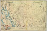
Northern British Columbia

Regional map depicting communities, parks, customs posts, airports, radio stations, hatcheries, bodies of water, transport routes, communication lines, elevation points, and lines of batholith contacts. Includes an inset of St. Elias Mountains. Includes “Special Note on the Mineralization of this Map Area” from Bureau of Mines, Victoria, B.C.

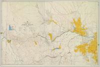
Pre-Emptor’s Map, Nechako Sheet

Colour-coded map depicting surveyed lands alienated, reserved, in B.C. Land Settlement Board Area, or open for preemption. Depicts land districts, land recording divisions, communities, bodies of water, transport routes, and communication lines.

Pre-Emptor’s Map, Peace River Sheet

Colour-coded topographic map depicting lands surveyed as alienated, reserved, or open to preemption. Depicts land districts, land recording divisions, communities, bodies of water, communication lines, and transport routes.

Pre-Emptor’s Map, Prince Rupert Sheet

Colour-coded map depicting surveyed lands respectively open and closed to preemption. Depicts land recording divisions, land district boundaries, government reserves, communities, bodies of water, and transport routes. Includes topographical inset.

Map of area covered by Tree Farm Licences no. 1 and no. 40 for Columbia Cellulose and Skeena Kraft

Item is a map that distinguishes the regions covered by Tree Farm Licence No. 1 granted to Columbia Cellulose and Three Farm Licence No. 40 granted to Skeena Kraft. Major locations indicated in this map include: Prince Rupert, Terrace, Hazelton, Smithers, Kitimat, Skeena River, and Nass River. Railway routes are also shown.

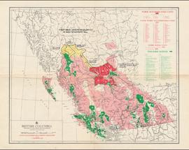
British Columbia

Item is a map of British Columbia and is a key map showing: maps published on scale 1 inch to 2 miles and summary zones of the provincial forest inventory. Map includes index of post offices correct to October 22, 1956.

Résultats 1 à 50 sur 66