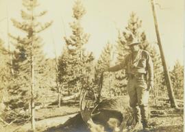
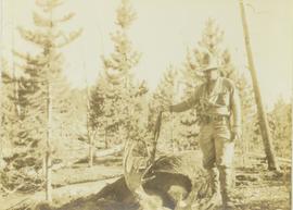
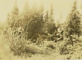
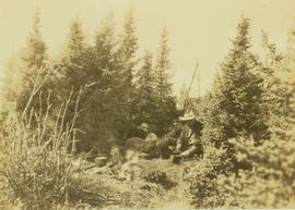
Item is a reproduction of a report by Leon Pavlick entitled "Carp Lake Park Report: 1973". Includes accompanying original Carp Lake Provincial Park brochure from 1983.
File contains slides depicting images of areas in the Carp Lake Provincial Park.
Habit of <i>Andromeda polifolia</i> in flower, Churchill, Manitoba [?]
Mountain meadow
<i>Xeromphalina campanella</i> and green moss covering a fallen tree
Image depicts a red carriage labelled in yellow "B.C. Express Co. No. 20." It is possibly located in Kamloops, B.C.
Image depicts a close-up of the carriage step. It is possibly located in Kamloops, B.C.
File consists of material relating to Carrie Jane Gray, a Mayor and Alderman on Prince George City Council who took part in several community organizations. Her dedication to Prince George is the reason why a former landfill was turned into park was named in her honour. Materials include newspaper clippings and reproductions of articles.
South Fort George Park, Prince George, British Columbia
File consists of notes and a reproduced map relating to Carrier Lake in the Omineca region, 35 km east from Fort St. James.
Collection consists of a set of 4 Carrier language audio recordings from a UNBC class, a set of 4 audio recordings from the Carrier Language Translation Project, a Carrier dictionary, and Carrier language publications.
Linden, CarolynVideotape contains footage of: [Sep-08?] - Carrier language program taught at CNC in Burns Lake in collaboration with CNC, UNBC, and Lake Babine Nation
Typed annotation on recto: "Tachi Village Indians (Carrier Tribe) Stuart Lake, B.C." Close up of an older woman with a small child on either side. The woman is smoking a pipe, and unidentified buildings can be seen in background.
Series consists of correspondence and reports on First Nations and the northern university.
File contains correspondence and reports on educational concerns of First Nations.
File contains a report on First Nations concerns regarding the University of Northern British Columbia and a cover letter.
File contains correspondence, a position paper and reports concerning education and First Nations and miscellaneous textual material.
File contains textual materials pertaining to an aboriginal studies program as part of a proposed northern university and includes correspondence, a press release, a meeting agenda, a copy of a government consultation paper and a report entitled “Planning the future of native adult education and vocation training in north central British Columbia”.
File consists of outgoing correspondence from BCUC to the Carrier Sekani Tribal Council and the Cheslatta Carrier Nation. Also includes incoming correspondence to BCUC from tribal council and the Cheslatta Band, as well as their representatives.
File consists of the second draft of a transcript of the meeting between the Department of Fisheries and Oceans (represented by Bell-Irving, Fretwell, and Blacket), the Aluminum Company of Canada (represented by Bill Rich, Brian Hemmingway, Doug Bruchet, Bruce Jenkins, and Clyde Mitchell), and the Carrier Sekani Tribal Council (Edward John, Justa Monk, Morris Joseph, et al) regard studies conducted by the Department of Fisheries and Oceans and the Aluminum Company of Canada Ltd. on the Nechako River and its resources. Document sent to Hartman by John Hummel, Cheslatta Band researcher, who included an accompanying letter. Annotated by John Hummel.
Series comprises correspondence and other textual material.
Close up of Elder First Nations woman in front of unidentified building. Typed annotation on recto: "Carrier Indian Squaw at Tachi Village Stuart Lake Section - B.C."
Photograph depicts Carrol Paul (left) and George Bates (right) standing with pack horses loaded with bull moose meat. In the background a burnt forest is visible.
Photograph depicts Carrol Paul (left) and George Bates (right) holding rifles and standing beside two felled bull moose. In the background a sparse forest is visible.
Photograph depicts Carrol Paul (right) and Harry Snyder (left) sitting on the ground during a tea break. In the background is a forested area filled with coniferous trees.
Photograph depicts Carrol Paul fishing along the banks of a creek. In the background a bush covered shoreline is visible.
Photograph depicts Carrol Paul fishing along the banks of a river. In the background is a forested shoreline.
Photograph depicts Carrol Paul standing to the left beside a felled bull moose while George Bates sits on top of a felled bull moose.
Photograph depicts Carrol Paul standing with rifle on top of felled bull moose. In the background a sparse forest is visible.
Photograph depicts Carrol Paul (left), unidentified man (middle), and Harry Snyder (right) sitting on the ground next to a small camp fire during a tea break. To the far left an unidentified fourth man is sitting amidst the bushes around the camp fire.
Photograph depicts Carrol Paul (left), unidentified man (middle), and Harry Snyder (right) sitting on the ground next to a small camp fire during a tea break. Surrounding the camp set up are several small coniferous trees.
Frontal detail
Skeena River running through rocky cliffsides, Northern British Columbia
Photo depicts a street perspective cars lining Third Avenue, in Prince George, BC, ca. 1950. Annotation recto reads: "3rd Ave Prince George BC Photo J. Wrathall." Handwritten annotation in pen on verso of postcard reads: “This is the equivalent of our Granville Street. Both theatres are located here as well as Hudson Bay Co., banks, library & stores.”
Elevated view of Third Avenue in Prince Rupert. Several cars and delivery trucks are visible driving along the road. Printed annotation on recto reads: "3rd Ave Prince Rupert BC Photo by Wrathalls."
Photograph depicts two cars with their front ends welded back-to-back.
Street view photograph looking down Carson Avenue at the Front St. intersection in Quesnel, BC. Several identified businesses line the gravel avenue on the right; however Cowan's Hardware store is visible at the intersection on the left. Printed annotation on recto reads: "Carson Ave., Quesnel, B.C. 1930 Looking East."
The item depicts plans for the interior basement, main floor, second floor and the roof of the Carter House at 1850 10th Avenue, Prince George. Original plans drafted in April 1979 and approved by the city and stamped on 1 June 1979. Annotations include notations regarding scale and other measurements.
The item depicts plans for the exterior, longitudinal and transverse sections of the Carter house at 1850 10th Avenue, Prince George.
Image depicts the Carter Industrial Area in Prince George, B.C.
The Cartographic Materials series consists of maps, plans, schematics and blueprints documenting a wide variety of subject areas pertaining to both the operation of the Cassiar Asbestos Corporation Ltd., and the company township of Cassiar, B.C.
Cassiar Asbestos Corporation Ltd.Subseries consists of cartographic material separated from Campagnolo’s government textual record files. Includes government maps of British Columbia created by the Department of Energy, Mines and Resources Surveys and Mapping Branch; tourist road maps of BC, Prince Edward Island, Corner Brook, and Regina; maps relating to the oil and gas industry; maps of site plans for proposed developments; and a map of Edmonton for the XI Commonwealth Games.
Series consists of two maps: one related to the traveled route of the surveyors of the Bedaux Sub-Artic Expedition in 1934; and the other related to a goldmine and a hotel in Africa.
Maps within this series document the placer streams, islands and harbours of the Queen Charlotte Islands; as well as the mining properties located within the vicinity of Stewart, BC.
Carvings sit among bushes in front of what appears to be a totem pole.
Handwritten annotation on verso reads: "Eagle & whale Monument Tanu".