2000.1.1.2.03.07
·
Item
·
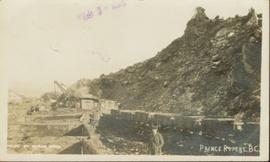
9 July 1964
Part of Cassiar Asbestos Corporation Ltd. fonds
Handwritten annotation on recto of photograph: "RETAINING WALL POUR JULY 9/64." Photograph depicts two construction workers standing on retaining wall in foreground. Two other men stand near a crane operating in midground, with its load suspended above men on wall. Crane stands on road between a building and retaining wall, mountain range in background.