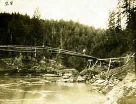
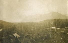
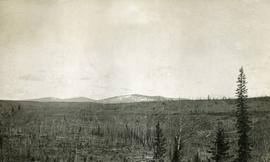
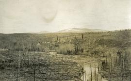
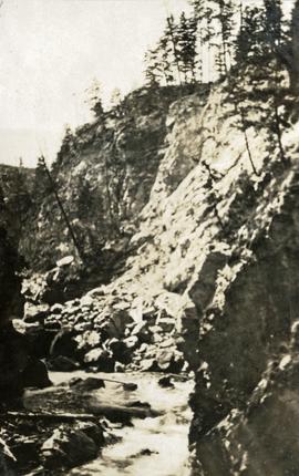
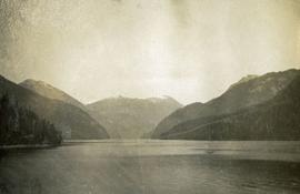
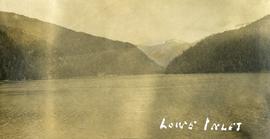
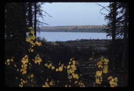
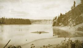
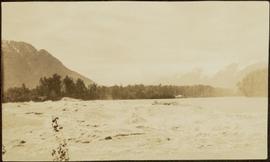
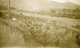
Photograph depicts a view of a log jam on the Kettle River from Billings siding.
Three men can be seen carrying bundles across bridge above river, forest on shore in background.
Handwritten annotation on verso reads: "Upper Nass River. Chapt. XXII. No. 4. An Indian Bridge on a canyon."
Photograph depicts a forested mountain, the bottom half of which has been logged and terraced; beneath the mountain is a railroad track and parked vehickes including a schoolbus and two dumptrucks.
Handwritten annotation on verso reads: “Fairview Sodturning, Prince Rupert, 1/3/75”.
Image depicts a logging area somewhere near Prince George, B.C.
Image depicts numerous piles of logs, and two unidentified individuals operating an excavator with a "thumb" attachment during the demolition of the Upper Fraser town site. Map coordinates 54°06'51.6"N 121°56'26.3"W
Image depicts a pile of old logs on the bank of the Fraser River with mountains in the background. In the foreground, a set of railway tracks run through an uncertain location, likely Upper Fraser, B.C.
Photograph depicts one unidentified man surveying a landscape from a snowy mountain peak with other mountain ranges in the background.
Slightly elevated photograph of Prince Rupert buildings. A lone vessel is visible in the background. Printed annotation on recto reads: "Courtesy of Can Nat'l Rys. Prince Rupert. B.C." Handwritten annotation on verso reads: "Dear Elma. We reached Prince Rupert (in the picture) today. Friday we arrive at Skagway and the glaciers. Having a fine trip- good weather and a good crowd. Love from Claire." Postcard is addressed to: "Mrs. Claude Millersh, River Forest, Guerneville, Sonoma Co., California." Postcard is affixed with a two cent American stamp. Postmark on verso reads: "Ketohikan Alaska. Jun 28 3 PM 1928."
Image depicts a house surrounded by trees and a mountain in the background; it is most likely located somewhere in or near Longworth, B.C.
Image depicts four unidentified individuals walking along the bank of the Fraser River in Longworth, B.C.
Image depicts numerous piles of wood in Longworth, B.C.
Image depicts two unidentified individuals standing next to the train station, and two railway tracks running through Longworth, B.C.
Image depicts the Fraser River and a mountain in Longworth, B.C.
Image depicts several old shacks and some railway tracks running through Longworth, B.C.
Image depicts the post office in Longworth, B.C.
Photograph depicts a man walking toward the photographer on a railroad track. Along side the track is newly cleared land with some building and tents. Forested hills and mountains in the background.
Photograph depicts looking down a railroad track on the left, a few scattered shanties in the right foreground, freshly cleared land, forest and a mountain range in the distance.
Photograph depicts newly cleared land with three or more buildings. Forest and mountains in the background.
Photograph depicts a view of a forested mountain valley, looking toward a peak.
Photograph depicts tree tops and sky.
Photograph depicts a view past tree tops to a snow capped mountain range.
Photograph depicts looking beyond a treed mountain ridge to snow capped mountains in the distance.
Photograph depicts rolling hills with dry vegetation and river in the background.
Photograph depicts river and high river bank in the distance.
Photograph depicts a view of sparsely forested rolling hills with low mountains in the background.
Photograph depicts a view of sparsely forested hillsides with a creek in the center of the photo, low mountains in the background.
Image depicts several buildings in the community of Loos, B.C.
Photograph depicts a stream of water, a steep canyon wall in the background.
Photograph depicts of Lowe Inlet BC from the water looking toward the mountains.
Photograph depicts a view from the water of Lowe Inlet.
Image depicts a view of the lower Cayoosh Valley.
Handwritten annotation on verso reads: "Lower end of canyon on Naas River. North of Prince Rupert". Forest and mountains visible on shore in distance.
Image depicts the lower end of the river channel leading to the Spectacle Lakes.
Image depicts two unknown individuals canoeing on the lower part of Spectacle Lake.
Image depicts numerous condominiums somewhere in Mackenzie, B.C.
Image depicts several apartment buildings and the sign for a Gulf Gas Station in Mackenzie, B.C.
Image depicts a row of houses in Mackenzie, B.C.
Image depicts the frozen Morfee Lake just to the East of Mackenzie, B.C. The slide is also labelled "sub-boreal," referencing that it is a sub-boreal spruce zone.
Image depicts a row of houses in Mackenzie, B.C.
Image depicts a trailer park somewhere in Mackenzie, B.C.
Image depicts a trailer park in Mackenzie, B.C.
Image depicts a truck parked on a beach in Mackenzie, B.C.
Image depicts a small section of Mackenzie, with the Mackenzie Curling Rink visible on the right side of the image.
Image depicts numerous vehicles in the parking lot of a mall in Mackenzie, B.C.
Image depicts the Mackenzie Reservoir in Mackenzie, B.C.