Showing 841 results

Archival description
761 results with digital objects Show results with digital objects
2023.2.2.7.1 · Bestanddeel · 1960, 1971, 1989
Part of Dr. Paul Sanborn fonds

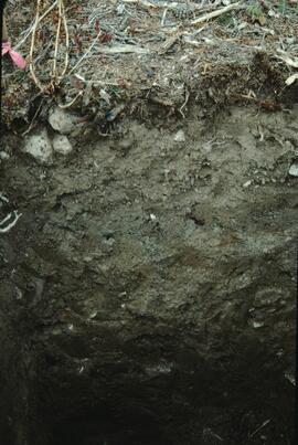
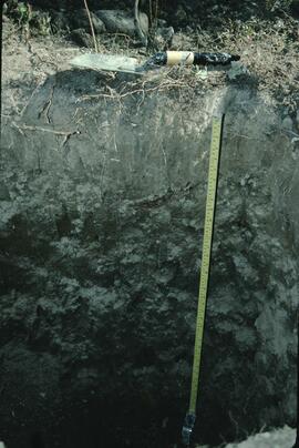
In July 2009, Dr. Paul Sanborn undertook the first soils field research at the Fort Selkirk volcanic field in central Yukon, with helicopter support and funding from the Yukon Geological Survey. This file consists of prints of aerial photographs that depict the area accessed for the study, upstream from the confluence of the Yukon River and the Pelly River.

Air photographs include:
Flight line A17210, Photo Nos. 54-60 (taken 1960)
Flight line A22354, Photo Nos. 43-45, 47-48 (taken 1971)
Flight line A27516, Photo Nos. 48-52 (taken 1989)

Research projects
2023.2.2 · Reeks · 1960-2024
Part of Dr. Paul Sanborn fonds

Series consists of records created and collected in relation to research projects Dr. Paul Sanborn was engaged in, often with other colleagues, during his employment with the BC Ministry of Forests and/or the University of Northern British Columbia. These archival research records are predominantly unpublished documents, reports, data, and photographs. Some of Sanborn's research projects did not result in a formal scientific publication. In other instances, some of Sanborn's research projects resulted in only a portion of the collected data utilized for a formal publication.

Sanborn compiled details about each research project and its associated records in a summary note. Each of these notes is provided in PDF format along with its research project series. These notes serve as an essential guide for researchers who wish to interpret, utilize, and repurpose Sanborn's data for other future research projects.

Dr. Paul Sanborn fonds
2023.2 · Archief · 1960-2024

Fonds consists of the research records of Dr. Paul Sanborn, a University of Northern British Columbia faculty member in the Department of Ecosystem Science and Management.

Zonder titel
Research reference material
2023.2.1 · Reeks · 1976-2016
Part of Dr. Paul Sanborn fonds

Series consists of reference material collected by Dr. Paul Sanborn, including field trip guidebooks, resource inventory documents, collected sources for various areas of research, and proceedings and abstracts for conferences and workshops.

2023.2.2.6.1 · Bestanddeel · 1983
Part of Dr. Paul Sanborn fonds

During the 1980s, Agriculture Canada pedologists Scott Smith (retired from Summerland Research Station, formerly based in Whitehorse) and Charles Tarnocai (retired from Central Experimental Farm, Ottawa) had a large field program which addressed the trends in soil development in the central Yukon. Across this region, particularly between Whitehorse and Dawson City, the land surfaces and surficial deposits vary greatly in age due to the differing extents of glaciations over the past ~2 million years.

Tarnocai and Smith shared the unpublished data and soil samples from this work with Dr. Paul Sanborn, and this resulted in a student project published as:
Daviel, E., P. Sanborn, C. Tarnocai, and C.A.A. Smith. 2011. Clay mineralogy and chemical properties of argillic horizons in central Yukon paleosols. Canadian Journal of Soil Science 91: 83-93. https://doi.org/10.4141/cjss10067
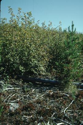
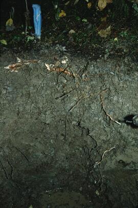
This file consists of photocopies of 76 detailed soil description forms from the 1983 Yukon Paleosol Study by Tarnocai and Smith.

2023.2.2.6.2 · Bestanddeel · 1983
Part of Dr. Paul Sanborn fonds

During the 1980s, Agriculture Canada pedologists Scott Smith (retired from Summerland Research Station, formerly based in Whitehorse) and Charles Tarnocai (retired from Central Experimental Farm, Ottawa) had a large field program which addressed the trends in soil development in the central Yukon. Across this region, particularly between Whitehorse and Dawson City, the land surfaces and surficial deposits vary greatly in age due to the differing extents of glaciations over the past ~2 million years.

Tarnocai and Smith shared the unpublished data and soil samples from this work with Dr. Paul Sanborn, and this resulted in a student project published as:
Daviel, E., P. Sanborn, C. Tarnocai, and C.A.A. Smith. 2011. Clay mineralogy and chemical properties of argillic horizons in central Yukon paleosols. Canadian Journal of Soil Science 91: 83-93. https://doi.org/10.4141/cjss10067
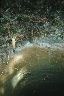
This file consists of photocopies of lab data sheets for Tarnocai & Smith Yukon soil samples from the Land Resource Research Institute, Agriculture Canada.

These lab data sheets were transcribed into an Excel spreadsheet (see item 2023.2.2.6.3).

2023.2.2.6.3 · Bestanddeel · 1983-2009
Part of Dr. Paul Sanborn fonds

During the 1980s, Agriculture Canada pedologists Scott Smith (retired from Summerland Research Station, formerly based in Whitehorse) and Charles Tarnocai (retired from Central Experimental Farm, Ottawa) had a large field program which addressed the trends in soil development in the central Yukon. Across this region, particularly between Whitehorse and Dawson City, the land surfaces and surficial deposits vary greatly in age due to the differing extents of glaciations over the past ~2 million years.

Tarnocai and Smith shared the unpublished data and soil samples from this work with Dr. Paul Sanborn, and this resulted in a student project published as:
Daviel, E., P. Sanborn, C. Tarnocai, and C.A.A. Smith. 2011. Clay mineralogy and chemical properties of argillic horizons in central Yukon paleosols. Canadian Journal of Soil Science 91: 83-93. https://doi.org/10.4141/cjss10067
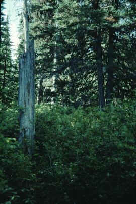
This data set consists of transcribed data from lab data sheets, showing McQuesten-Dawson City paleosol data from the Tarnocai and Smith 1983 AAFC Yukon Paleosol Study. The data set includes chemical and particle size data for Tarnocai & Smith samples, as determined by the Ag Canada lab. Note that the “Site” column indicates the NTS topographic map sheet (e.g. 115P/13) for the sampling locations.

2023.2.2.6 · Deelreeks · 1983-2010
Part of Dr. Paul Sanborn fonds

During the 1980s, Agriculture Canada pedologists Scott Smith (retired from Summerland Research Station, formerly based in Whitehorse) and Charles Tarnocai (retired from Central Experimental Farm, Ottawa) had a large field program which addressed the trends in soil development in the central Yukon. Across this region, particularly between Whitehorse and Dawson City, the land surfaces and surficial deposits vary greatly in age due to the differing extents of glaciations over the past ~2 million years.

This work built on a pioneering study from the previous decade:
Foscolos, A.E., N.W. Rutter, and O.L. Hughes. 1977. The use of pedological studies in interpreting the Quaternary history of central Yukon Territory. Bulletin 271. Geological Survey of Canada, Ottawa. 48 p. https://doi.org/10.4095/103066

Tarnocai and Smith presented their results in two publications:
C. A. S. Smith, C. Tarnocai, and O. L. Hughes. 1986. Pedological investigations of Pleistocene glacial drift surfaces in the central Yukon. Géographie physique et Quaternaire, 40 (1): 29–37. https://doi.org/10.7202/032620ar
Tarnocai, C. and C. A. S. Smith. 1989. Micromorphology and development of some central Yukon paleosols, Canada. Geoderma 45 (2): 145-162. https://doi.org/10.1016/0016-7061(89)90047-5

Tarnocai and Smith shared the unpublished data and soil samples from this work with Dr. Paul Sanborn, and this resulted in a student project published as:
Daviel, E., P. Sanborn, C. Tarnocai, and C.A.A. Smith. 2011.Clay mineralogy and chemical properties of argillic horizons in central Yukon paleosols. Canadian Journal of Soil Science 91: 83-93. https://doi.org/10.4141/cjss10067
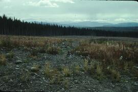
2023.2.2.1.1.2 · Bestanddeel · 1988-1990
Part of Dr. Paul Sanborn fonds

During a year away from studies in 1987-88, Dr. Paul Sanborn developed a successful grant proposal to the Science Council of BC (SCBC) to pursue a postdoctoral project with Dr. Tim Ballard in relation to sulphur-deficient soils in BC and prescribed fire. This project built on an existing broadcast burning study conducted by Macmillan Bloedel Ltd. near Port Alberni on Vancouver Island, led by Bill Beese (later at Vancouver Island University). Dr. Sanborn's work addressed sulphur forms and amounts in the soils at these sites, and the chemical processes influencing sulphur availability in relation to prescribed fire.

Only one part of this work was eventually published:
Sanborn, P.T. and T.M. Ballard. 1991. Combustion losses of sulphur from conifer foliage: Implications of chemical form and soil nitrogen status. Biogeochemistry 12: 129–134. https://doi.org/10.1007/BF00001810

The remainder of the work was documented in this Project Completion Report to SCBC, dated February 28, 1990, and entitled "Effects of Prescribed Fire on Sulphur in Forest Soils".

Thirty-four data files were selected for archival retention. There is some redundancy of content among these, with some formatted for incorporation as tables in the report appendices, and others containing some of the same data, but set up as input files for a statistics program. These account for almost all of the data listed in the Project Completion Report appendices. No glossary of variable names is provided, but these should be identifiable by referring to the Report.

Forest soil sulphur research
2023.2.2.1 · Deelreeks · 1988-2011
Part of Dr. Paul Sanborn fonds

Forest soil sulphur research was a continuing interest for Dr. Paul Sanborn for more than 30 years, beginning at UBC in the mid-1980s when he took a graduate course in Forest Soils from Dr. Tim Ballard. Among the things that he learned was that soils in much of BC were deficient in sulphur (S). Simultaneously, he became aware of the large amount of research on prescribed fire in BC forests, with broadcast burning being the main method of site preparation across much of the province at that time.

Sanborn undertook various projects in this area of research:

  1. UBC Postdoctoral Project on effects of prescribed fire on sulphur in forest soils (1988-90)
  2. Cluculz retrospective study (E.P. 886.10) with the BC Ministry of Forests and UNBC
  3. Sulphur stable isotope tracer study (E.P. 886.15) with the BC Ministry of Forests and UNBC
2023.2.2.1.1 · Sub-subseries · 1988-1991
Part of Dr. Paul Sanborn fonds

During a year away from studies in 1987-88, Dr. Paul Sanborn developed a successful grant proposal to the Science Council of BC (SCBC) to pursue a postdoctoral project with Dr. Tim Ballard in relation to sulphur-deficient soils in BC and prescribed fire. This project built on an existing broadcast burning study conducted by Macmillan Bloedel Ltd. near Port Alberni on Vancouver Island, led by Bill Beese (later at Vancouver Island University). Dr. Sanborn's work addressed sulphur forms and amounts in the soils at these sites, and the chemical processes influencing sulphur availability in relation to prescribed fire.

Only one part of this work was eventually published:
Sanborn, P.T. and T.M. Ballard. 1991. Combustion losses of sulphur from conifer foliage: Implications of chemical form and soil nitrogen status. Biogeochemistry 12: 129–134. https://doi.org/10.1007/BF00001810

The remainder of the work was documented in the Project Completion Report to SCBC, dated February 28, 1990.

Thirty-four of the accompanying project data files were selected for archival retention.

2023.2.2.1.1.1 · Stuk · 28 Feb. 1990
Part of Dr. Paul Sanborn fonds

During a year away from studies in 1987-88, Dr. Paul Sanborn developed a successful grant proposal to the Science Council of BC (SCBC) to pursue a postdoctoral project with Dr. Tim Ballard in relation to sulphur-deficient soils in BC and prescribed fire. This project built on an existing broadcast burning study conducted by Macmillan Bloedel Ltd. near Port Alberni on Vancouver Island, led by Bill Beese (later at Vancouver Island University). Dr. Sanborn's work addressed sulphur forms and amounts in the soils at these sites, and the chemical processes influencing sulphur availability in relation to prescribed fire.

Only one part of this work was eventually published:
Sanborn, P.T. and T.M. Ballard. 1991. Combustion losses of sulphur from conifer foliage: Implications of chemical form and soil nitrogen status. Biogeochemistry 12: 129–134. https://doi.org/10.1007/BF00001810

The remainder of the work was documented in this Project Completion Report to SCBC, dated February 28, 1990, and entitled "Effects of Prescribed Fire on Sulphur in Forest Soils".

2023.2.2.5.5 · Bestanddeel · 1991
Part of Dr. Paul Sanborn fonds

Original Land Resource Research Institute soil description detail forms prepared by Scott Smith for 3 locations, annotated on covers as follows:
SS91010 Lost Chicken Regosol Paleosol 26/6/91
SS91011 Lost Chicken Ash in Felty Peat 27/6/91
SS91013 Lost Chicken Mine “Up the Creek” ash site 28/6/91

Each of the three forms contains an attached annotated Polaroid photograph depicting each site.

2023.2.2.5 · Deelreeks · 1991-2023, predominant 2004
Part of Dr. Paul Sanborn fonds

The Lost Chicken Mine, a placer gold mine in eastern Alaska, approximately 120 km west of Dawson City, Yukon, is an important fossil locality for the late Pliocene (approximately 2.5 – 3.0 million years ago). A comprehensive account of the stratigraphy and paleontology of this site was given by:
Matthews, J.V., Jr., J.A. Westgate, L. Ovenden, L.D. Carter, and T. Fouch. 2003. Stratigraphy, fossils, and age of sediments at the upper pit of the Lost Chicken gold mine: new information on the late Pliocene environment of east central Alaska. Quaternary Research 60: 9-18. https://doi.org/10.1016/S0033-5894(03)00087-5

Dr. Paul Sanborn visited the site on July 20, 2004, as part of a group led by Duane Froese (Professor, University of Alberta). The group concentrated on a single exposure (~ 2 m thick) straddling the Lost Chicken tephra, a volcanic ash bed (2.9 ± 0.4 myr) which is a major stratigraphic marker at the site. Sanborn described, photographed, and sampled this exposure, and obtained a basic set of characterization data. Intact samples were collected but thin sections were never produced.

2023.2.2.10 · Deelreeks · 1993-2001
Part of Dr. Paul Sanborn fonds

While at the Ministry of Forests, Dr. Paul Sanborn carried out two retrospective studies which examined soil chemical properties at long-term silvicultural research sites where different vegetation types had been created, either as planned or unplanned experiments. These studies were Experimental Project (EP) 660 and a research project at the Archie Creek site.

2023.2.2.5.3 · Stuk · 1993
Part of Dr. Paul Sanborn fonds

Carter, L. David, Thomas D. Fouch, C.A.Scott Smith and Michael J. Kunk. (n.d.) Physical stratigraphy, sedimentology, and regional setting of Pliocene deposits at the Lost Chicken placer mine, east-central Alaska. [unpublished draft manuscript, with cover memo from D. Carter dated Oct 15, 1993]

Archie Creek Site
2023.2.2.10.2 · Sub-subseries · 1993-2001
Part of Dr. Paul Sanborn fonds

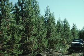
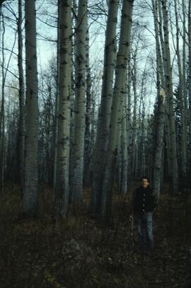
The Archie Creek site is the informal name used for a research installation established in 1971 east of Prince George by the Canadian Forest Service, and subsequently abandoned by the end of that decade. Dr. Paul Sanborn revisited the site in 1995, and sampled forest floors and mineral soils across a range of conifer-broadleaf mixtures established by natural establishment of broadleaf trees among planted lodgepole pines.

Details of the site conditions, sampling methods, and results were published in:
Sanborn, P. 2001. Influence of broadleaf trees on soil chemical properties: A retrospective study in the Sub-Boreal Spruce Zone, British Columbia, Canada. Plant and Soil 236: 75–82. https://doi.org/10.1023/A:1011973402414

Archie Creek slides
2023.2.2.10.2.8 · Bestanddeel · Sept. 1995
Part of Dr. Paul Sanborn fonds

File contains 2 rolls (51 slides) taken September 25-26, 1995 that depict paired views of plot vegetation and forest floor surface. Handwritten number notations on slide frames indicate plot numbers from the original research installation.

2023.2.2.11 · Deelreeks · 1995-1997
Part of Dr. Paul Sanborn fonds

The BC Ministry of Forest's EP 1148 Long-term Soil Productivity (LTSP) study addresses two key factors— soil porosity and site organic matter—that potentially limit tree growth and site productivity in the timber-harvesting land base and that can be affected by forestry operations.

2023.2.2.2 · Deelreeks · 1995-2005
Part of Dr. Paul Sanborn fonds

In the mid-1990s, Dr. Paul Sanborn worked with Dr. Lito Arocena of UNBC to assemble and interpret basic physical, chemical, and mineralogical data for typical soils at important long-term forestry research sites in central and northeastern BC. The key results were published as:

J.M. Arocena and P. Sanborn. 1999. Mineralogy and genesis of selected soils and their implications for forest management in central and northeastern British Columbia. Canadian Journal of Soil Science 79: 571-592. https://doi.org/10.4141/S98-07

Nine pedons were involved, with 7 located at the sites of 4 Ministry of Forests Experimental Projects (E.P.), and 2 at the Aleza Lake Research Forest.

2023.2.2.10.2.4 · Stuk · 1995
Part of Dr. Paul Sanborn fonds

This document is an unpublished 1995 UNBC co-op work term report by B. Roosdahl entitled "Forest Floor Development on Bladed Trails in the SBS: A retrospective study of the Archie Creek site". B. Roosdahl was a co-op student who was one of the student research assistants involved in the field work at the Archie Creek site in fall 1995.

Archie Creek site data
2023.2.2.10.2.7 · Bestanddeel · 1995-1996
Part of Dr. Paul Sanborn fonds

File contains the following data sets:

  • Archie Site Tree Data.xls [diameter (dbh) and basal area of trees within and overhanging plots]
  • Archie Site non-woody forest floor properties (1995).xls [non-woody forest floor chemical properties – individual sample results & plot means]
  • Archie Site woody forest floor component properties (1995).xls [total C, N & S concentrations, pool sizes for woody forest floor components]
  • Archie Site mineral soil properties (1995).xlsx [0-20 cm mineral soil chemical properties – individual sample results & plot means]
  • Archie Site forest floor mass (1995).xlsx [mass per unit area of non-woody & woody forest floor components, corrected to oven-dry basis]
  • S221FINL.xls [MoF lab data report: non-woody forest floor components]
  • S222FINL.xls [MoF lab data report: woody forest floor components]
  • S251FINL.xls [MoF lab data report: 0-20 cm mineral soil]
2023.2.2.11.2 · Bestanddeel · 1995-1997
Part of Dr. Paul Sanborn fonds

This 3.5" floppy contains the following EP 1148 .TXT data sets from 1995-1997:

  • sbsapc.txt "Long-term soil productivity study, Sub-Boreal Spruce" Intact soil cores
  • sbsbd.txt "Long-term soil productivity study, Sub-Boreal Spruce" Bulk density mineral soil 0-20cm
  • sbsffc.txt "Long-term Soil Productivity Study, Sub-boreal Spruce" SBS forest floor bulk density and mass3
  • sbsfc.txt "Long-term Soil Productivity Study, Sub-boreal spruce" SBS forest floor chemistry
  • sbsmc.txt "Long-term Soil Productivity Study, Sub-boreal Spruce sites" SBS mineral soil chemistry
  • sbskgff.txt "Long-term soil productivity study, Sub-boreal spruce zone" SBS forest floor nutrient mass in kg/ha
  • sbskgmm.txt "Long-term soil productivity study, Sub-boreal spruce" SBS mineral nutrient mass in kg/ha
  • sbsom.txt "Long-term Soil Productivity Study, SBS" "SBS bole-only treatment, slash levels"
  • sbscr.txt "Long-term soil productivity study, Sub-boreal spruce zone" Timber cruise of initial stands
  • sbshtcr.txt "Long-term soil productivity study, SBS" Age vs height curves - pretreatment data (mature stand)
  • sbssi.txt "Long-term soil productivity study, Sub-Boreal Spruce zone" Carmean estimates of site indices for initial stand
  • sbstr.txt "Long-term soil productivity study, Sub-Boreal Spruce" Tree measurements
2023.2.2.2.7 · Bestanddeel · 1996-2005
Part of Dr. Paul Sanborn fonds

Data sets associated with the Arocena & Sanborn 1999 regional soil mineralogy study:

  • S234FINL.XLS [data report for mineral horizons from MoF Analytical Chemistry Laboratory, June 20 1996]
  • S235FINL.XLS [data report for organic horizons from MoF Analytical Chemistry Laboratory, June 20 1996]
  • SAMPLIST.XLS [conversion table for sample numbers used in MoF lab data reports]
  • Fe Al extractions.xlsx [assembled from lab data report by L. Arocena for oxalate & dithionite extractions; pyrophosphate extraction data from MoF lab]
  • MINSTUDY.XLS [consolidated lab data for organic & mineral horizons, except for BaCl2 exchangeable cations]
  • MINCEC.XLS [BaCl2 exchangeable cations & Morgan’s extraction for organic & mineral horizons]
"Profile Descriptions"
2023.2.2.2.5 · Stuk · 1996
Part of Dr. Paul Sanborn fonds

This born-digital "Profile Descriptions" document provides descriptions of Williams Lake (Skulow Lake), Aleza 1 & 2, Log Lake, and Lucille Mountain pedons.

2023.2.2.11.1 · Stuk · 1996
Part of Dr. Paul Sanborn fonds

The BC Ministry of Forest's EP 1148 Long-term Soil Productivity (LTSP) study addresses two key factors— soil porosity and site organic matter—that potentially limit tree growth and site productivity in the timber-harvesting land base and that can be affected by forestry operations.

This establishment report for EP 1148, "The effects of soil compaction and organic matter retention on long-term soil productivity in British Columbia (Experimental Project 1148)", is accompanied by a floppy disk containing 12 data sets (see 2023.2.2.11.2).