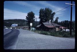
Image depicts a group of people observing splintered wooden boards at an uncertain location.
Image depicts several unidentified individuals and a bridge behind them; it is possibly crossing the Peace River.
The photograph depicts Penny train station next to the train tracks. There is a girl sitting in front of the station. Annotation on slide states, "Penny Station 0118."
The photograph depicts a man and a woman standing outside Penny Station. The first-floor windows are boarded up and one of the upper windows has broken glass.
The photograph depicts Penny train station next to the train tracks. Annotation on reverse side of photograph states, "Penny formerly at Lindup." Annotation on 35 mm slide states, "Penny."
The photograph depicts Penny train station next to the train tracks. Annotation on slide states, "0117 Penny."
The photograph depicts Penny train station next to the train tracks. A girl is sitting in front of the station. Annotation on slide states, "0116 Penny."
Image depicts the community hall in Penny, B.C.
Image depicts the CN Station in Penny B.C. A woman, possibly Sue Sedgwick, is sitting against the outside wall.
Image depicts the CN Station in Penny B.C.
Image depicts a railway crossing sign with peeling and cracked paint somewhere in or near Penny, B.C.
Image depicts the post office in Penny, B.C.
Image depicts Sue Sedgwick standing in front of an old, run-down house somewhere in or near Penny, B.C.
Image depicts two signs for hiking trails in Penny, B.C. One reads: "Hiking trail to Red Mt. Lake (Grizzly Bear Mt.) expect to meet wild animals."
Image depicts a beehive burner somewhere in or near Penny, B.C.
Image depicts the condominiums in the "Pemberton Valley Estates" in Pemberton, B.C.
Image depicts rail road tracks and several buildings in Pemberton, B.C.
Image depicts a view of Peden Hill in Prince George, B.C.
Image depicts the Pearson Homestead.
Image depicts a street of shops at an uncertain location somewhere in the Peace River Regional District. A pink and blue building, possibly a theatre, is labelled "Lux."
Image depicts the W.A.C. Bennett Dam on the Peace River in Hudson's Hope, B.C.
Image depicts a dam and a reservoir of water, possibly on the Peace River.
Image depicts a dam, possibly on the Peace River.
Image depicts a dam on what is possibly the Peace River.
File contains slides depicting places along the Peace River.
Image depicts the Peace Canyon Dam and generating station under construction on the Peace River.
Image depicts the remains of an old bridge, somewhere near Pavilion Mountain.
Image depicts the First Nations village of Pavilion, B.C.
Image depicts an old theatre owned by Paul Aivazoff in Prince Rupert, B.C. It opened in 1935 and was closed in 1981; it has since been renovated for retail use.
The photograph depicts a blurred image of a yellow carpet with colourful designs.
Image depicts several eighteen wheelers at the Pass Lake Road and Upper Fraser Road intersection with numerous houses and buildings in the background in McGregor, B.C. Map coordinates 54°04'38.1"N 121°50'00.1"W
Image depicts Parkside Intermediate Care Home on Ospika Boulevard in Prince George. Map coordinates 53°55'02.6"N 122°47'41.6"W
Image depicts a group of people throwing a frisbee in a parking lot at an uncertain location, likely in the Peace River Region.
Photograph depicts a parking lot and alleyway behind the Europe Hotel on 3rd Avenue.
This item is a photograph of a yellow parkade in downtown Prince George. Liquidation World can be seen in the background.
This item is a photograph of a yellow parkade in downtown Prince George.
Image depicts a group of individuals on the sidewalk outside Spee-Dee Printers on Brunswick Street in Prince George, B.C.
Image depicts what is likely an outhouse at Island Cache.
Image depicts a number of buildings at an uncertain location; the slide labels the older building in the image as potentially being the "original road house."
Image depicts the original steam engine for the White Pass Train, located in Skagway, Alaska.
Image depicts the original bank building in Wells, B.C.
Photograph depicts an open grassy field surrounded by trees in Soda Creek.
Image depicts a field in Giscome, B.C. On the right side of the image, in the background, is a grey strip that appears to be a mine, possibly the quarry at Eaglet Lake in Giscome, B.C. Map coordinates 54°03'52.9"N 122°22'10.0"W
Image depicts an open field and Giscome, B.C. in the background. Map coordinates 54°03'52.9"N 122°22'10.0"W