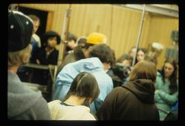
Image depicts the old Goat River Train Station in Goat River, B.C.
The item is a photograph of Gold Mine Pawn Shop and an unknown commercial building on 3rd Avenue in Prince George.
Image depicts the Canadian Forces Recruiting Centre on the north side of 3rd Ave in Prince George, B.C.
The item is a photograph of of the Government of Canada service office on 3rd Avenue in Prince George.
Image depicts a grain elevator in Prince Rupert, B.C.
Image depicts a large vessel docked at a grain elevator and two smaller boats at a dock in the foreground somewhere in Prince Rupert, B.C.
Image depicts the Fraser River and the Grand Trunk Pacific Bridge from Cottonwood Island Park.
The photograph depicts an old Grand Trunk Pacific train station on Highway 16, West of Edmonton. The train station is white with a dark roof. Annotation on reverse side of photograph states, "on HWY #16, West of Edmonton 1991-04-16."
The photograph depicts an old Grand Trunk Pacific train station West of Entwistle on Highway 16 West. The station is white with a brown roof and brick chimney. Annotation on reverse side of photograph states, "6 km west from Entwistle on the south side of HWY 16 W, Alberta, 2001-04-17."
Image depicts a row of houses in Granduc, near the Granduc Mine and located north of Stewart, B.C.
Image depicts a row of boarded up houses in Granduc, near the Granduc Mine and located north of Stewart, B.C.
Image depicts housing in Granduc, near the Granduc Mine and located north of Stewart, B.C.
Image depicts an example of "typical housing" in Granduc, near the Granduc Mine and located north of Stewart, B.C.
Image depicts Grassy Plains, B.C.
Image depicts the grave of W.L. Meason in the upper Fraser Canyon.
Image depicts numerous grave markers at an uncertain location.
Image depicts a small graveyard at an uncertain location.
Image depicts a large group of people in a room at an uncertain location in the Peace River Region.
The photograph depicts seven men and women on the railway turntable at the CN Railyard in Prince George, B.C. Reproduction of photograph from 1984.
Image depicts a group of individuals standing on the corner of 3rd Ave in Prince George, B.C.
Image depicts the Grand Trunk Pacific railway roundhouse in Prince George, B.C.
Image depicts the GTP roundhouse in Prince George, B.C.
Image depicts the Grand Trunk Pacific railway roundhouse in Prince George, B.C.
Image depicts the interior of the GTP roundhouse in Prince George, B.C.
Image depicts machinery in the GTP roundhouse in Prince George, B.C.
The photograph depicts the Grand Trunk Pacific Railyard roundhouse and water tower in Prince George, B. C. Reverse side of photograph states, "Photo Credit: Fort George Museum." Reproduction from [192-?].
The item is a photograph of Gundy's News and an empty commercial building on 3rd Avenue in Prince George.
The item is a photograph depicting the exterior view of the front of Gundy's News Supply Ltd. at 1244 3rd Avenue, Prince George. Part of the Columbus Hotel and Pub at 1250 3rd Avenue and a vacant building at 1232 3rd Avenue can be seen. There is a woman standing outside one of the businesses. Photograph originally taken between 1978 and 1979.
The item is a photograph of the H&R Block building and an empty commercial building on 3rd Avenue in Prince George.
Image depicts a bridge in Hagwilget, B.C.
Image depicts a church on a hill in Hagwilget, B.C.
Image depicts an old, half-collapsed building at an uncertain location.
Image depicts a house on Blackwater Road.
Image depicts a hallway in an unknown building somewhere in Wells, B.C.
The photograph depicts a hallway with windows at the interior of the CN roundhouse in Prince George, BC. Reproduction of photograph from 1984.
Image depicts a man and woman shaking hands in a building at an uncertain location, possibly in Cottonwood Park. The man standing behind the two is possibly Elmer Mercier, a former mayor of Prince George, B.C.
Image depicts the new Hansard Bridge. Map coordinates 54°04'57.9"N 121°51'10.1"W
Image depicts the Hansard railroad bridge taken from the new Hansard vehicle bridge. Map coordinates 54°04'58.1"N 121°50'58.0"W
Image depicts the Hansard railroad bridge looking west. Map coordinates 54°04'37.9"N 121°50'46.3"W
Image depicts Glenview Drive near the Hart Highway in Prince George, B.C.
Image depicts a neighbourhood on the Hart Highway in Prince George, B.C.
Image depicts a "box barn" on the historic Hat Creek Ranch site north of Ashcroft, B.C.