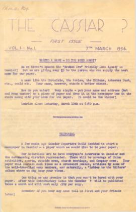
On March 7, 1956 the Cassiar Reporters Guild published one issue of an untitled newspaper simply titled "The Cassiar '?'" (vol.1, no.1) along with a "name that newspaper" contest call out to the local community. It is believed that no other issue of this first volume was published until December 7, 1957 when The Asbestos Sheet (vol.2, no.1) was published. The Asbestos Sheet, was generally published twice a month and ran from December 1957 to September 1976; after which time both its name and its format changed: the 8-1/2 x 10" news bulletin changing to an 11 x 17" newspaper; and The Asbestos Sheet becoming the Cassiar Courier. The Courier was published monthly from fall 1976 until February 1991 when it stopped circulation shortly before the closure of both the mine and the company town.
Photograph depicts three unknown RCMP constables standing in red serge uniform with four unknown young girls in dresses.
Photograph depicts three unknown RCMP constables standing in red serge uniform.
Photograph depicts 19 tonnes of tightly packed asbestos in a shipping container.
Photograph depicts mill production worker Tony Mlikovic.
Photograph depicts the Cassiar valley: town in foreground, plant and tailings pile behind. Mine road can be seen from plant to mine valley on left. Mountain range in background.
Photograph depicts the Cassiar valley: town in foreground, plant and tailings pile in background.
Photograph depicts the Cassiar valley: town in left foreground, plant and tailings pile in midground, mountains in background. Photograph was taken from the air, portion of plane visible in top left of image.
Photograph depicts the Cassiar valley: town on left, plant and tailings pile on right, mountains in background. Mine road can be seen from plant to mine valley in top left of image.
Photograph depicts the Cassiar valley: town in foreground, plant and tailings pile in background. Mountain range visible in distance. Photograph was taken from above, facing east.
Photograph depicts the Cassiar valley: plant and tailings pile on left, town on right. Mountain range visible in distance. Photograph was taken from above, facing south.
Photograph depicts the town of Cassiar behind plant buildings in left foreground. Mountain base in background. Photograph was taken from the air, portion of plane visible in top left of image.
Photograph depicts the town of Cassiar, mountain base in background. Mine road visible in top right of image.
Photograph depicts the Cassiar valley: town on left, plant on right, mine valley in background. Photograph was taken from above, facing north east.
Photograph depicts the town of Cassiar behind plant and tailings pile in foreground. Mountain range in background.
Photograph depicts the town of Cassiar, mountain base in background.
Photograph depicts the town of Cassiar in foreground, mountain base in background. Photograph was taken from the air, portion of plane visible in top left of image.
Photograph depicts the Cassiar townsite in foreground. Mill, dry rock storage building, and tailings pile can be seen in background. Handwritten annotation on verso of photograph: "1958 [1961 crossed through]."
Photograph depicts the Cassiar plantsite including the mill, dry rock storage building, tailings pile, and many other buildings. A portion of the townsite can be seen on left.
Photograph depicts the Cassiar plantsite in foreground, including the mill, dry rock storage building, tailings pile, and many other buildings. Townsite in midground, mountains in background. Handwritten annotation on recto of photograph: "Cassiar."
Photograph depicts the Cassiar valley. Handwritten annotation on verso of photograph: "1958 [1961 crossed through]", on recto: "Cassiar Asbestos Corporation Limited. Cassiar B.C. Townsite in foreground mill and ore storage in left middle ground," "Toronto set". It is believed that this photograph was made into a post card.
Photograph depicts towers and buckets in distance. Gravel road in foreground winding through hills of dirt. Handwritten annotation on recto of photograph: "#1 SECTION". Photograph was glued to cardboard backing with the annotation: "1962".
Photograph depicts towers and bucket in foreground, plantsite midground in valley, opposite mountains in background. Handwritten annotation on recto of photograph: "GENERAL VIEW VISIBLE TOWERS ARE IN #1 SECTION PLANT IN BACKGROUND". Photograph was glued to cardboard backing with the annotation: "1962".
This photograph is part of tramline study of bucket loads. It depicts the tramline station at the top of the mountain and terrain it runs above.
Photograph depicts a shipping container being transported by a yellow vehicle at the asbestos wharf on pier 94.
Photograph depicts a truck carrying asbestos on a winter road.
Photograph depicts back of truck on wet mud road in forest. People visible in truck, one man on left, partial image of man on far right.
Photograph depicts man on left of truck in wet mud road. Shadow of unknown person in foreground.
Photograph depicts a wet mud road in forest. Truck and people on left in distance, one man in foreground on right.
Photograph depicts two men in front of truck on a wet mud road in forest. Road in foreground, one man in shade on left, trees in background.
Photograph depicts two men bent in front of truck on wet mud road in forest. Road in foreground, partial image of man on far left, trees in background.
Photograph depicts a truck and two men on a wet mud road in forest. Photo taken from side of road, road in foreground, trees in background.
Photograph depicts a wet mud road in forest. Two men in foreground on left, truck in distance, one man in distance on right.
Photograph depicts a wet mud road in forest. Truck in distance, woman and shadow of unknown person in foreground.
Handwritten annotation on recto of photograph: "MINE DRY ON LEFT". Photograph was glued to cardboard backing with the annotation: "1962".
Gravel road in foreground, mountain in background. Sign over road reads: "CAUTION TRAMLINE CROSSING".
Photograph depicts freight truck being ferried across the Stewart River, north bound. It is believed that this truck may have been owned by United Keno Hills Mines Ltd. It is speculated that this photograph was taken for research purposes.
Photograph depicts a red semi truck transporting packaged asbestos.
Photograph depicts five trucks and Eimco loader in snow-covered campsite. Photo taken facing south, forest and snow-covered mountains in background.
Photograph of Prime Minster Pierre Trudeau standing with a group of men looking over the Cassiar valley. Trudeau stands in the middle wearing a yellow shirt.
Photograph of Prime Minster Pierre Trudeau standing with two other men at the Cassiar Mine.
Photograph depicts Prime Minster Pierre Trudeau shaking hands with two men upon arrival in Cassiar.
Photograph depicts Prime Minster Pierre Trudeau speaking with an unknown man in a yellow hardhat while standing in a crowd by a Department of Transport airplane.
Photograph depicts unknown men driving bulldozers on edge of mine area at high elevation. Dozers are Internationals, model TD24 (manufactured between 1947 and 1955). Mountain range in background.
Photograph depicts unknown men driving bulldozers on edge of mine area at high elevation. Dozers are Internationals, model TD24 (manufactured between 1947 and 1955). Valley and mountain range in background.
Photograph depicts two Vancouver firemen wearing Justice Institute hats standing on a firetruck.
Photograph depicts two unidentified men at high elevation on mountain. Trucks and tanks visible in background, hose (possibly of air track drill) in right foreground. Mountain range in background.
Photograph depicts two unidentified men on road or mining bench at high elevation on mountain, valley in background.