Showing 2223 results

Archival description
2097 results with digital objects Show results with digital objects
Old House in Sinclair Mills
2012.13.1.87.019 · Item · [between 1975 and 1995]
Part of J. Kent Sedgwick fonds

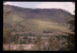
Image depicts an old house missing windows and doors in the foreground, and a bunkhouse in the background, in Sinclair Mills, B.C. Map coordinates 54°01'17.4"N 121°40'53.0"W

Old Mill?
2012.13.1.50.157 · Item · [1982?]
Part of J. Kent Sedgwick fonds

Image depicts what appears to be an old mill at an unknown location.

Old Slump
2012.13.1.50.064 · Item · 1978
Part of J. Kent Sedgwick fonds

Image depicts an old slump type of landslide. The slide labels it as being near "McAlister."

Old Trestle
2012.13.1.100.22 · Item · 1999
Part of J. Kent Sedgwick fonds

Image depicts an old trestle along the White Pass railway, and the White pass Train on the left of the image.

Open Field in Giscome
2012.13.1.87.069 · Item · [between 1975 and 1995]
Part of J. Kent Sedgwick fonds

Image depicts a field in Giscome, B.C. On the right side of the image, in the background, is a grey strip that appears to be a mine, possibly the quarry at Eaglet Lake in Giscome, B.C. Map coordinates 54°03'52.9"N 122°22'10.0"W

Open Field in Giscome
2012.13.1.87.068 · Item · [between 1975 and 1995]
Part of J. Kent Sedgwick fonds

Image depicts a field in Giscome, B.C. On the right side of the image, in the background, is a grey strip that appears to be a mine, possibly the quarry at Eaglet Lake in Giscome, B.C. Map coordinates 54°03'52.9"N 122°22'10.0"W

Open Field in Giscome
2012.13.1.87.163 · Item · [between 1975 and 1995]
Part of J. Kent Sedgwick fonds

Image depicts an open field and Giscome, B.C. in the background. Map coordinates 54°03'52.9"N 122°22'10.0"W

Open Pit
2012.13.1.50.093 · Item · [1978?]
Part of J. Kent Sedgwick fonds

Image depicts an open mining pit at an uncertain location; it is possibly Gibraltar.

Orchard Irrigation
2012.13.1.82.27 · Item · 1981
Part of J. Kent Sedgwick fonds

Image depicts water flowing through an irrigation channel in an orchard, somewhere in or near Seton Portage, B.C.

Oscar Peak
2012.13.1.57.24 · Item · 1982
Part of J. Kent Sedgwick fonds

Image depicts the north aspect of Oscar Peak overlooking Lava Lake in the Nass Valley.

Oscar Peak
2012.13.1.57.25 · Item · 1982
Part of J. Kent Sedgwick fonds

Image depicts the north aspect of Oscar Peak overlooking Lava Lake in the Nass Valley.

Other Town Plans
2012.13.1.030 · Subseries · [between 1985 and 1988]
Part of J. Kent Sedgwick fonds

File contains slides depicting old town site plans for various cities.

Paddlewheel Park
2012.13.1.7.202 · Item · Nov. 2000
Part of J. Kent Sedgwick fonds

Image depicts the Fraser River at Paddlewheel park, with a train on the other side of the river, in Prince George B.C.

Paddlewheel Park
2012.13.1.7.201 · Item · Nov. 2000
Part of J. Kent Sedgwick fonds

Image depicts the Fraser River at Paddlewheel park, with a train on the other side of the river, in Prince George B.C.

Parking Lot Frisbee
2012.13.1.93.18 · Item · 1979
Part of J. Kent Sedgwick fonds

Image depicts a group of people throwing a frisbee in a parking lot at an uncertain location, likely in the Peace River Region.

2012.13.1.87.004 · Item · [between 1975 and 1995]
Part of J. Kent Sedgwick fonds

Image depicts several eighteen wheelers at the Pass Lake Road and Upper Fraser Road intersection with numerous houses and buildings in the background in McGregor, B.C. Map coordinates 54°04'38.1"N 121°50'00.1"W

Pat's Pass
2012.13.1.79.18 · Item · Aug. 1977
Part of J. Kent Sedgwick fonds

Image depicts a view of a valley; the slide itself labels the image in two places, "central basin" on the left side of the image, and "Pat's Pass" on the top of the image between the two mountains.

Peace River
2012.13.1.091 · Subseries · [between 1974 and 1979]
Part of J. Kent Sedgwick fonds

File contains slides depicting places along the Peace River.